基于多源卫星遥感的暴雨灾情时空动态信息的提取
Spatio-temporal Dynamics of the Impacts of Rainstorm Disaster on Crop Growing Using Multi-satellites Remote Sensing
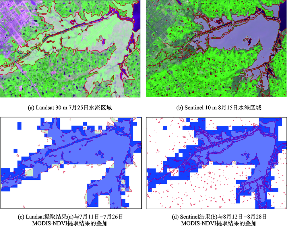
注:红色边界和透明色为Landsat和Sentinel提取结果的图斑;蓝色为对应时期MODIS提取的受灾影响区域
基于多源卫星遥感的暴雨灾情时空动态信息的提取 |
| 苏亚丽, 郭旭东, 雷莉萍, 汪晓帆, 吴长江 |
|
Spatio-temporal Dynamics of the Impacts of Rainstorm Disaster on Crop Growing Using Multi-satellites Remote Sensing |
| SU Yali,GUO Xudong,LEI Liping,WANG Xiaofan,WU Changjiang |
| 图7 Landsat 30 m以及Sentinel 10 m的水淹区域提取结果的样例 注:红色边界和透明色为Landsat和Sentinel提取结果的图斑;蓝色为对应时期MODIS提取的受灾影响区域 |
| Fig. 7 Examples of the extraction results of flooded area from Landsat-30m and Sentinel 10 m data |
|
|