
土地执法监察中的高分辨率遥感及变化检测技术
作者简介:吴田军(1986-),男,博士,讲师,研究方向为遥感信息计算。E-mail: wutianjun1986@163.com
收稿日期: 2015-12-20
要求修回日期: 2016-01-24
网络出版日期: 2016-07-15
基金资助
中国科学院重点部署项目(KZZD-EW-07-02)
国家高技术研究发展计划项目(2015AA123901)
长安大学中央高校(OBDMA201508)
国家自然科学基金项目(11261044)
The Application of High-resolution Remote Sensing and Change Detection Technologies in Law Enforcement and Supervision of Land Resources
Received date: 2015-12-20
Request revised date: 2016-01-24
Online published: 2016-07-15
Copyright
吴田军 , 夏列钢 , 吴炜 , 马江洪 . 土地执法监察中的高分辨率遥感及变化检测技术[J]. 地球信息科学学报, 2016 , 18(7) : 962 -968 . DOI: 10.3724/SP.J.1047.2016.00962
Law enforcement and supervision of land resources are important components in the land resources management systems. Their current way of working is mainly manipulated by the traditional manual operation, which is not efficient in performance. With the launch of high-spatial-resolution remote sensing satellites, the application of details contained within these received images makes it possible to accurately and rapidly enforce the law and supervise the land resources with the adoption of remote sensing technology. Therefore, in order to analyze the actual requirements of the applications and the latest technological developments, this paper intends to extract the illegal construction land information using the high-spatial-resolution remote sensing images, and we choose the Huangyan district to be the demonstration area to carry out the county-level law enforcement and to implement proper supervision to land resources. We have extracted the suspected illegal build-up construction sites using the change detection and urban extraction technologies. The experiment achieves a good result and demonstrates the significant potentials of domestic high-spatial-resolution satellite in the practical applications of law enforcement and supervision of land resources.
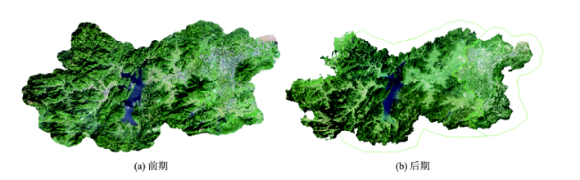
Fig. 1 Two images used for monitoring the illegal build-up construction land图1 违法新增建设用地监测应用的2期影像数据 |
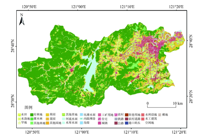
Fig. 2 Land use data set of Huangyan district in 2012图2 2012年黄岩区土地利用数据 |
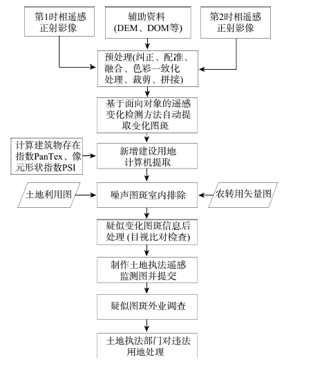
Fig. 3 Flow chart of the object-based remote sensing change detection method图3 面向对象的遥感变化检测方法流程 |
Fig. 4 Flow chart for extracting the illegal new construction land using high-resolution remote sensing images图4 高分辨率遥感违法新增建设用地提取技术流程图 |
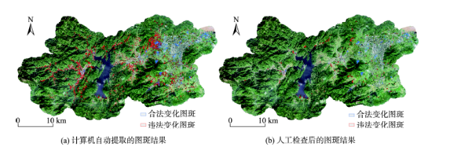
Fig. 5 Extraction result of the suspected illegal new construction land图5 提取的疑似违法新增建设用地图斑结果 |
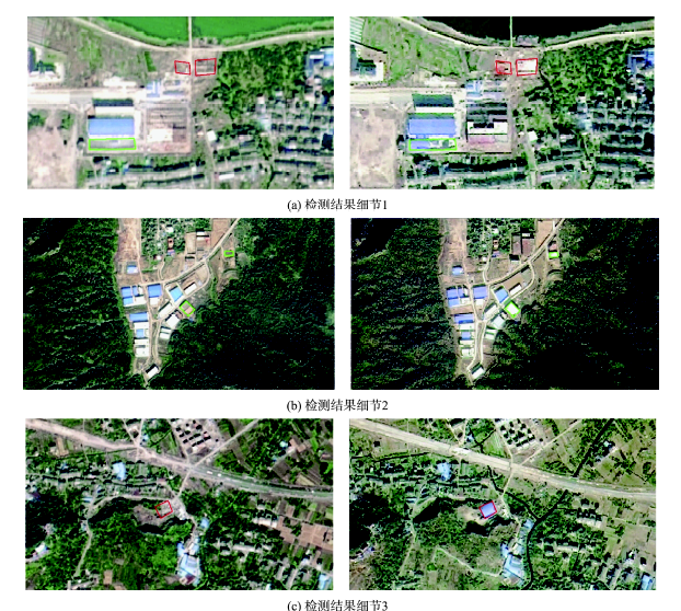
Fig. 6 Details of the detection results图6 检测结果细节 |
The authors have declared that no competing interests exist.
| [1] |
[
|
| [2] |
美国国家科学院.理解正在变化的星球(刘毅,刘卫东译)[M].北京:科学出版社,2011.
[ United States National Academy of Sciences. Understanding the changing planet: strategic directions for the geographical sciences (translated by Liu Y, Liu W D)[M]. Beijing: Science Press, 2011. ]
|
| [3] |
[
|
| [4] |
[
|
| [5] |
[
|
| [6] |
|
| [7] |
[
|
| [8] |
[
|
| [9] |
|
| [10] |
[
|
| [11] |
[
|
| [12] |
[
|
| [13] |
|
| [14] |
|
| [15] |
|
| [16] |
[
|
| [17] |
[
|
| [18] |
|
| [19] |
|
| [20] |
|
| [21] |
[
|
/
| 〈 |
|
〉 |
