地球信息科学理论与方法

抗投影变换的矢量地理数据水印算法

  • 佟德宇 ,
  • 任娜 , * ,
  • 朱长青 ,
  • 林威
展开
  • 1. 南京师范大学 虚拟地理环境教育部重点实验室,南京 210023;2. 江苏省地理信息资源开发与利用协同创新中心,南京 210023
*通讯作者:任 娜(1981-),女,山东莱西人,博士,副教授,研究方向为地理数据安全。E-mail:

作者简介:佟德宇(1989-),男,江苏高邮人,博士生,研究方向为地理数据安全。E-mail:

收稿日期: 2015-07-27

  要求修回日期: 2015-09-11

  网络出版日期: 2016-08-10

基金资助

国家社科基金重大项目(11&ZD162)

国家自然科学基金项目(41301413)

江苏省自然科学基金项目(BK20130903)

公益性行业科研专项(201512021、201512019)

A Watermarking Algorithm Resisting to Projection Transformation for Vector Geographic Data

  • TONG Deyu ,
  • REN Na , * ,
  • ZHU Changqing ,
  • LIN Wei
Expand
  • 1. Key Laboratory of Virtual Geographic Environment of Ministry of Education, Nanjing Normal University, Jiangsu Province, Nanjing 210023, China;2. Jiangsu Center for Collaborative Innovation in Geographical Information Resource Development and Application, Jiangsu Province, Nanjing 210023, China
*Corresponding author: REN Na, E-mail:

Received date: 2015-07-27

  Request revised date: 2015-09-11

  Online published: 2016-08-10

Copyright

《地球信息科学学报》编辑部 所有

摘要

在矢量地理数据水印算法研究中,以往研究较多考虑增删点、裁剪、平移、旋转等攻击方式,而对抗投影变换的攻击方式研究较少。由于投影变换在GIS中具有重要意义,故本文提出了一种抗投影变换的矢量地理数据水印算法。水印嵌入前,对待嵌矢量地理数据利用道格拉斯算法进行压缩,使用四叉树分块选取特征点,提取并保存特征点及其属性信息;水印嵌入采用坐标映射和量化机制以增强水印算法的鲁棒性;检测水印时,将待检测数据与原始特征点进行属性信息匹配,匹配成功的同名点采用二元三次多项式进行最小二乘法拟合,根据拟合的多项式系数对待检测数据进行投影变换,最终实现水印信息的提取。实验结果表明,本方法能抵抗投影变换攻击、增删点、几何变换以及它们的复合攻击,具有较好的可行性和实用性。

本文引用格式

佟德宇 , 任娜 , 朱长青 , 林威 . 抗投影变换的矢量地理数据水印算法[J]. 地球信息科学学报, 2016 , 18(8) : 1037 -1042 . DOI: 10.3724/SP.J.1047.2016.01037

Abstract

Among the researches on watermarking algorithms for vector geographic data, more attentions have been paid on the attacking methods such as increasing points, deleting points, translation, rotation and so on. However, there is scarce research on watermarking algorithms resisting the attack of projection transformation. As a common data processing method in geography, projection transformation would affect and ruin the watermark embedded by normal ways in vector geographic data. Therefore this paper proposes an anti-projection watermarking algorithm for this kind of data based on the correspondence points matching. First, feature points of the data are extracted using Douglas-Peucker compression and quad-tree partition. And the points are stored with their attribute information together. Then the watermark is embedded based on coordinate mapping and quantization mechanism, which would enhance the robustness of the watermarking algorithm. Data containing watermark can now be distributed and shared. When it is needed to detect the watermark from the suspect data, the detected one will be compared and matched with the points stored according to their attribute information. If the corresponding points are matched, the project transformation of them can be realized by the bivariate cubic polynomial. When calculating the coefficients of the polynomial, the least square method and QR decomposition are used to improve its accuracy. After the calculation, the polynomial will help to transform the projection coordinate system from the detected data to the original data. And the watermark will be able to be detected after the transformation if enough accuracy is ensured. Experiments have been conducted to prove the proposed algorithm is robust against the attacks of projection transformation, adding data, deleting data, ordinary geometric transform and their compound attacks. Results of the experiments show that the algorithm has a good feasibility and can be taken into practice easily.

1 引言

矢量地理数据作为测绘、遥感和GIS等领域的重要数据资源和成果,具有重要的经济和科学研究价值。由于地理数据的获取、处理等过程需花费大量的人力物力,只有在取得版权和许可的前提下地理数据才能得到合法应用[1]。随着大数据时代的发展和地理数据日益增长的共享需要,矢量地理数据的非法、侵权使用,以及安全事件泄露的时有发生,因而从技术上实现这类数据的安全保护成为一项迫切需求。当前,采用数字水印保护矢量地理数据的安全,能有力地实现版权鉴定和泄密追踪,且国内外已有许多研究成果[1-4]。在矢量地理数据水印算法研究中,需重点考虑水印算法的鲁棒性,即嵌入水印的矢量地理数据在受到各种方式攻击后,能否正确检测出水印。
常见的矢量地理数据攻击方式包括道格拉斯-普克压缩攻击、均匀噪声攻击、随机删点攻击、地图裁剪攻击、地图旋转攻击、地图平移攻击、地图缩放攻击、地图扭曲变形攻击和数据格式转换攻击等[5]。在上述攻击中,空域的水印算法能保持矢量数据的形状特性,控制水印嵌入的精度,对压缩攻击、删点攻击和裁剪攻击等攻击方式抵抗性较好,但是难以抵抗几何变形的攻击方式[5-9],而基于频率域或几何特征的水印算法鲁棒性相对较好,对于压缩、噪声、平移、旋转和缩放等攻击都具有较好的鲁棒性[10-15]
地图投影变换作为矢量地理数据处理、分析和应用的一种重要手段,主要用来解决地图制图、GIS中换带计算、地图转绘和图层叠加等与地图投影密切相关的问题[16]。然而,目前对抗投影变换攻击的水印算法研究较少。因此,本文提出一种抗投影变换的矢量地理数据水印算法,通过同名点匹配和多项式校正,将待检测的矢量地理数据进行投影变换,实现水印的检测。

2 地图投影变换对水印算法鲁棒性的影响

在矢量地理数据的数字水印算法中,考虑到数据的几何特性,能否抵抗几何攻击是衡量算法鲁棒性的一个重要评价标准。多数文献中所提及的几何攻击方式主要包括平移、旋转和缩放,均属于仿射变换的范畴。设变换前原坐标为 ( M , N ) ,变换后的坐标为 ( M , N ) ,则仿射变换可表示为式(1)。
M = a 0 + a 1 M + a 2 N N = b 0 + b 1 M + b 2 N (1)
式中: a i b i ( i = 0,1 , 2 ) 为仿射变换系数。
地图投影按投影变换方法分为有准确解的正反解变换法和有数值解的数值变换法。数值变换法通过同名点进行多项式的系数拟合,可表示为式(2)。
M = i = 0 n j = 0 n a ij M i N j N = i = 0 n j = 0 n b ij M i N j   i + j n (2)
式中: a ij b ij 为多项式系数;n为多项式的最高项。
数值变换法采用数值逼近的方法,需要考虑其误差。由文献[17]可知,采用多项式进行投影变换的误差受各种因素的影响,如多项式类型、多项式次数、求解系数算法、变换区域大小、同名点数量和同名点分布情况等。相关实验表明,采用二元三次多项式能保证制图精度的要求[18],故投影变换可用式(2)表达与实现。
从水印算法的角度考虑,以几何图形旋转、线性拉伸和平移等变换之后的不变因素作为设计思路的水印算法,实现了式(1)变换下的算法鲁棒性。而式(1)不能完全表达式(2),故此类算法理论上难以抵抗地图投影变换攻击。而式(2)从形式上包含了式(1),因而能够抵抗投影变换攻击的矢量地理数据水印算法,理论上能抵抗各种形式的仿射变换攻击。

3 抗投影变换的矢量地理数据水印算法

3.1 算法思想

在设计抗投影变换的矢量地理数据水印算法时,由式(2)可考虑使用数值变换法对数据进行投影逆变换。属性数据在矢量地理数据中具有重要的应用价值,通常情况较为稳定。以相同属性数据作为同名点进行匹配,即可实现投影逆变换。
算法原理可表示为:假设原始矢量地理数据为 Dat a 0 ( x 0 , y 0 ) ,含有水印的矢量地理数据为 Data ( x , y ) ,受到投影变换攻击后的矢量地理数据为 Dat a ( x , y ) ,根据同名点匹配关系,对 Dat a 进行投影逆变换(式(3))。投影逆变换后,对该数据进行水印检测。由于数值变换的计算结果能保证精度, Dat a 逆变换后近似等于含水印的 Data ,因此从理论上可实现水印的正确检测。
x = i = 0 n j = 0 n a ij x i y j y = i = 0 n j = 0 n b ij x i y j i + j n (3)

3.2 算法步骤

抗投影变换的水印算法主要包括水印嵌入、投影变换和水印检测3个过程,具体步骤如下:
(1)记录特征点。如果原始矢量地理数据为线状数据或面状数据,使用道格拉斯-普克法进行压缩,得到特征点数据;如果为点数据,则全部视为特征点。对于特征点,采用四叉树分块法随机适量选取块内的点。记录压缩后的矢量要素的空间坐标和属性信息。特征点的数目根据数据量合理变动,一般不少于原数据的20%。
(2)嵌入水印。采用坐标映射的方法[3],对未经压缩的原始矢量数据嵌入水印,嵌入机制采用量化嵌入。水印信息为 wm [ i ] ( i = 0,1 , , N - 1 ) , N 为水印信息长度,则嵌入算法可概括为式(4)。
x = x 0 wm [ Ha s h ( x 0 , y 0 ) ] y = y 0 wm [ Ha s h ( x 0 , y 0 ) ] (4)
式中: Ha s h 为地理坐标至水印位的映射函数; 为量化嵌入规则。
(3)分发数据。将嵌入水印后的数据 Data 进行分发。分发后, Data 有可能遭受投影变换攻击及其他常见的攻击,如删除数据、增加数据、平移数据等攻击方式。
(4)匹配数据。将待检测的数据 Dat a 与已有的地理数据特征点进行属性信息匹配,匹配不成功的视为未嵌入水印的矢量地理数据;匹配成功则继续进行下一步投影变换的操作。
(5)选择同名点。对于已经匹配的同名矢量要素,根据同名矢量要素的数量划分格网,选择格网中的同名矢量要素提取同名点,其中线状要素、面状要素可随机选择端点或特征点作为同名点,将选择的同名点的总量控制在30~40个左右。记录同名点的对应坐标 x , y ) ( x , y )
(6)同名点拟合。采用最小二乘法进行拟合,变换的多项式为二元三次多项式,表达式为式(5)。
x = a 0 + a 1 x + a 2 y + a 3 x 2 + a 4 x y +      a 5 y 2 + a 6 x 3 + a 7 x 2 y + a 8 x y 2 + a 9 y 3 y = b 0 + b 1 x + b 2 y + b 3 x 2 + b 4 x y +      b 5 y 2 + b 6 x 3 + b 7 x 2 y + b 8 x y 2 + b 9 y 3 (5)
式中: a i , b i ( i = 0,1 , 2 , , 9 ) 为二元三次多项式系数。
(7)矩阵计算及优化。式(5)的最小二乘法的矩阵形式可表示为式(6)。
min A X , Y - X 2 min B X , Y - Y 2 (6)
式中: A B 为待求的系数矩阵; X , Y 为式(5)中同名点坐标的多项式构成的矩阵。由最小二乘法原理,直接计算系数的公式为式(7)。
A = X , Y T X , Y - 1 X , Y T X B = X , Y T X , Y - 1 X , Y T Y (7)
由于超定方程组解算过程中常出现矩阵奇异的情形,为了减少计算量并得到稳定的解,对矩阵 X , Y 进行 QR 分解,可表示为式(8)。
[ X , Y ] [ Q , R ] (8)
式中: Q 为标准正交方阵;R为上三角矩阵。计算多项式系数的优化表达式为式(9)。
A = R - 1 Q T X B = R - 1 Q T Y (9)
(8)投影变换。在得到二元三次多项式系数 A B 之后,通过式(5)对 Dat a 进行变换,得到与原始坐标系一致的矢量地理数据 Dat a T ( x T , y T )
(9)水印检测。利用坐标映射的方法对 Dat a T 进行水印检测式(10)。
wm [ Has h ( x T , y T ) ] = Detect ( x T , y T ) (10)
式中: Detect 为从量化机制的水印检测方法,判断受到攻击后的 Dat a T 是否包含水印信息。

3.3 方法评价与分析

投影变换中的正反解变换法可得到准确的结果,但需要掌握变换前后的坐标系和参数。在实际应用中,地理坐标系作为与空间信息密切相关的参数,也有可能遭受攻击导致地理坐标系信息的不完善。而数值变换法以属性数据为匹配依据,在一般情形下属性数据受到的攻击可能性较小,较为稳定。同时,数值变换法只涉及到多项式的计算,计算量较小。因此,对于抗投影变换的水印算法,采用数值变换法具有较好的可行性。
数值变换法的原理是用多项式对投影变换函数的数值逼近,所以,此种方法存在误差,可能影响到水印的正确检测。设检测水印允许的误差为 T ,变换后的误差为 t ,则当 t T 时,水印仍能检测出;当 t > T ,无法检测出水印。但是, T t 与水印算法的设计、水印嵌入的规则、同名点的选择、多项式的形式等有关,难以量化判定,可通过实验对提出的水印算法进行多角度验证。

4 算法实验及结果分析

根据提出的矢量地理数据水印算法,通过实验验证算法在投影变换,以及其他攻击方式下的鲁棒性。实验数据采用3组范围不同的矢量地理数据(图1),第1组为WGS84坐标下的中国部分城市离散点数据;第2组为兰伯特投影坐标系下的某县级行政边界数据;第3组为高斯克吕格投影坐标系下的道路数据。按照不同数据代表的比例尺大小不同,第1组、第2组、第3组分别嵌入精度为0.1、0.01、0.001 m的水印。嵌入水印之后进行删除数据、增加数据、平移和投影变换等攻击及它们的复合攻击,并进行投影变换和水印检测,验证水印算法的鲁棒性。在上述进行水印嵌入及X、Y坐标误差计算时,数据统一转为原始投影坐标系或变换后的投影坐标系,水印嵌入和误差计算的度量单位为m。使用检测出的水印与原始水印计算相关系数衡量鲁棒性,经验阈值设为0.7。
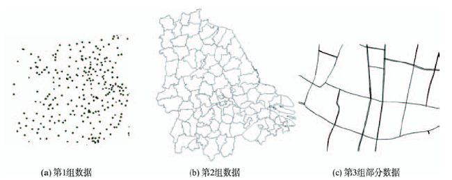
Fig.1 General view of the experimental data

图1 实验数据示意图

对测试的矢量地理数据进行投影变换攻击并检测水印,实验结果如表1所示。
Tab.1 Result of the algorithm robustness after the project transformation

表1 投影变换攻击鲁棒性实验结果

实验编号 实验1 实验2 实验3 实验4 实验5 实验6
实验数据 第1组 第1组 第2组 第2组 第3组 第3组
原始坐标系 WGS84 墨卡托 兰伯特 WGS84 高斯克吕格 兰伯特
投影攻击后坐标系 墨卡托 WGS84 WGS84 兰伯特 兰伯特 高斯克吕格
水印精度/m 0.1 0.1 0.01 0.01 0.001 0.001
X坐标误差最大值 3.6 4.6 5.6×10⁻³ 4.9×10⁻³ 4.3×10⁻³ 3.3×10⁻³
X坐标误差最小值 4.3×10⁻⁸ 9.3×10⁻⁸ 6.0×10⁻⁸ 2.5×10⁻⁸ 5.7×10⁻⁹ 6.1×10⁻⁹
X坐标误差平均值 0.12 0.14 1.5×10⁻³ 2.4×10⁻³ 7.9×10⁻⁴ 4.7×10⁻⁴
Y坐标误差最大值 2.5 3.2 0.32 0.27 5.6×10⁻³ 4.3×10⁻³
Y坐标误差最小值 6.6×10⁻⁸ 3.8×10⁻⁸ 1.3×10⁻⁸ 8.0×10⁻⁸ 3.5×10⁻⁸ 1.9×10⁻⁸
Y坐标误差平均值 0.14 0.15 2.6×10⁻³ 1.9×10⁻³ 5.1×10⁻⁴ 3.7×10⁻⁴
自相关系数 1.0 1.0 1.0 1.0 1.0 1.0
检测结果 成功 成功 成功 成功 成功 成功
运行时间/s 6.78 6.96 3.28 3.04 11.90 10.29
在投影变换攻击实验的基础上,进一步增加复合攻击的方式验证算法的鲁棒性,实验结果如表2所示。
Tab.2 Result of the algorithm robustness after the compound attack

表2 复合攻击鲁棒性实验结果

实验7 实验8 实验9 实验10 实验11 实验12 实验13
实验数据 第2组 第1组 第1组 第2组 第3组 第2组 第3组
复合攻击方式 压缩20%+实验3 增加30%+实验1 删除30%+实验2 平移500 m+实验4 旋转120°+实验5 压缩20%+平移500 m+实验4 增加30%+旋转60°+实验6
自相关系数 1.0 1.0 1.0 1.0 1.0 1.0 1.0
检测结果 成功 成功 成功 成功 成功 成功 成功
运行时间/s 2.98 7.23 6.22 3.03 11.56 2.86 13.45
表1可见,水印算法能保证矢量地理数据在不同类型的投影变换的攻击下,仍能检测出水印,表明算法对投影变换具有好的鲁棒性,并且具有较高的运算效率。其原因是使用二元三次多项式进行拟合已经能较好的保证精度,且计算量不大。比较每个实验结果,使用多项式进行投影变换的误差 t 较小,并远低于投影变换的误差 T ,即 t < T ,故在这种精度保证的条件下,投影变换后的数据与原始数据可认为一致,能够保证水印的存在,实现了抗投影变换的特性。
表2可见,在数据受到压缩、增加、删除、平移等攻击与投影变换复合攻击下,水印仍能完好检测出,效率也较高。由于水印算法设计中包含道格拉斯压缩的预处理,因此对压缩攻击具有理论上的鲁棒性,采用的坐标映射和量化嵌入即水印算法,能抵抗一定程度上的常规攻击方式。而算法能抵抗平移旋转等攻击,验证了上述能抵抗投影变换攻击的水印算法理应同时抵抗仿射变换的攻击。综上所述,实验证明了算法能够较好地抵抗投影变换和各种类型的复合攻击。

5 结论

本文针对矢量地理数据容易受到投影变换攻击的情形下,使用二元三次多项式建立投影坐标系之间的变换,提出了一种能抵抗投影变换的矢量地理数据水印算法,并进行了鲁棒性实验。实验结果表明,提出的水印算法不仅能抵抗投影变换攻击,而且对常规的数据删除、数据增加攻击、几何攻击及其复合攻击均具有好的鲁棒性。因此,该算法实现了矢量地理数据对安全保护的需要,拓展了矢量地理数据的安全应用范畴,具有一定的实用价值。

The authors have declared that no competing interests exist.

[1]
Yan H W, Li J, Wen H.A key points-based blind watermarking approach for vector geospatial data[J]. Computers, Environment and Urban systems, 2011,35(6):485-492.This paper presents a blind watermarking approach to protecting vector geo-spatial data from illegal use. By taking into account usability, invisibility, robustness, and blindness, the approach firstly determines three feature layers of the geo-spatial data and selects the key points from each layer as watermark embedding positions. Then it shuffles the watermark and embeds it in the least significant bits (LSBs) of the coordinates of the key points. A similar process for selecting the feature layers and the key points in the watermark embedding process is carried out to detect the watermark followed by obtaining the embedded watermark from the LSBs of the coordinates of the key points. Finally, the similarity degrees of three versions of the watermark from three feature layers are calculated to check if the data contains the watermark. Our experiments show that the method is rarely affected by data format change, random noise, similarity transformation of the data, and data editing.

DOI

[2]
Cao J, Li A, Lv G.Study on multiple watermarking scheme for GIS vector data[C]. 2010 IEEE 18th International Conference on Geoinformatics, 2010:1-6.

[3]
杨成松,朱长青,陶大欣.基于坐标映射的矢量地理数据全盲水印算法[J].中国图象图形学报,2010,15(4):684-688.通过对全盲水印特点的分析,提出了将文字按照字符编码方式直接转化为二进制位的水印信息生成方式。基于矢量地理数据的空间定位特性,研究了水印嵌入与提取中坐标映射机制和映射函数构造原则。利用提出的水印生成和坐标映射方法,建立了一种矢量地理空间数据全盲水印算法。实验结果表明,提出的算法能抵抗矢量数据中常见的数据压缩、增点、删点、编辑、裁剪以及平移等攻击,具有很好的鲁棒性。

DOI

[ Yang C S, Zhu C Q, Tao D X.A blind watermarking algorithm for vector geo-spatial data based on coodinate Mapping[J]. Journal of Image and Graphics, 2010,15(4):684-688. ]

[4]
Zope-Chaudhari S, Venkatachalam P.Protecting geospatial data using digital watermarking[C]. 2012 International Conference on Computer and Communication Engineering (ICCCE), 2012:594-598.

[5]
郭思远,朱长青,阚映红,等.空域矢量地理数据水印算法及攻击方法分析[J].测绘科学,2009,34(3):37-38.本文提出了一种数据精度较高的基于灰度图像的空间域矢量地理数据水印算法,总结了一些矢量地理数据水印的常用攻击方法,并通过实验证明该算法对数据精度的影响较小鲁棒性较强,文中的攻击方法能比较全面地评价矢量地理数据水印算法的优劣.

[ Guo S Y, Zhu C Q, Kan Y H, et al.Analysis of spatial domain arithmetic and attacking methods for vector geo-data watermarking[J]. Science of Surveying and Mapping, 2009,34(3):37-38. ]

[6]
Bird S, Bellman C, Schyndel R V.A shape-based vector watermark for digital mapping[C]. 2009 Digital Image Computing: Techniques and Applications, 2009:454-461.

[7]
郭思远,朱长青.基于灰度图像的矢量地理空间数据水印算法[J].测绘工程,2008,17(1):21-23.根据灰度图像信息量大、可视化效果好等特点,提出一种基于灰度图像水印的空间域矢量地理空间数据水印算法,即先将灰度图像水印信息按一定法则进行处理,再将处理后的水印信息嵌入到空间域矢量地理空间数据中,最后对嵌入水印信息的矢量地理空间数据进行检测。文中还对矢量地理空间数据进行了攻击实验,分析表明,提取出的灰度图像水印具有较好的鲁棒性效果和一定的实用价值。

DOI

[ Guo S Y, Zhu C Q.Vector geo-spatial data watermarking arithmetic based on gray image[J]. Engineering of Surveying and Mapping, 2008,17(1):21-23. ]

[8]
曹刘娟,门朝光,孙建国.基于空间特征的二维矢量地图可逆水印算法原理[J].测绘学报,2010,39(4):422-427.可逆水印技术能够在精确提取水印信息的同时,完全无损恢复原始载体数据,更适用于矢量地图版权保护。提出一种基于空间特征的二维矢量地图可逆水印算法。该算法在保持矢量地图特征点相对位置的前提下,根据密钥对特征点位置进行非线性置乱,避免非授权用户对矢量地图高精度数据的使用,并在置乱后的特征点中嵌入水印信息,能够在提取水印信息的同时无损恢复原始矢量数据。实验结果表明该水印方案严格可逆,具有较好的隐蔽性。

[ Cao L J, Men C G, Sun J G.Space feature-based reversible watermarking theory for 2D-vector maps[J]. Acta Geodaetica et Cartographica Sinica, 2010,39(4):422-427. ]

[9]
谭斌,李岩.一种基于特征点的矢量地图水印算法[J].计算机工程,2012,38(4):134-139.提出一种基于特征点的矢量地图水印算法。在嵌入水印信息前,采用Torus自同构映射对水印图像进行置乱处理,将矢量地图分割为指定数量顶点的曲线集合,选择曲线中角度最小的顶点作为特征点,在地图精度允许的范围内,通过改变该特征点的坐标值,将制作的水印图像重复嵌入到这些特征点中。实验结果表明,该算法不仅能获得较好的地图精度,且对压缩攻击和各种裁剪攻击也具有较强的鲁棒性。

DOI

[ Tan B, Li Y.Watermark algorithm for vector map based on feature point[J]. Computer Engineering, 2012,38(4):134-139. ]

[10]
Xu D, Wang Q.The study of watermarking algorithm for vector geospatial data based on the phase of DFT[C]. 2010 IEEE International Conference on Wireless Communications, Networking and Information Security, 2010:625-629.

[11]
Im D H, Lee H Y, Ryu S J, et al.Vector watermarking robust to both global and local geometrical distortions[J]. Signal Processing Letters, 2008,15:789-792.A blind watermarking algorithm for vector graphic images is presented. The algorithm is resilient to both global and local geometrical distortions. The polygonal line is represented by the wavelet descriptor. An additive watermarking scheme is used to embed the watermark by slightly modifying the wavelet descriptor, and that causes invisible distortions to the coordinates of the vertices. The invariant properties of the wavelet descriptor ensure that the presented algorithm is resilient against both global and local geometrical distortions. Using vector graphic images from contour maps, we demonstrate that the presented algorithm outperforms the algorithm based on the Fourier descriptor.

DOI

[12]
王奇胜,朱长青,许德合.利用DFT相位的矢量地理空间数据水印方法[J].武汉大学学报·信息科学版,2011,36(5):523-526.基于矢量地理空间数据自身的特点,运用离散傅立叶变换(DFT)技术研究了基于DFT相位的矢量地理空间数据数字水印算法。由于DFT相位的较小变化也会导致原始数据的较大改变,因此引入自相关检测来辅助判定数字水印的存在。实验表明,DFT相位水印算法在抗矢量地理空间数据处理中常见的删点、数据格式转换、平移、旋转等攻击方面具有较好的效果,并且针对浮点型数据的效果要明显优于整数型数据的结果。

[ Wang Q S, Zhu C Q, Xu D H.Watermarking algorithm for vector geo-spatial data based on DFT phase[J]. Geomatics and Information Science of Wuhan University, 2011,36(5):523-526. ]

[13]
Lee S H, Kwon K R.Vector watermarking scheme for GIS vector map management[J]. Multimedia tools and applications, 2013,63(3):757-790.A geographical information services (GIS) can be provided on the basis of a digital map, which is the fundamental form of representation of data in a GIS. Because the process of producing a digital map is considerably complex and the maintenance of a digital map requires substantial monetary and human resources, a digital map is very valuable and requires copyright protection. A digital map consists of a number of layers that are categorized in terms of topographical features and landmarks. Therefore, any unauthorized person can forge either an entire digital map or the feature layers of the map. In this paper, we present a robust and invisible watermarking scheme based on polylines and polygons for the copyright protection of a GIS digital map. The proposed scheme clusters all polylines and polygons in the feature layers of the map on the basis of the polyline length and the polygon area. And then a watermark is embedded in GIS vector data on the basis of the distribution of polyline length and polygon area in each group by moving all vertices in polylines and polygons within a specified tolerance. Experimental results confirm that the proposed scheme is more robust against geometric attacks, such as rotation, scaling, and translation (RST) transformations, data addition, cropping, breaking, and filleting attacks, and layer attacks with rearrangement and cropping, when compared with conventional schemes. Moreover, the scheme also satisfies data position accuracy.

DOI

[14]
Lafaye J, Béguec J, Gross-Amblard D, et al.Blind and squaring-resistant watermarking of vectorial building layers[J]. Geoinformatica, 2012,16(2):245-279.Abstract<br/>Due to the ease of digital copy, watermarking is crucial to protect the intellectual property of rights owners. We propose an effective watermarking method for vectorial geographical databases, with the focus on the buildings layer. Embedded watermarks survive common geographical filters, including the essential squaring and simplification transformations, as well as deliberate removal attempts, e.g. by noise addition, cropping or over-watermarking. Robustness against the squaring transformation is not addressed by existing approaches. The impact on the quality of the data sets, defined as a composition of point accuracy and angular quality, is assessed through an extensive series of experiments. Our method is based on a quantization of the distance between the centroid of the building and its extremal vertex according to its orientation.<br/>

DOI

[15]
张驰,李安波,闾国年,等.以夹角调制的矢量地图可逆水印算法[J].地球信息科学学报,2013,15(2):180-186.传统水印嵌入方法往往导致原始载体数据质量的下降, 而可逆水印技术由于能完整恢复原始载体数据, 因此,在精度要求较高的矢量地图版权保护应用中具有较高的适用性。目前, 栅格图像的可逆水印算法研究较为成熟, 而在矢量地图领域则主要借鉴栅格图像的相关方法, 由于没有充分利用矢量数据的组织特性, 因此鲁棒性不强。针对上述问题, 本文以矢量地图坐标点之间的基本空间关系在常规地图操作前后的不变性, 提出一种鲁棒的矢量地图可逆水印算法。算法首先利用道格拉斯&mdash;普克方法将要素点分为特征点与非特征点两类, 在此基础上计算每个非特征点与其相邻前后特征点连线所构成的夹角。在水印嵌入时, 利用该夹角来映射水印比特位, 并通过调整非特征点坐标来对该夹角进行调制以实现水印信息的嵌入。实验表明该算法所生成的水印具有一般可逆水印的不可感知性与可逆性, 同时, 对旋转、平移、要素排序、裁剪、压缩、简化等攻击也具有较好的鲁棒性。

DOI

[ Zhang C, Li A B, Lv G N, et al.A reversible watermarking algorithm for vector map based on angle modulating[J]. 2013,15(2):180-186. ]

[16]
李英奎,吕肖庆,李敬.多投影间地图投影变换实现的途径与优化[J].地理学与国土研究,2000,16(2):79-84.针对多种地图投影间自由变换的需求,综合对比地图投影变换的主要方法及其特点,该文认为反解变换是解决多种投影间投影变换的最佳途径.以此为基础,具体探讨了地图投影变换计算机实现的主要过程,讨论了地图投影体系、投影参数、算法优化和误差控制等投影变换计算机实现中的

DOI

[ Li Y K, Lv X Q, Li J.Computer Implementation method and optimization of map projection transformation among multi-projections[J]. Geography and Territorial Research, 2000,16(2):79-84. ]

[17]
刘宏林,吕晓华,江南,等.影响地图投影多项式变换精度的若干因素分析[J].测绘科学技术学报,2011,28(2):108-112.地图投影变换是数字地图制图和地理信息系统中进行地理空间数据处理的重要步骤和过程,而多项式变换又是地图投影数值变换中最常用和最有效的方法之一。提出了影响地图投影多项式变换精度的若干因素,深入分析了这些因素对多项式变换精度的影响,最后得出了提高多项式投影变换精度的相关结论。

DOI

[ Liu H L, Lv X H, Jiang N, et al.Analysis of some influencing factors on accuracy of map projective polynomial transformation[J]. Journal of Geomatics Science and Technology, 2011,28(2):108-112. ]

[18]
朱长青. 数值计算方法及其应用[M].北京:科学出版社,2006:113-115.

[ Zhu C Q.Numerical calculation method and its applications[M]. Beijing: Science Press, 2006:113-115. ]

文章导航

/