
基于条件控制扩散模型的遥感图像超分辨率增强算法
|
付奕博(1999— ),男,辽宁鞍山人,硕士生,研究方向为遥感、深度学习。E-mail: 2220902121@cnu.edu.cn |
Copy editor: 蒋树芳 , 黄光玉
收稿日期: 2024-06-04
修回日期: 2024-09-03
网络出版日期: 2024-10-09
基金资助
国家自然科学基金项目(42071318)
国家重点研发计划项目(2022YFB3904104)
A Super-Resolution Enhancement Algorithm for Remote Sensing Images Using Conditional Controlled Diffusion Models
Received date: 2024-06-04
Revised date: 2024-09-03
Online published: 2024-10-09
Supported by
National Natural Science Foundation of China(42071318)
National Key R&D Program of China, grant number(2022YFB3904104)
图像超分辨率技术通过提升图像的空间分辨率,增强图像清晰度,增加图像细节信息,实现在硬件条件不变的情况下提高图像质量。鉴于遥感影像具有较大的像幅、复杂的特征表现和丰富的细节,结合遥感图像信息高效获取的需求,本文提出了一种基于条件控制扩散模型(Diffusion Model)的遥感图像超分辨率算法DSR(Diffusion Super-Resolution)。该算 法以同一区域的低分辨率遥感图像为扩散模型的控制条件,与添加噪声后的高分辨率遥感图像拼接作为输入,构建了一个以U-Net为主干,融合残差连接和自注意力机制的深度噪声训练网络,并改进了损失函数以获得更优的超分辨率效果。 本文实验中采用了多时相、多时期的国产卫星高分系列、高景系列的高分辨率遥感图像以及公开数据集Alsat-2B作为测试数据,测试了从32像素尺寸扩大至128像素的超分辨率效果。在这一基础上,将本文提出的算法与Bicubic、SRGAN、Real-ESRGAN、SwinIR等超分辨率算法进行比较,在PSNR和SSIM指标上取得了更好的性能。实验结果表明: DSR算法适用于遥感图像的超分辨率重建,特别是在多光谱遥感图像的超分辨率处理中,能够提升超分辨率结果质量,克服了简单卷积网络只能提取图像浅层特征的局限,避免了对抗神经网络训练过程中难以收敛的问题,显著提升了遥感图像中丰富细节的还原能力。

付奕博 , 谢东海 , 王志博 , 易畅 , 郭柳艳 , 吴俣 . 基于条件控制扩散模型的遥感图像超分辨率增强算法[J]. 地球信息科学学报, 2024 , 26(10) : 2384 -2393 . DOI: 10.12082/dqxxkx.2024.240315
Image super-resolution technology enhances image clarity and enriches image detail by improving image spatial resolution, enabling quality enhancement without changing hardware conditions. Given the large size, complex target features, and abundant details of remote sensing images, along with the need for efficient information acquisition, we propose a Diffusion Super-Resolution (DSR) algorithm based on a conditional diffusion model. This approach uses low-resolution remote sensing images from the same region as conditioning inputs to the diffusion model, while high-resolution images with added noise are concatenated as inputs. A deep noise training network was constructed with U-Net as the backbone, incorporating residual connections and self-attention mechanisms. The loss function was also improved for better super-resolution results. The DSR method was tested using high-resolution remote sensing images from multiple periods of the domestic Gaofen and SuperView satellite series. The super-resolution results demonstrated pixel dimension expansion from 32 to 128. Comparative experiments with Bicubic, SRGAN, Real-ESRGAN, and SwinIR super-resolution algorithms showed that the DSR method outperforms these algorithms in both PSNR and SSIM metrics. Additionally, the DSR method significantly improves the quality of multispectral remote sensing images. By leveraging the conditional diffusion model, it successfully preserves rich detail and enhances spatial resolution without compromising image clarity. This method offers an efficient solution for super-resolution reconstruction, ensuring effective information acquisition in remote sensing applications and fulfilling the requirements of various domains such as land use classification, environmental monitoring, and urban planning. Moreover, the DSR method also opens new avenues for future research by demonstrating the potential of diffusion models in remote sensing image processing. It overcomes the limitations of simple convolutional networks, which extract only shallow features, and avoids the convergence issues commonly seen in adversarial neural networks during training, ultimately improving the restoration of rich details in remote sensing images.
表1 SR训练与验证实验数据集Tab. 1 SR training and validation experimental datasets |
| 数据集 | 原始空间分辨率/m | 展示图 |
|---|---|---|
| GF2系列 | 0.7 |    |
| GF7系列 | 0.6 |    |
| Alsat-2B数据集 | 2.5 |   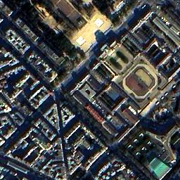 |
表2 SR算法在2个数据集上的PSNR、SSIM平均值Tab. 2 SR algorithms on two datasets: PSNR and SSIM mean values |
| 算法名称 | PSNR | SSIM |
|---|---|---|
| SRGAN | 23.67 | 0.594 |
| Real-ESRGAN | 17.71 | 0.474 |
| SwinIR | 17.92 | 0.602 |
| DSR(Ours) | 24.48 | 0.717 |
| [1] |
唐艳秋, 潘泓, 朱亚平, 等. 图像超分辨率重建研究综述[J]. 电子学报, 2020, 48(7):1407-1420.
[
|
| [2] |
朱红, 宋伟东, 谭海, 等. 多尺度细节增强的遥感影像超分辨率重建[J]. 测绘学报, 2016, 45(9):1081-1088.
[
|
| [3] |
李欣, 韦宏卫, 张洪群. 结合深度学习的单幅遥感图像超分辨率重建[J]. 中国图象图形学报, 2018, 23(2):209-218.
[
|
| [4] |
张兵, 高连如, 李嘉鑫, 等. 高/多光谱遥感图像超分辨率融合研究进展与展望[J]. 测绘学报, 2023, 52(7):1074-1089.
[
|
| [5] |
|
| [6] |
|
| [7] |
|
| [8] |
|
| [9] |
|
| [10] |
|
| [11] |
|
| [12] |
|
| [13] |
|
| [14] |
|
| [15] |
|
| [16] |
|
| [17] |
闵杰, 张永生, 于英, 等. 增强型遥感影像SRGAN算法及其在三维重建精度提升中的应用[J]. 地球信息科学学报, 2022, 24(8):1631-1644.
[
|
| [18] |
|
| [19] |
|
| [20] |
|
| [21] |
苏健民, 杨岚心. 基于生成对抗网络的单帧遥感图像超分辨率[J]. 计算机工程与应用, 2019, 55(12):202-207,214.
[
|
| [22] |
|
| [23] |
|
| [24] |
|
| [25] |
|
/
| 〈 |
|
〉 |


