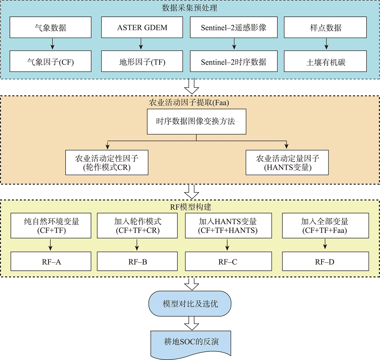
| 变量类别 | 变量 | 软件 | 数据来源 | 原始分辨率 |
|---|---|---|---|---|
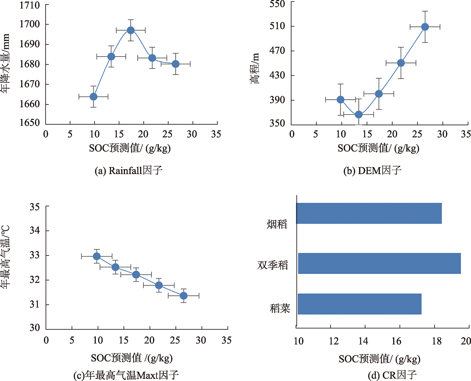
| 气候因子 (Climate Factors, CF) | 年最高气温(Max Annual Temperature, Maxt) 年最低气温(Min Annual Temperature, Mint) 年降水量(Mean Annual Rainfall, Rainfall) | ArcGIS10.2 | 世界气象数据库(WorldClim Database, | 4.6 km |
| 地形因子 (Topographical Factors, TF) | 数字高程模型(Digital Evaluatio Model, DEM) 坡度(Slope)、坡向(Aspect) 平面曲率(Surface Curvature, Suc) 剖面曲率(Section Curvature, Sec) 地形湿度指数(Topographic Wetness Index, TWI) | ArcGIS10.2 | 地理空间数据云网站(Geospatial Data Cloud, | 30.0 m |
| 农业活动因子(Factor of agricultural activity, Faa) | 轮作模式(Crop Rotation, CR) | Google Earth Engine | 欧洲航天局(European Space Agency, | 10.0 m |
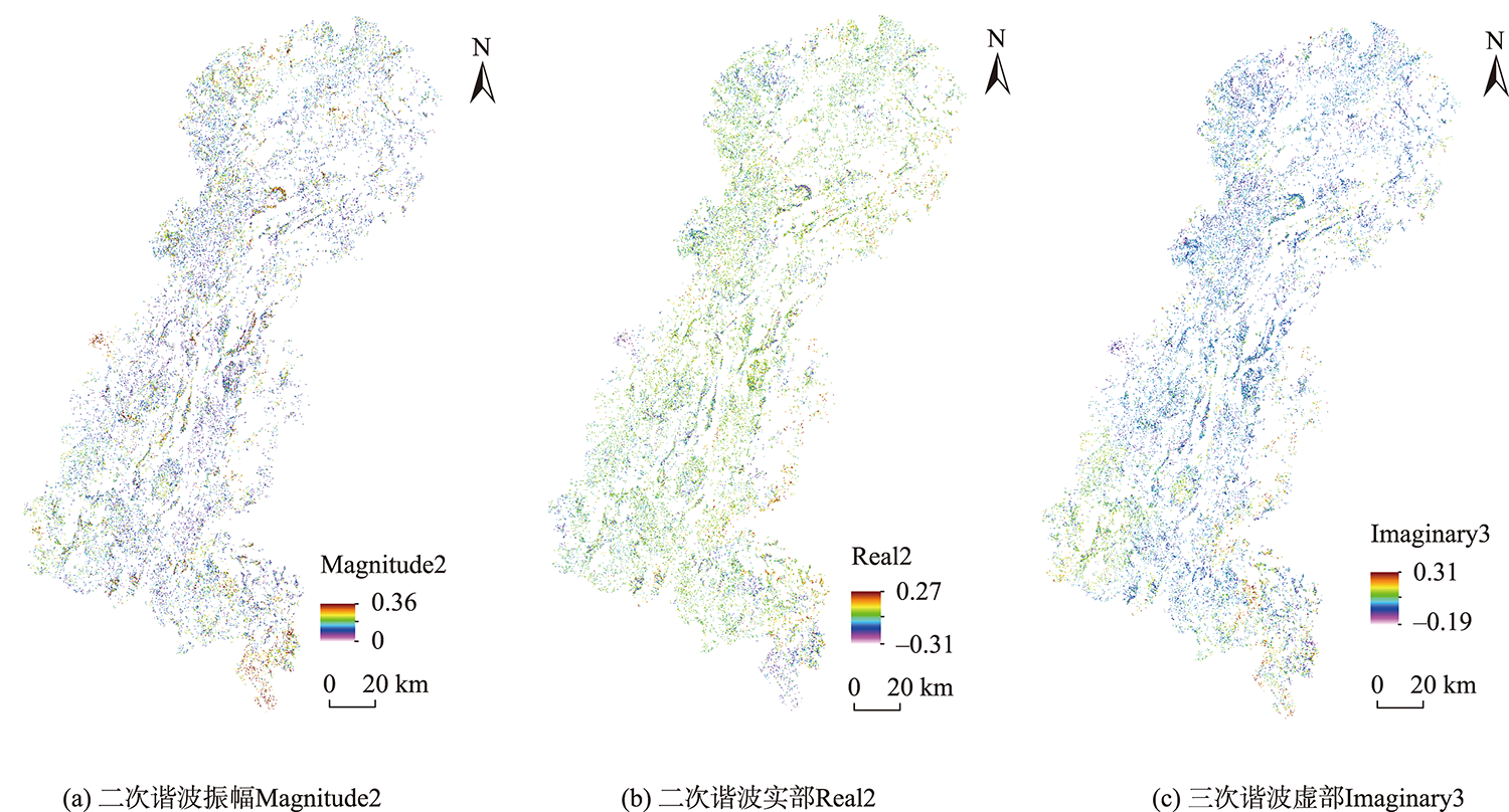
| 哨兵2号 NDVI 时间序列数据进行HANTS变换生成的13个变量:前三次谐波相位(The 1st phase part, Phase1; The 2st phase part, Phase2; The 3st phase part, Phase3) 前三次谐波振幅相位(The 1st magnitude part, Magnitude1; The 2st magnitude part, Magnitude2; The 3st magnitude part, Magnitude3) 前三次谐波虚部(The 1st imaginary part, Imaginary1; The 2st imaginary part, Imaginary2; The 3st imaginary part, Imaginary3) 前三次谐波实部(The 1st real part, Real1; The 2st real part, Real2; The 3st real part, Real3) NDVI均值(Mean of NDVI, Pndvi) | ENVI/IDL |