
Journal of Geo-information Science >
Fractal Based Method on Selecting the Optimal Spatial Resolution for Remote Sensing Image
Received date: 2014-10-16
Request revised date: 2014-11-15
Online published: 2015-04-10
Copyright
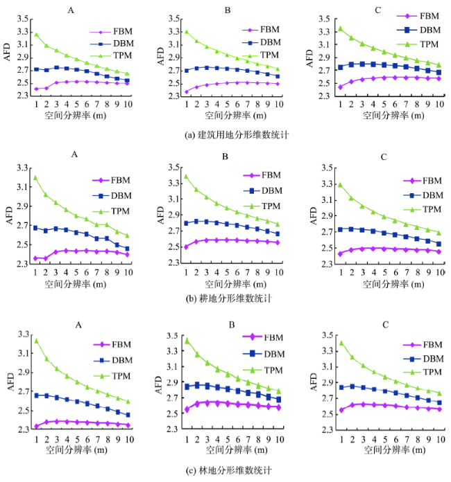
Observation scale research is one of the important subjects of scale research in remote sensing, and it is also one of the research focuses of information extraction from remote sensing images. Analysis of the scale properties in remote sensing image is normally based on geo-statistics, which mainly highlights the linear features of the remote sensing image. However, remote sensing image generally consists of both linear and non-linear features, it is insufficient and to use analysis that based on only geo-statistics. This paper discusses a fractal based method on selecting the optimal spatial resolution for remote sensing image (also known as optimal pixel-based observation scale) by analyzing the remote sensing image scale effect and study the mechanism of fractal characteristics. Three categories of study regions, covered by building, farmland and forest respectively, were cut from IKONOS panchromatic image and used as the experimental data. Then, a series of fractal dimensions based on Fractal Brown Motion, Double Blanket Method and Triangular Prism Method respectively were calculated along with the change of spatial resolution. The statistical analyses of the experimental results demonstrate that the fractal dimensions generally show a decreasing trend with the increase of spatial resolution, and some turning points emerged at certain spatial resolutions. According to the analysis, the spatial patterns or internal structures in remote sensing image vary among different scales. And with the decreasing of spatial resolution, the roughness of image will also decrease since many details are ignored. Nevertheless, the fractal dimension is the only basic quantitative value to describe the self-similarity and irregular degree of object, and it is intuitively consistent with the roughness. Therefore, the turning points at certain spatial resolutions indicate the significance for choosing the optimal spatial resolution. The experimental results show that the fractal based method on selecting the optimal observation scale is theoretically and practically significant to geo-applications, and it extends the research categories by analyzing remote sensing observation scales from different perspectives.
FENG Guixiang , MING Dongping . Fractal Based Method on Selecting the Optimal Spatial Resolution for Remote Sensing Image[J]. Journal of Geo-information Science, 2015 , 17(4) : 478 -485 . DOI: 10.3724/SP.J.1047.2015.00478
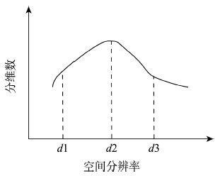
Fig. 1 Sketch map of the relation between spatial resolution and fractal dimension图1 遥感影像空间分辨率与分形维数关系图 |
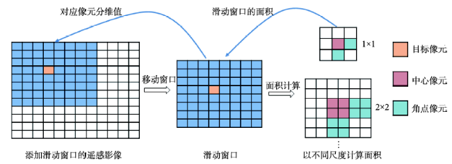
Fig. 2 Calculation diagram of window FBM method based on surface area图2 表面积加窗分形布朗运动法计算示意图 |
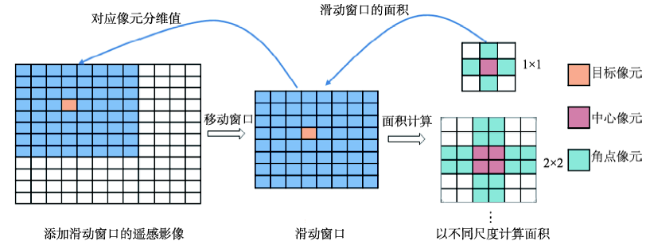
Fig. 3 Calculation diagram of window DBM method图3 加窗双层地毯法计算示意图 |
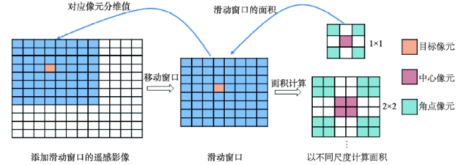
Fig. 4 Diagram of window TPM method图4 加窗三棱柱法示意图 |
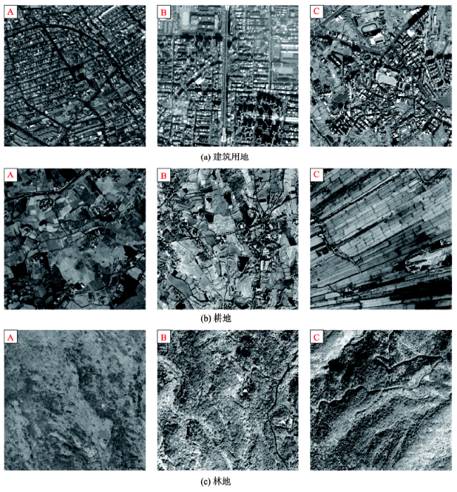
Fig. 5 Experimental image with 1 m spatial resolution图5 实验影像图(1 m分辨率) |
Fig. 6 Statistical charts of the fractal dimension for different ground features图6 各地物分形维数统计图 |
The authors have declared that no competing interests exist.
| [1] |
|
| [2] |
|
| [3] |
|
| [4] |
|
| [5] |
|
| [6] |
|
| [7] |
|
| [8] |
|
| [9] |
|
| [10] |
|
| [11] |
|
| [12] |
|
| [13] |
|
| [14] |
|
| [15] |
|
| [16] |
|
| [17] |
|
| [18] |
|
| [19] |
|
| [20] |
|
| [21] |
|
| [22] |
|
/
| 〈 |
|
〉 |