
Journal of Geo-information Science >
Research on Classification of Rainstorm Watershed Delineation Approach for Plain Urban Regions
Received date: 2014-05-16
Request revised date: 2014-10-28
Online published: 2015-04-10
Copyright
The compartmentalization of urban rainwater catchment basin is an initial step in the application of spatially distributed hydrological models. Traditional watershed delineation approach has a better application in the plain region where less human activities are involved. However, in the flat areas of city it cannot get a correct watershed boundary and accurate watershed delineations. The realistic river network and watershed boundary may not always be derived from conventional DEM processing methods. In this paper, in order to reflect the city morphologies and represent the real situation of drainage network, a new method is proposed based on city classification and anthropogenic land cover features that influence the drainage patterns. According to the city drainage system and urban land classification, this method divides the city into the inner-city and suburban neighborhoods. According to the ability of river catchment, we take the rainwater catchment basins into lower divisions, and then find the anthropogenic land cover features that influence the convergence of the inner-city and suburban neighborhoods. To downscale the DEM and extract drainage structures and watershed boundaries with improved accuracy, we take the anthropogenic land cover features (i. e. roads and streams, buildings, some pond and drainage networks) into the DEMs, divide the catchment basin based on D8 algorithm and modify the catchment areas using Thiessen polygon. The results show that the method is effective and matches well with the real situation of city, which not only take the advantage of anthropogenic land cover features. but also combine with the spatial distribution of urban drainage facilities. The method is applied to a watershed in the Shanghai Jiading drainage basin based on high accuracy DEM and topographic river map, and we compare the proposed method with traditional methods. The results show that the proposed method has a good applicability for the plain urban areas and is able to produce more realistic results. Above all, we conclude that this method is effective and easy to implement.
Key words: watershed; classification; flat region; DEM; Voronoi
XUE Fengchang , SHENG Jieru , QIAN Hongliang . Research on Classification of Rainstorm Watershed Delineation Approach for Plain Urban Regions[J]. Journal of Geo-information Science, 2015 , 17(4) : 462 -468 . DOI: 10.3724/SP.J.1047.2015.00462
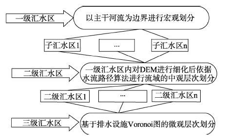
Fig. 1 Flowchart of urban storm flood classification图1 城市暴雨积涝分级划分流程图 |
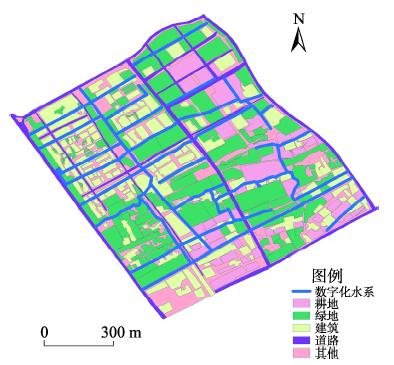
Fig. 2 Land use map in the research area图2 研究区土地利用图 |
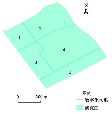
Fig. 3 First-level catchment division in the research area图3 研究区一级汇水区划分 |
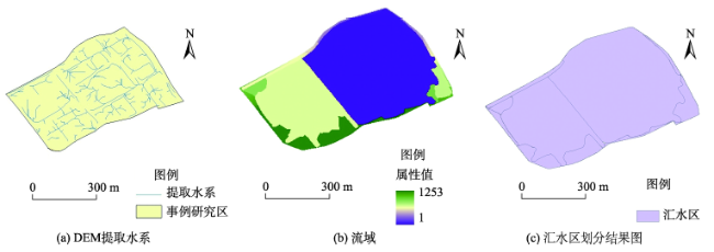
Fig. 4 Second-level catchment division in the research area图4 研究区二级汇水区划分过程 |
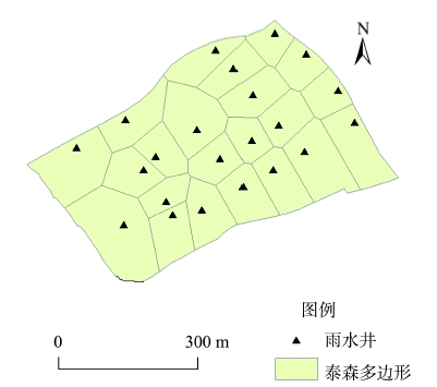
Fig. 5 Catch basins and Thiessen polygons图5 雨水井及泰森多边形确定 |
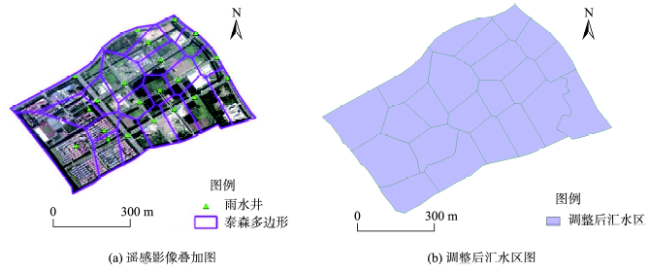
Fig. 6 Adjusted results of watershed delineation图6 汇水区调整结果 |
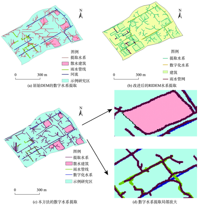
Fig. 7 Comparison of different methods图7 方法比较 |
The authors have declared that no competing interests exist.
| [1] |
|
| [2] |
|
| [3] |
|
| [4] |
|
| [5] |
|
| [6] |
|
| [7] |
|
| [8] |
|
| [9] |
|
| [10] |
|
| [11] |
|
| [12] |
|
| [13] |
|
| [14] |
|
| [15] |
|
| [16] |
[ 16] 郑子彦,
|
| [17] |
|
| [18] |
|
| [19] |
|
| [20] |
|
| [21] |
|
/
| 〈 |
|
〉 |