
Journal of Geo-information Science >
Research and Experiments on Repairing and Correction of Ancient Maps
Received date: 2015-06-01
Request revised date: 2015-07-09
Online published: 2016-01-10
Copyright
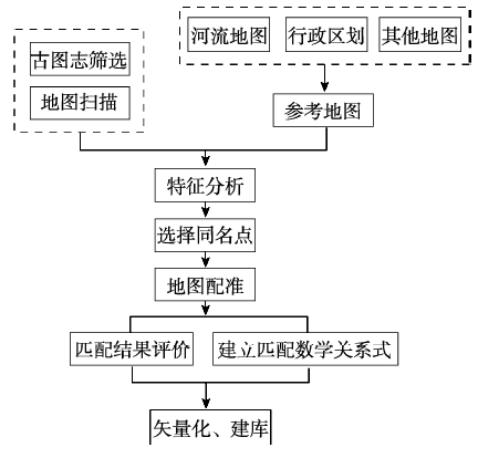
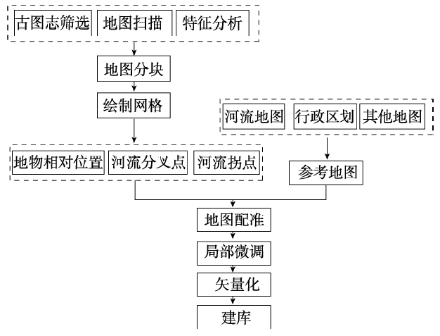
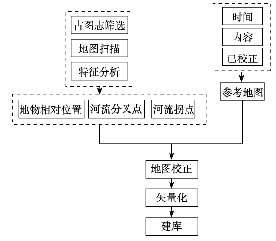
The kilometer grid style and landscape painting style are two features of Chinese ancient maps. However, the positioning accuracy of ancient maps is very low due to the lack of a clear mathematical basis. It is difficult to apply map processing, map correction and geo-referencing on these ancient maps. This paper divides the current positioning datum of ancient maps into three types: one with no geo-reference, one with partial geo-reference, and one with definite geo-reference, and explores the map repairing methods from the following aspects: data selection, pre-processing, radiometric correction, and geographical information recovery. Besides, this paper takes some Chinese near modern maps as examples in several map matching experiments, adapts different spatial positioning methods, such as feature point correction, matching by grid, and relative position shift, to complete corrections between Chinese ancient maps and modern maps, and focuses on the mathematical relationship in the square grid maps and different geo-reference systems and projection systems. Finally, we try to establish the mathematical relationships between the corrected ancient maps and the accurate maps, and study the relationship between “six key points of mapping” and the modern coordinates system.
ZHAO Kai , JIANG Lili . Research and Experiments on Repairing and Correction of Ancient Maps[J]. Journal of Geo-information Science, 2016 , 18(1) : 21 -31 . DOI: 10.3724/SP.J.1047.2016.00021
Tab. 1 Grades of different conditions of maps表1 地图品相级别 |
| 级别 | 描述 |
|---|---|
| 十品 | 崭新、平整、无磨损、无折痕 |
| 九品 | 基本崭新,有自然磨损,有少数轻度折痕 |
| 八品 | 画面有不能除去的轻度污迹(如汗迹、锈迹等),四角微损 |
| 七品 | 中度磨损,页面较干净、平整,有个别字迹,但不能有明显的污迹 |
| 六品 | 失去大部分光泽,有明显的疤痕和角位受损,有明显的污迹补 |
| 五品及以下 | 除非罕见或作为资料备存,否则无收藏价值 |
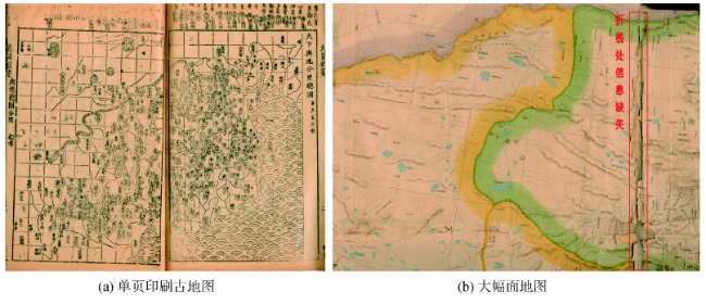
Fig. 1 Conditions of different sizes and types of maps图1 不同幅面地图品相 |
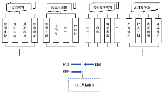
Fig. 2 Geo-correction dataset图2 地理校正数据集合 |
Fig. 3 Pre-processing图3 预处理 |
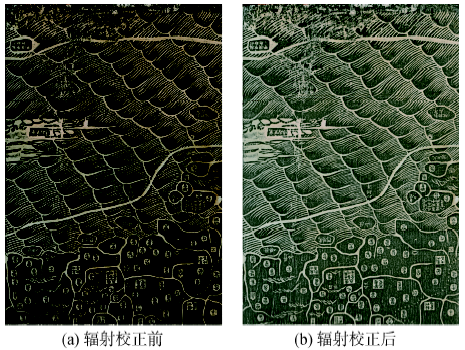
Fig. 4 Radiometric correction图4 辐射校正 |
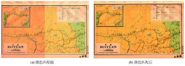
Fig. 5 Color matching图5 颜色匹配 |
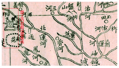
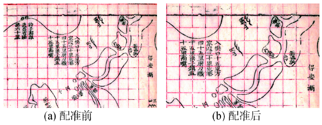
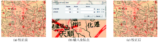
Fig. 6 Registration points selection图6 配准点选取 |
Fig. 7 Map matching using kilometer grid (local maps)图7 方里网校正(局部图) |
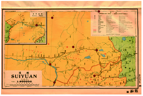
Fig. 8 Map matching using kilometer grid (global maps)图8 方里网校正(全局图) |
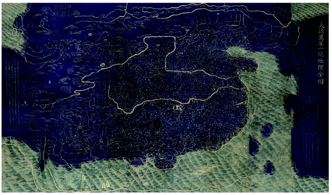
Fig. 9 Matched complete geographical map of great Qing Dynasty图9 大清万年一统地理全图(局部拼接后) |
Fig. 10 Georeferenced map correction图10 有地理参考的地图的地理校正 |
Fig. 11 Corrected map of Qing Dynasty图11 大清帝国图的校正 |
Fig. 12 Kilometer girded map correction图12 计里画方地图校正 |
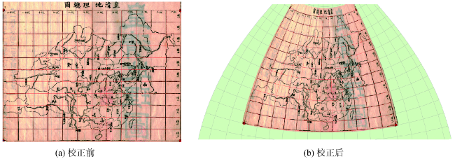
Fig. 13 Corrected geographical general map of Qing Dynasty图13 皇清地理总图校正 |
Fig. 14 Correction of maps represented by landscape painting图14 山水形象画法地图校正 |
The authors have declared that no competing interests exist.
| [1] |
[
|
| [2] |
|
| [3] |
[
|
| [4] |
[
|
| [5] |
[
|
| [6] |
[
|
| [7] |
[ Han Z Q. A new explanation of six elements of map making and related issues[J]. Journal of Tsinghua University, 2009,24(6):110-115, 159-160. ]
|
| [8] |
[
|
| [9] |
[ Zhang Z M. The development and enlightenment of the Governance channel maps[N]. Yellow River News, 2009-9-4(3). ]
|
| [10] |
[
|
| [11] |
国家地理信息网中心网站.
[ National Geomatics Center of China). ]
|
| [12] |
[
|
| [13] |
|
| [14] |
[
|
| [15] |
[
|
| [16] |
|
| [17] |
[
|
| [18] |
[
|
| [19] |
|
| [20] |
|
| [21] |
|
| [22] |
|
| [23] |
|
| [24] |
|
| [25] |
|
| [26] |
|
| [27] |
[
|
| [28] |
[
|
| [29] |
[
|
/
| 〈 |
|
〉 |