
Journal of Geo-information Science >
Study on the Features of Navigational Charts in China's Ming Dynasty
Received date: 2015-04-13
Request revised date: 2015-05-14
Online published: 2016-01-10
Copyright
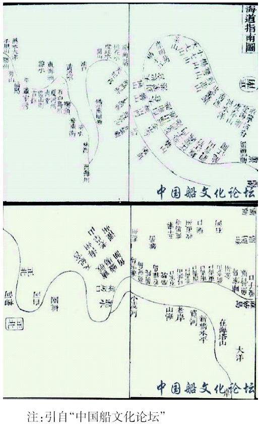
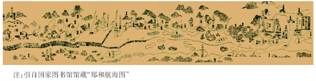
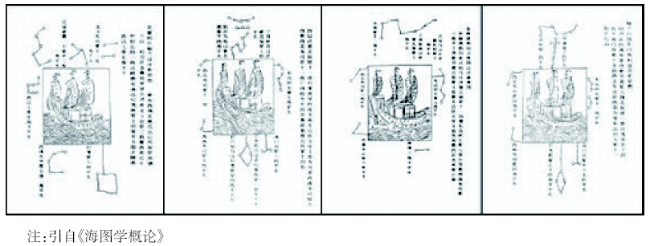
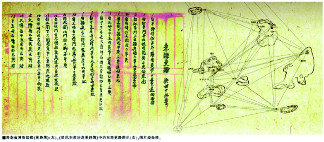
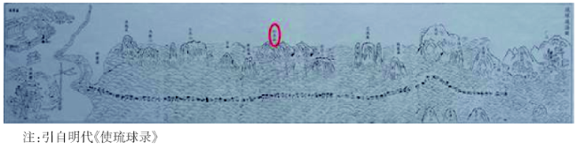
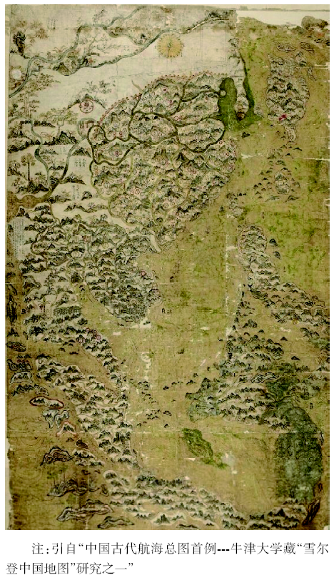
The navigational charts in China's Ming dynasty are famous all over the world at that time, such as the ‘Hydrographic Guide Map’ so far discovered in the early Ming Dynasty, which collected the detailed shipping route to transport grain from the south to the north along the coastline between Ningbo and Liao river over thousands of years; and the ‘ZhengHe Navigational Chart’, which reveals the style and features in a period of great prosperity on Chinese ancient navigation achievements and navigational chart techniques and includes 14 seaway routes crossing Asia, Africa and Europe recognized as the first one in the world. The inheritance and development of the ‘Maritime Silk Road’ since Han dynasty, once again advocates the main purpose of the traditional business between china and foreign countries, which is the culture exchange and local product trading. The ‘Sea Route Book’ recorded the navigational guide of South China Sea as the legacy and at the cost of generations of fishermen's life during the ancient times. The ‘Ryukyu Nautical Charts’ shows the distribution of navigation routes that ancient Chinese navigators recorded during their visits to Ryukyu, Taiwan, Japan and other places across the east ocean of China. The ‘Selden Map of China’ keeps the functions of a general nautical map, and perfected the nautical chart series of Ming dynasty. This paper also systematically discusses the realistic style of the navigational charts, their matching descriptions or drawings in Ming dynasty, as well as the adoptions of ‘Opposite Scenery Method’, ‘Lead Star Board’, ‘Water Compass’, ‘Astronomical Observation Instruments’, ‘Speed Detection On Board’ and other unique techniques.
LIANG Xun . Study on the Features of Navigational Charts in China's Ming Dynasty[J]. Journal of Geo-information Science, 2016 , 18(1) : 32 -38 . DOI: 10.3724/SP.J.1047.2016.00032
Fig. 1 Hydrographic guide map图1 海道指南图(局部) |
Fig. 2 ZhengHe’s nautical chart图2 郑和航海图(样品) |
Fig. 3 The constellation chart of crossing seas图3 过洋牵星图 |
Fig. 4 The South China Sea mumbo-jumbo (Sea Route Book)图4 南海天书《更路薄》(局部) |
Fig. 5 Ryukyu nautical charts图5 琉球过海图 |
Fig. 6 The Selden Map of China图6 雪尔登中国地图 |
The authors have declared that no competing interests exist.
| [1] |
[
|
| [2] |
[
|
| [3] |
[
|
| [4] |
[
|
| [5] |
[
|
| [6] |
钮仲勋等. 《郑和航海图》在我国古代地图发展史中的地位[J].中国古代地图集(明代卷)文物出版社,1995(10):56-57.
[
|
| [7] |
[
|
| [8] |
[
|
| [9] |
杨晓虹.述评:世界现存最早的海图档案-郑和航海图[J].档案学通信,2006(2):91-93.
[
|
| [10] |
[
|
| [11] |
[
|
| [12] |
[
|
| [13] |
[
|
| [14] |
[ Jing Y C. Qiu Fuke.Chinese map myth[M]. The Science Press, 1984. ]
|
| [15] |
[
|
| [16] |
[
|
| [17] |
[
|
| [18] |
[
|
| [19] |
[
|
| [20] |
[
|
/
| 〈 |
|
〉 |