
Journal of Geo-information Science >
Study on the Artistic Characteristics of Ancient Scenic Spots Map
Received date: 2015-05-08
Request revised date: 2015-05-27
Online published: 2016-01-10
Copyright
Maps of scenic spots in ancient China were originated from Chinese landscape painting and thus associated with it closely. At the same time, the ancients paid more attention to the artistic features of maps due to time limitations as well as the lack of ancient scientific requirements for mapping. Ancient map of scenic spot is products of China's unique art and culture. It is the combination of Chinese traditional ideology and culture, calligraphy, painting and the other types of arts and it has important cultural and artistic value. This paper discusses the artistic characteristics of ancient scenic spot maps in terms of cartography, generalization, scaling, orientation, color, annotation and traditional ideology. Also, the corresponding artistic characteristics are presented by the attached maps to show the beauty of ancient art. Chinese culture is extensive and profound, and it contains a variety of ideas, such as Confucianism, Taoist thought and Buddhist thought. These thoughts have a profound impact on the development of ancient map art. Modern map pays great attention to the scientific nature leading to the lack of artistic quality. Nevertheless, the ancient Chinese map of scenic spot is inspired by Chinese traditional ideology, culture, calligraphy, painting and other forms of art ,which can well make up for its defects. Studying the artistic features of ancient scenic spot maps not only has an important reference significance for the development of contemporary cartography, but also plays an important role for inheriting Chinese traditional culture, therefore we should dig deeper into these cultural treasures and also introduce Chinese culture to the world.
PI Longfeng , ZHANG An , XIA Xiaolin . Study on the Artistic Characteristics of Ancient Scenic Spots Map[J]. Journal of Geo-information Science, 2016 , 18(1) : 96 -105 . DOI: 10.3724/SP.J.1047.2016.00096
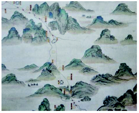
Fig. 1 Map of the scenic spots of Wutai Mountain (local)图1 五台山名胜图(局部) |
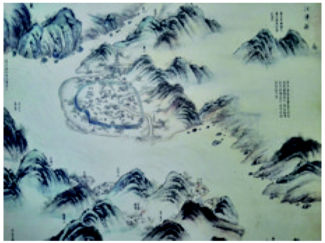
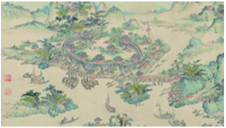
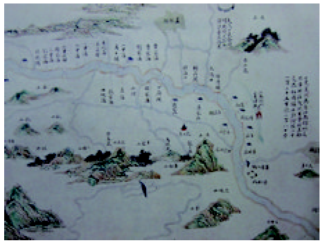
Fig. 2 Jiangjin County (local)图2 江津县(局部) |
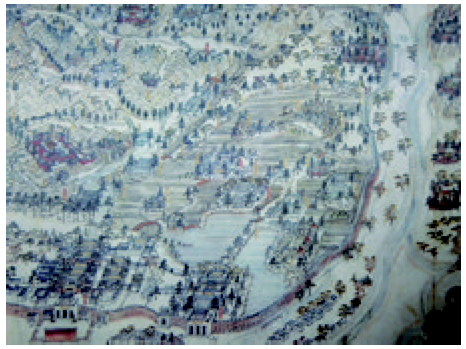
Fig. 3 Complete map of Imperial Summer Resort (local)图3 避暑山庄全图(局部) |
Fig. 4 Complete geographical map of the five imperial gardens adjacent to the three mountains and the three external garrison camps (local)图4 三山五园外三营地理全图(局部) |
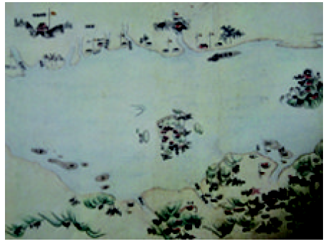
Fig. 5 Map of the scenic around Yangtze River (local)图5 长江名胜图(局部) |
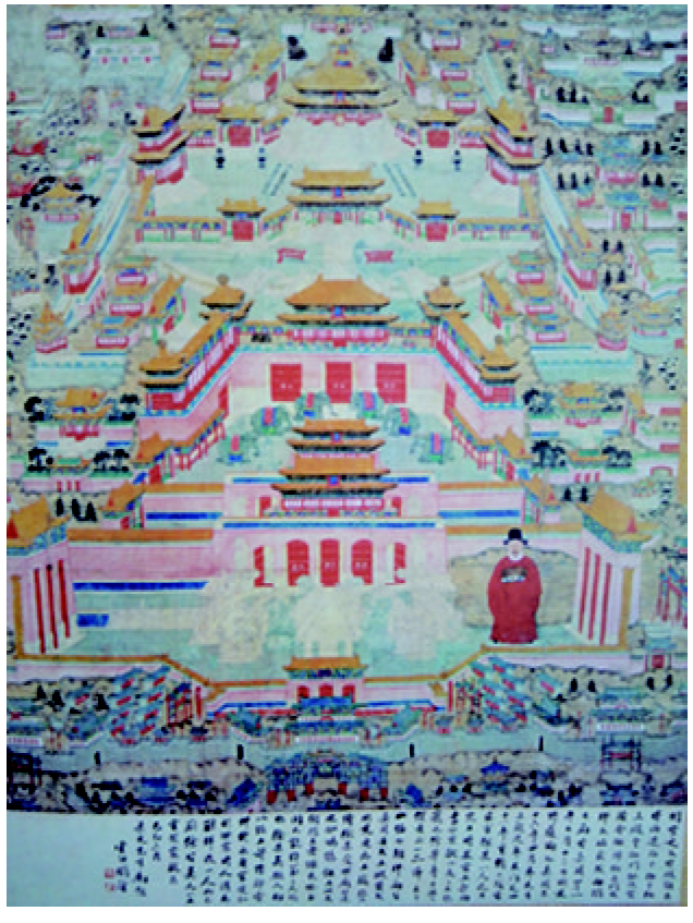
Fig. 6 Figure of Peking palace图6 北京宫殿图 |
Fig. 7 Map of Nanyue Mountain (local)图7 南岳全图(局部) |
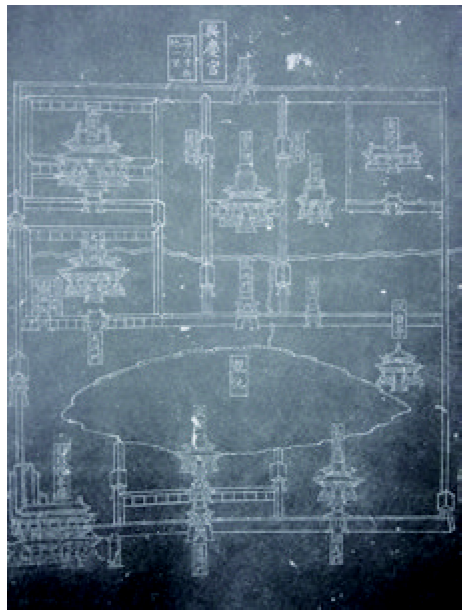
Fig. 8 Map of Xingqing Palace (local)图8 兴庆宫图(局部) |
Fig. 9 Map of Eastern Imperial Mausoleums (local)图9 东陵图(局部) |
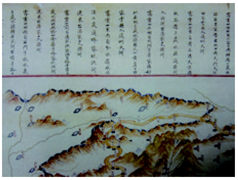
Fig. 10 Shandong canal map (local)图10 山东运河全图(局部) |
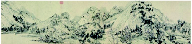
Fig. 11 Dwelling in the Fuchun Mountains(local)图11 富春山居图(局部) |
The authors have declared that no competing interests exist.
| [1] |
[
|
| [2] |
[
|
| [3] |
[
|
| [4] |
[
|
| [5] |
[
|
| [6] |
[
|
| [7] |
[
|
| [8] |
[
|
| [9] |
[
|
| [10] |
[
|
| [11] |
[
|
| [12] |
[
|
| [13] |
[
|
| [14] |
[
|
| [15] |
[
|
| [16] |
[
|
| [17] |
[
|
| [18] |
[
|
| [19] |
[
|
| [20] |
[
|
| [21] |
[
|
| [22] |
|
| [23] |
|
/
| 〈 |
|
〉 |
