
Journal of Geo-information Science >
A Study on the Method for Functional Classification of Urban Buildings by Using POI Data
Received date: 2019-10-17
Request revised date: 2019-12-09
Online published: 2020-08-25
Supported by
National Key Research and Development Program of China(2017YBF0503601)
National Key Research and Development Program of China(2017YFB0503502)
The Basal Research Fund of Chinese Academy of Surveying and Mapping(AR1904)
Copyright
As the carrier of human activity and social development, buildings are the most important geographical entities that constitute the spatial structure of a city. It is one of the urgent tasks in the construction of smart cities in China to build elaborate digital models of urban buildings. Classifying a large amount of buildings by their functions facilitates urban functional area division and urban spatial cognition, thus assisting the government in population estimation, land management, urban planning, and smart city construction. In this paper, POI (Point of Interest) with rich semantic information including name, address, and types was used as the main data source, because it was more accessible and updated more frequently than the traditional geographic information data. The process of finding out the functional type of a building was similar with identifying urban functional areas by using POI data, but there existed the problem of low classification rate due to the sparsity of POI. Therefore, to improve the traditional quantitative identification of urban functional areas, this study attempted to calculate the weighted frequency density ratio of each type of POIs inside and within a certain range around a building. Experimenting on more than 5000 buildings near South Shawo Bridge in the west of Beijing, the study found that 93.04 percent of the buildings were effectively classified into different functional types: residential, commercial, public service, and other three mixed types. The classification rate has been greatly improved compared with that of the traditional method. These classified buildings showed the spatial distribution of functional areas more clearly and precisely than blocks used in identifying urban functional areas, since too many multi-functional blocks with very limited practical meaning were identified by using the traditional method. In order to calculate the classification accuracy, more than 2000 randomly selected buildings were manually divided into functional classes with the assistance of POI and AOI data. The overall classification accuracy reached 91.18 percent compared with the manually classified result. The classification error was mainly caused by the shortage of POI and the poor data quality, which could be avoided by merging multi-source POI to improve the data quality or applying various Internet location information, such as the social media data and the real estate transaction data. However, by using easily accessible web POI data, the proposed method, which can replace manual classification in an automated way, has greatly improved the effectiveness of classifying large number of buildings into different functional types, and shown higher accuracy than existing researches.

CAO Yuanhui , LIU Jiping , WANG Yong , WANG Liangjie , WU Wenzhou , SU Fenzhen . A Study on the Method for Functional Classification of Urban Buildings by Using POI Data[J]. Journal of Geo-information Science, 2020 , 22(6) : 1339 -1348 . DOI: 10.12082/dqxxkx.2020.190608
图6 2019年北京市南沙窝桥附近区域5552栋建筑物的功能分类结果与3大类建筑物的空间分布Fig. 6 Functional classification results of 5552 buildings in the area near the South Shawo Bridge in Beijing in 2019 and the spatial distribution of three major types of buildings |
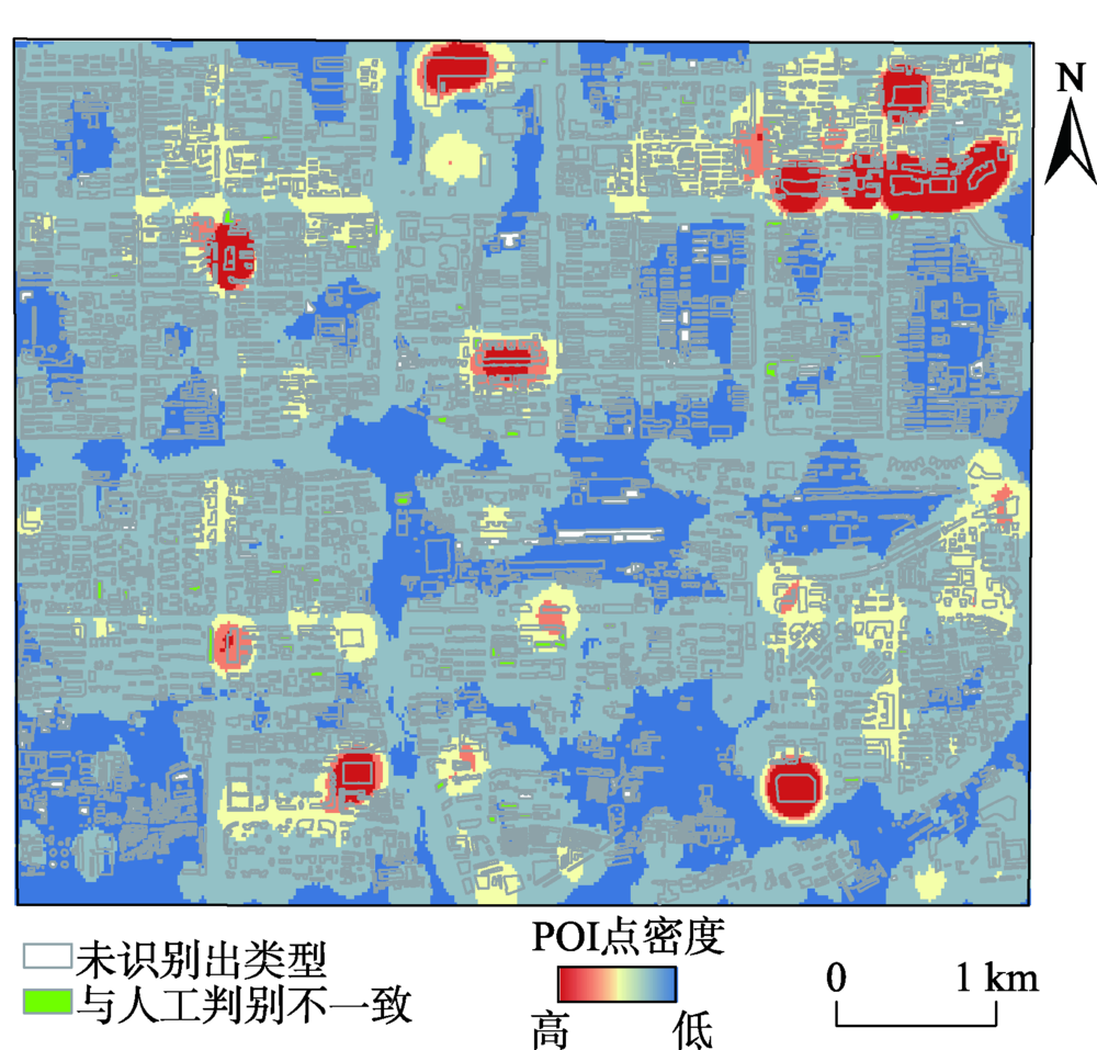
图8 研究区内部分街区的建筑物功能分类结果与百度地图所示实际情况的对比注:图(a)中①所示区域对应百度地图中芳园小区的建筑;②所示区域对应百度地图中丰台区人民检察院与中国人民大学少年新闻学院北京分院的建筑。图(b)中①所示区域对应百度地图中北京十一学校的建筑;②所示区域对应百度地图中太平路33号院的建筑;③所示区域对应百度地图中太平路小学的建筑。 Fig. 8 Comparison of building functional classification results of some blocks in the study area with Baidu map |
表1 与人工判读结果对比的建筑物功能自动分类误差矩阵Tab. 1 Automatic classification error matrix of building functions compared with manual classification results |
| 自动分类 结果/个 | 人工判读/个 | |||
|---|---|---|---|---|
| 居住 | 公共 | 商业 | 混合 | |
| 居住 | 1283 | 8 | 2 | 8 |
| 公共 | 46 | 304 | 6 | 7 |
| 商业 | 50 | 12 | 252 | 9 |
| 混合 | 37 | 3 | 6 | 167 |
| [1] |
|
| [2] |
叶娟娟, 杨昕, 熊礼阳, 等. 南京市老城区城市建筑点格局研究[J]. 地球信息科学学报, 2015,17(11):1404-1411.
[
|
| [3] |
|
| [4] |
|
| [5] |
|
| [6] |
|
| [7] |
|
| [8] |
|
| [9] |
|
| [10] |
|
| [11] |
|
| [12] |
|
| [13] |
曲畅, 任玉环, 刘亚岚, 等. POI辅助下的高分辨率遥感影像城市建筑物功能分类研究[J]. 地球信息科学学报, 2017,19(6):831-837.
[
|
| [14] |
许泽宁, 高晓路. 基于电子地图兴趣点的城市建成区边界识别方法[J]. 地理学报, 2016,71(6):928-939.
[
|
| [15] |
雷英哲, 田晶, 林镠鹏, 等. 道路网与兴趣点相结合的城市中心提取方法[J]. 测绘学报, 2015,44(S1):42-48.
[
|
| [16] |
|
| [17] |
|
| [18] |
谷岩岩, 焦利民, 董婷, 等. 基于多源数据的城市功能区识别及相互作用分析[J]. 武汉大学学报·信息科学版, 2018,43(7):1113-1121.
[
|
| [19] |
邓悦. 基于多源兴趣点数据的城市功能区划分方法研究[D]. 北京:中国测绘科学研究院, 2018.
[
|
| [20] |
池娇, 焦利民, 董婷, 等. 基于POI数据的城市功能区定量识别及其可视化[J]. 测绘地理信息, 2016,41(2):68-73.
[
|
| [21] |
熊艳艳, 吴先球. 粗大误差四种判别准则的比较和应用[J]. 大学物理实验, 2010,23(1):66-68.
[
|
| [22] |
王勇. 深网POI信息获取与一致性处理方法研究[J]. 测绘学报, 2017,46(3):399.
[
|
| [23] |
OpenStreetMap Data Extracts[DB/OL]. http://download.geofabrik.de/asia/china.html, 2019.
|
| [24] |
GB/T 21010-2017.土地利用现状分类[S].北京: 中国标准出版社, 2017.
[ GB/T 21010-2017. Current land use classification[S]. Beijing: Standards Press of China, 2017. ]
|
| [25] |
陈晨, 王法辉, 修春亮. 长春市商业网点空间分布与交通网络中心性关系研究[J]. 经济地理, 2013,33(10):40-47.
[
|
| [26] |
邹颖, 卞洪滨. 对中国城市居住小区模式的思考[J].世界建筑,2000(5):21-23.
[
|
/
| 〈 |
|
〉 |