×
模态框(Modal)标题
在这里添加一些文本
Close
Close
Submit
Cancel
Confirm
×
模态框(Modal)标题
×
Journal
Article
Figure
Search
EN
中文
Home
About Journal
Overview
Indexing
Awards
Editorial Board
Guide for Authors
Editorial Policies
Subscription
Contact Us
EN
中文
Figure/Table detail
Improving Urban Digital Elevation Models Based on Iinterpretable Random Forest Method Considering Spatial Heterogeneity
LIU Yan, SUN Yanning, CHEN Chuanfa, LIU Panpan, LIU Yating
Journal of Geo-information Science
, 2024, 26(
4
): 978-988. DOI:
10.12082/dqxxkx.2024.230590
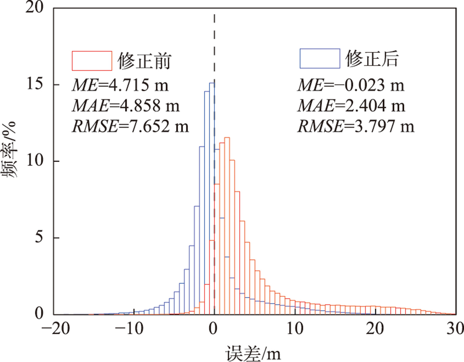
Fig. 7
Error histogram of COPDEM30 before and after correction
Other figure/table from this article
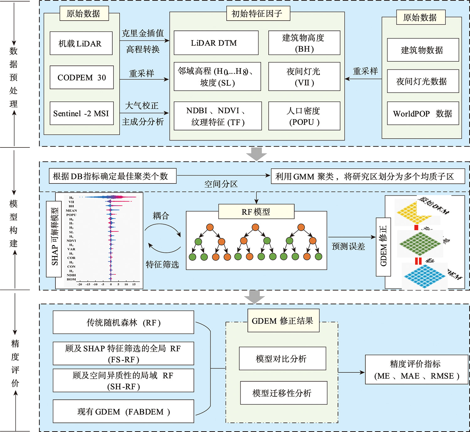
Fig. 1
Flowchart of the proposed method
Tab. 1
Texture feature description
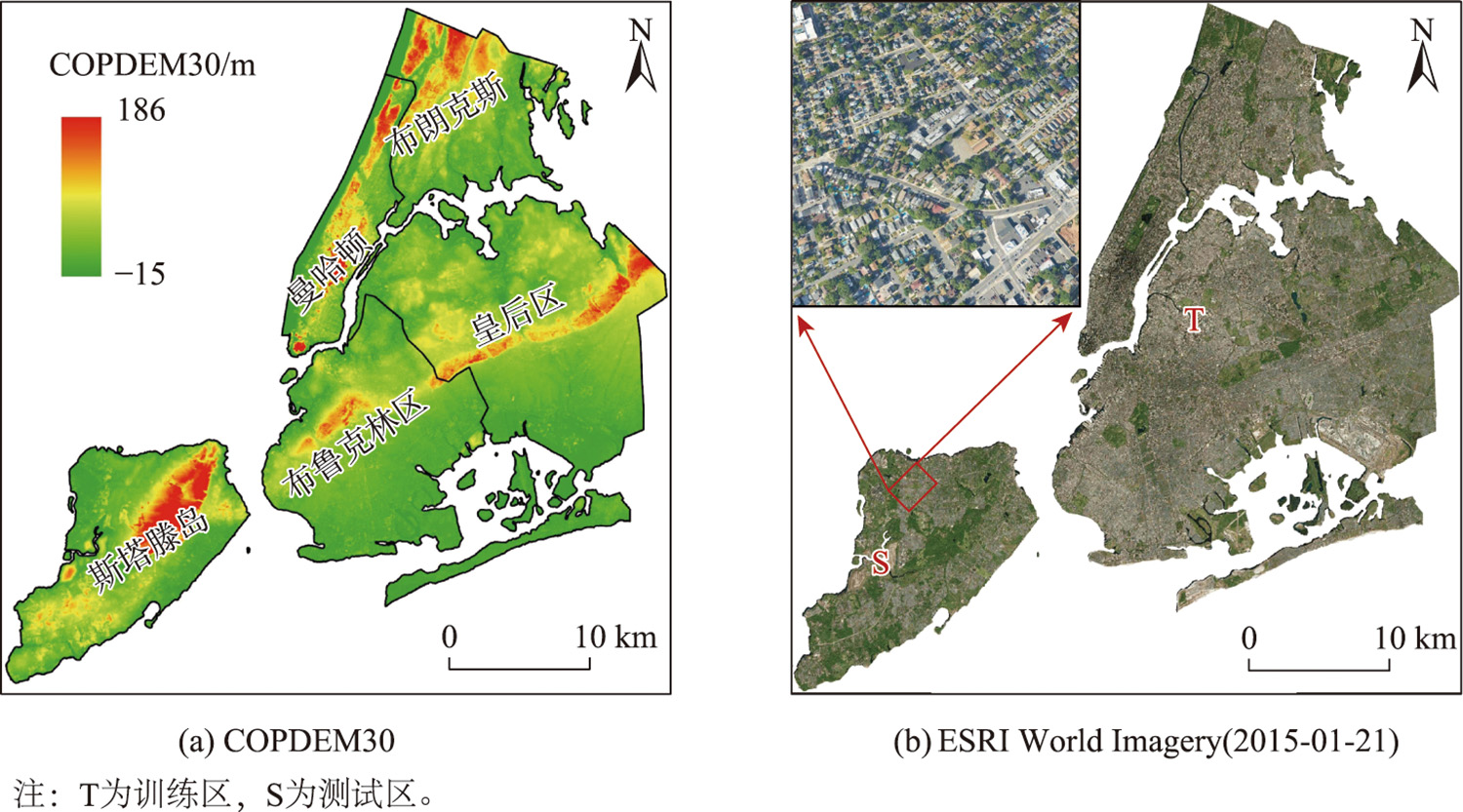
Fig. 2
Study area GDEM and remote sensing image
Tab. 2
Data source and data type
Tab. 3
DBI value under different number of clusters
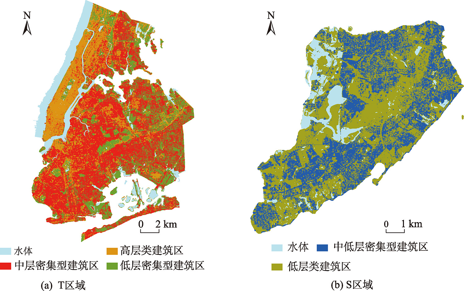
Fig. 3
Spatial partition result
Tab. 4
Statistical information of each subarea
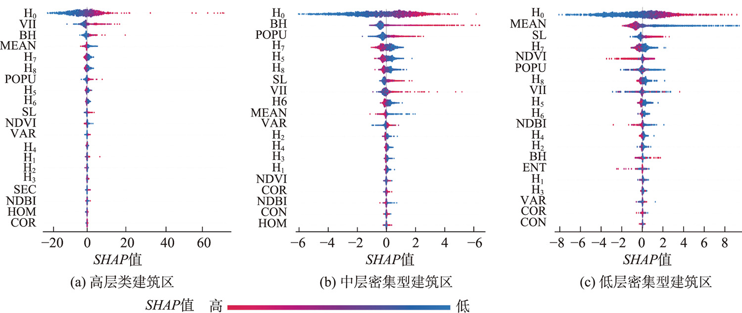
Fig. 4
SHAP feature analysis in training area
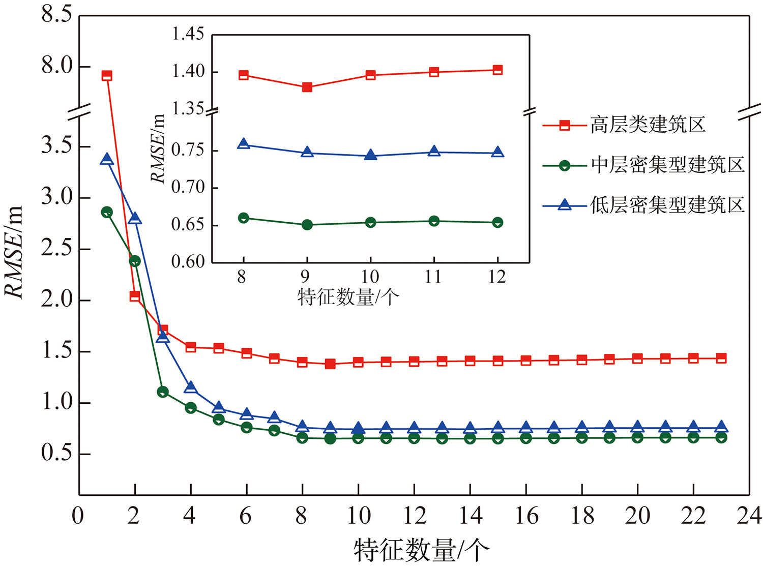
Fig. 5
Relationship between the number of features in the training area and the accuracy of the model
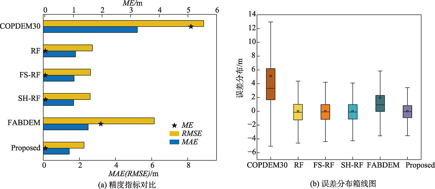
Fig. 6
Precision comparison of GDEM
Tab. 5
Accuracy analysis after COPDEM30 correction in test area (m)
Tab. 6
Correlation coefficient of the characteristic variables of training and test data
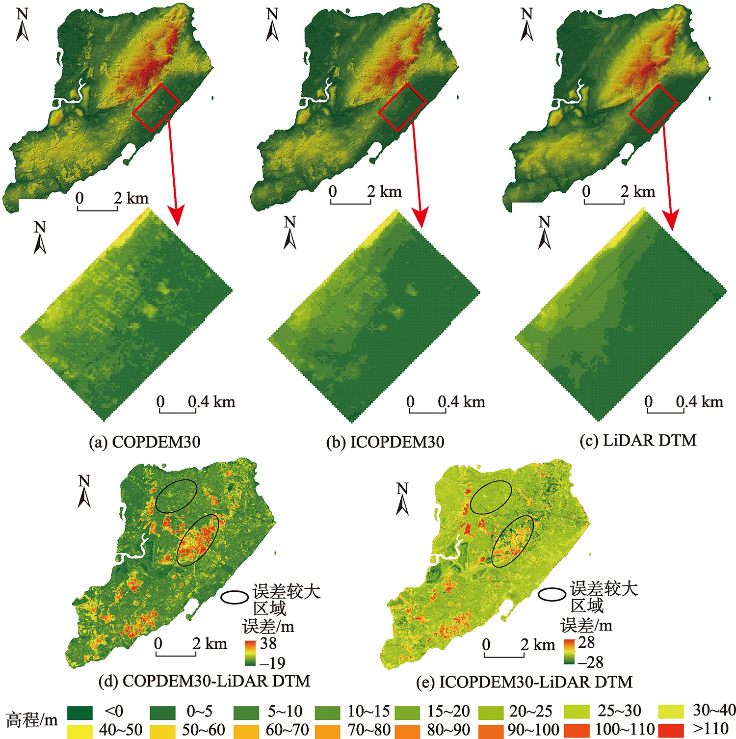
Fig. 8
Comparison of different GDEM in the test area