×
模态框(Modal)标题
在这里添加一些文本
Close
Close
Submit
Cancel
Confirm
×
模态框(Modal)标题
×
Journal
Article
Figure
Search
EN
中文
Home
About Journal
Overview
Indexing
Awards
Editorial Board
Guide for Authors
Editorial Policies
Subscription
Contact Us
EN
中文
Figure/Table detail
Spatial Identification and Temporal-spatial Evolution of Wilderness Areas in China
MA Li, PAN Jinghu
Journal of Geo-information Science
, 2023, 25(
2
): 324-339. DOI:
10.12082/dqxxkx.2023.220273
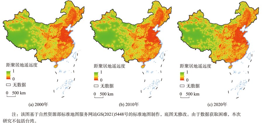
Fig. 6
Grid distance from settlements from 2000 to 2020
Other figure/table from this article
Fig. 1
Workflow for defining the extent of the WAs in China
Tab. 1
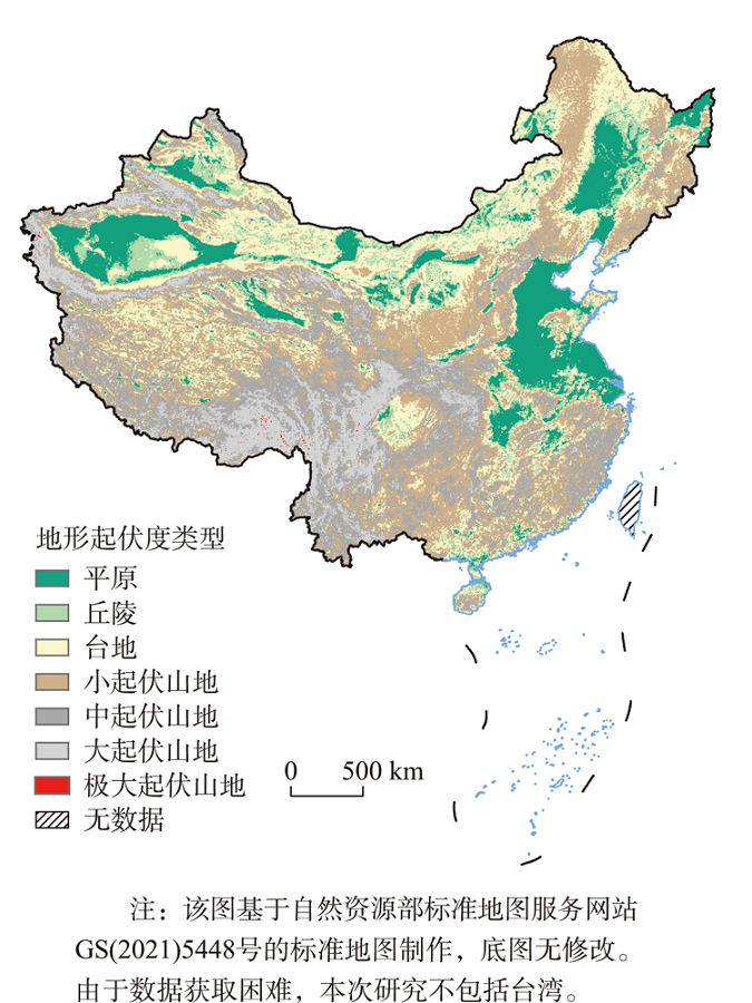
Topographic relief classification criteria and percentage of settlements
Fig. 2
Spatial distribution of topographic relief types in China
Tab. 2
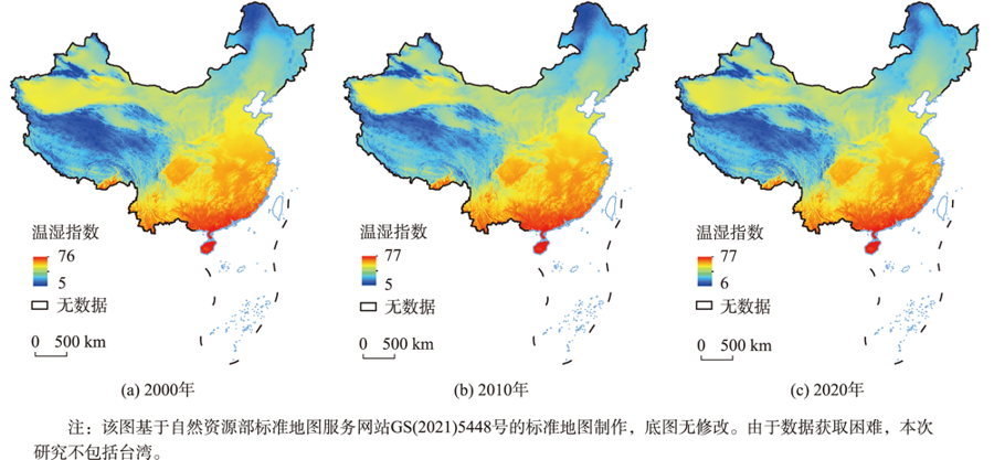
The biometeorology grade standard of THI
Fig. 3
Spatial distribution of THI in China from 2000 to 2020
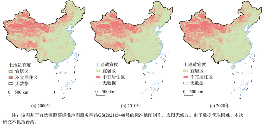
Fig. 4
Distribution of land suitability in China from 2000 to 2020
Fig. 5
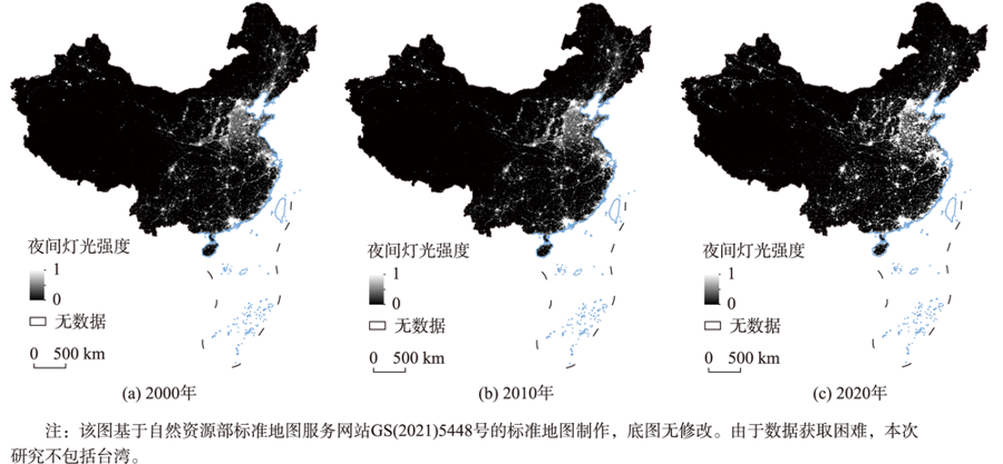
Nightlight intensity in China from 2000 to 2020
Fig. 7
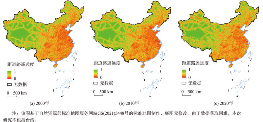
Grid distance from motor vehicle road remoteness from 2000 to 2020
Tab. 3
Sources of data required
Fig. 8
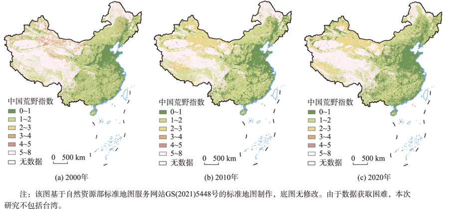
China WAsI grading from 2000 to 2020
Fig. 9
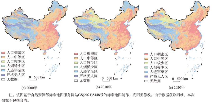
Classification of wilderness degree in China from 2000 to 2020
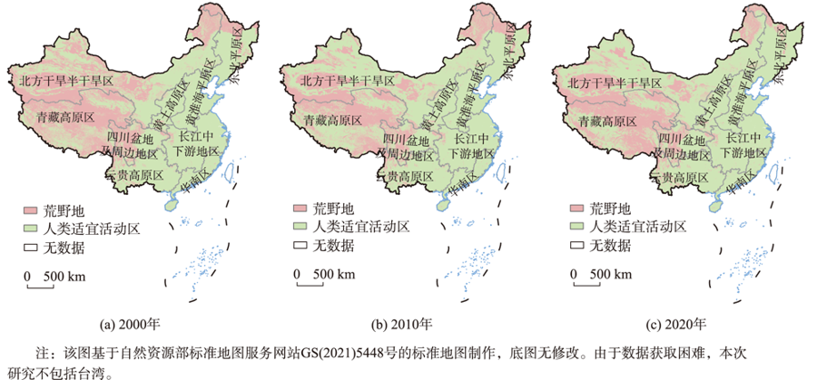
Fig. 10
Spatial distribution of WAs in different geographical divisions from 2000 to 2020
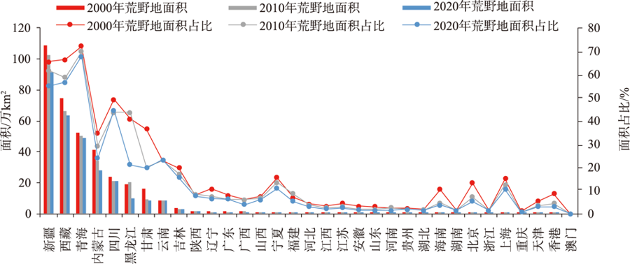
Tab. 4
Proportion of WAs in different provinces ( autonomous regions and municipalities directly under the Central Government ) of China from 2000 to 2020
Tab. 5
Area of WAs accounted for by different land types(万km
2
)
Fig. 11
Change in the area of WAs by provinces ( autonomous regions and municipalities directly under the Central Government
)
Fig. 12
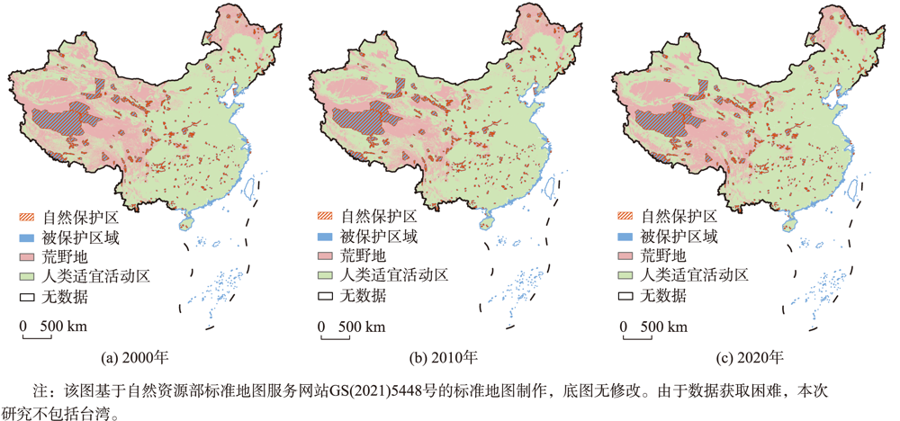
Distribution of protected WAs areas in China from 2000 to 2020
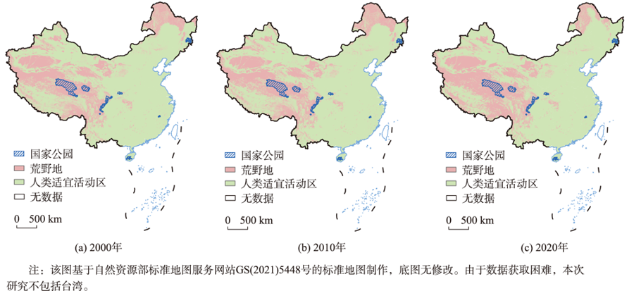
Fig. 13
Distribution of national parks and WAs from 2000 to 2020