×
模态框(Modal)标题
在这里添加一些文本
Close
Close
Submit
Cancel
Confirm
×
模态框(Modal)标题
×
Journal
Article
Figure
Search
EN
中文
Home
About Journal
Overview
Indexing
Awards
Editorial Board
Guide for Authors
Editorial Policies
Subscription
Contact Us
EN
中文
Figure/Table detail
A We-Map Mapping Method for Urban Waterlogging Scenarios
FU Xuan, YAN Haowen, WANG Xiaolong, YAN Xiaojing, WANG Zhuo, MA Wenjun
Journal of Geo-information Science
, 2024, 26(
5
): 1166-1179. DOI:
10.12082/dqxxkx.2024.230153
图结构
起点
终点
最短路径
长度
A
B
{A,B}
1
C
{A,B,E,C}
8
D
{A,B,D}
4
E
{A,B,E}
3
F
{A,B,E,F}
7
A
B
{A,B}
1
C
{A,B,D,C}
8
D
{A,B,D}
4
E
{A,B,D,C,E}
13
F
{A,B,D,C,E,F}
17
Tab. 1
Example of Dijkstra algorithm calculation
Other figure/table from this article
Fig. 1
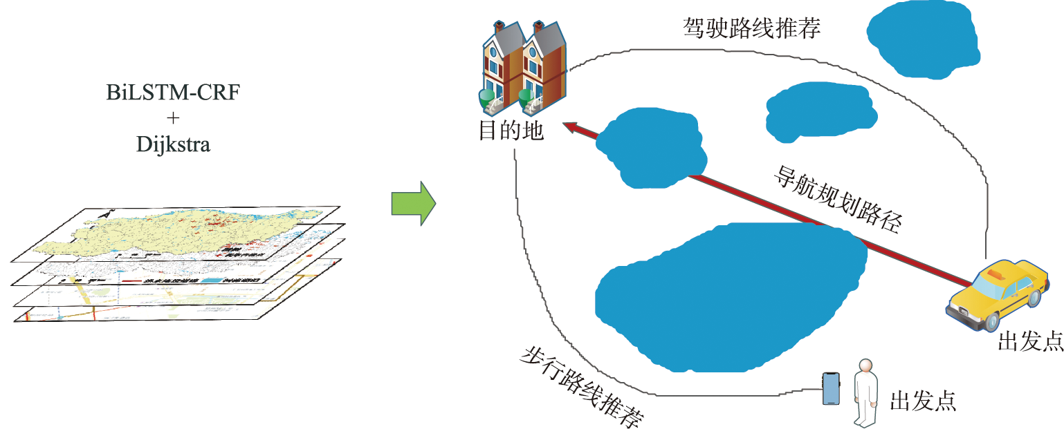
Diagram of proposed scheme
Fig. 2
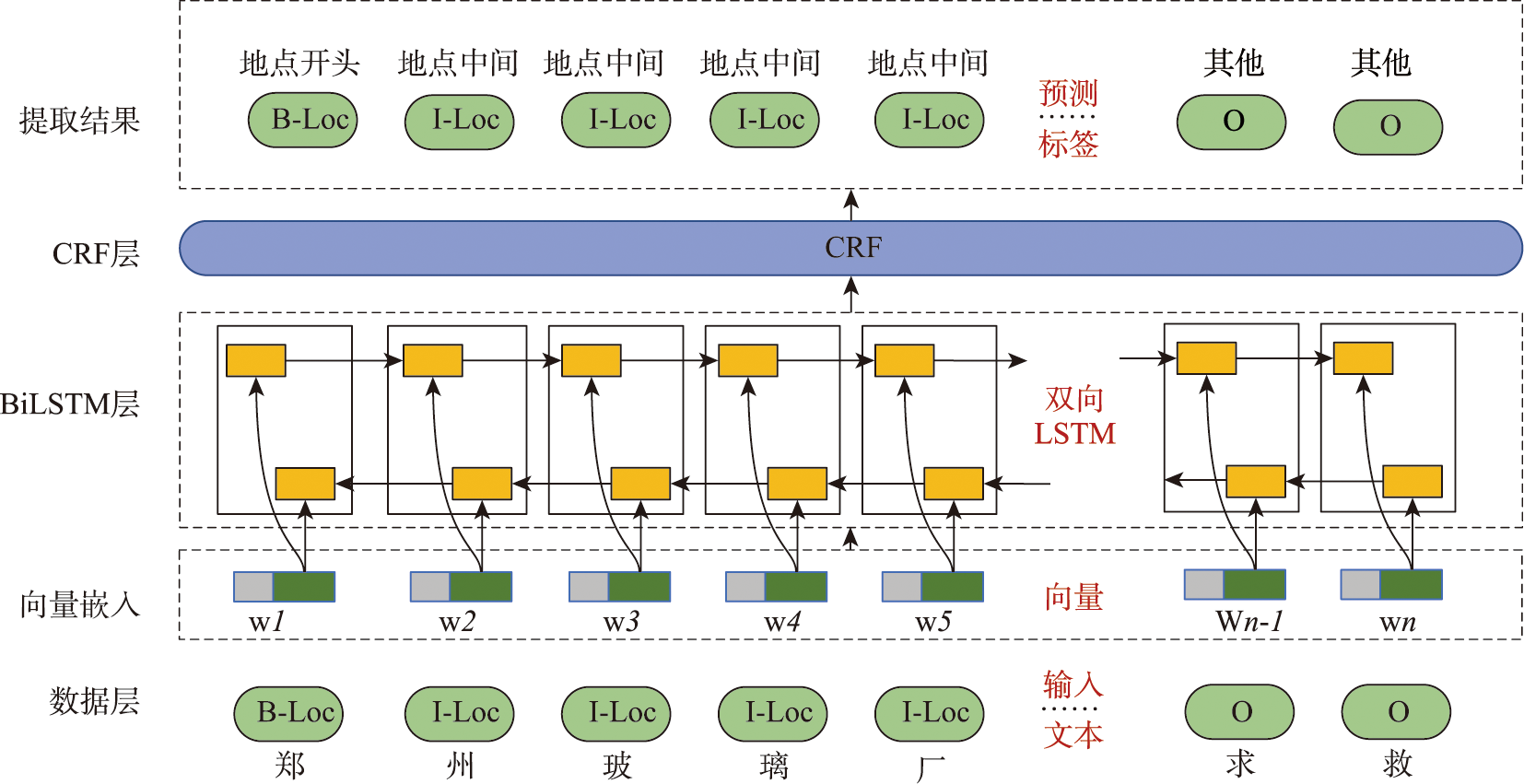
Structure diagram of BiLSTM-CRF
Fig. 3
Disaster emergency navigation map
Tab. 2
Experimental environment configuration
Tab. 3
Experimental test results
Fig. 4
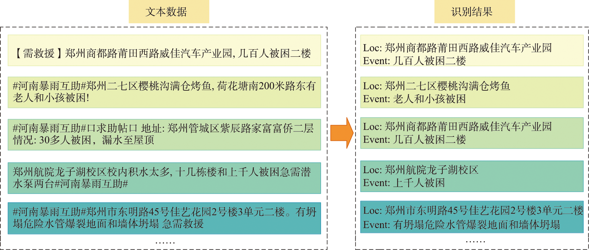
Example of identifying waterlogging points in weibo text data
Fig. 5
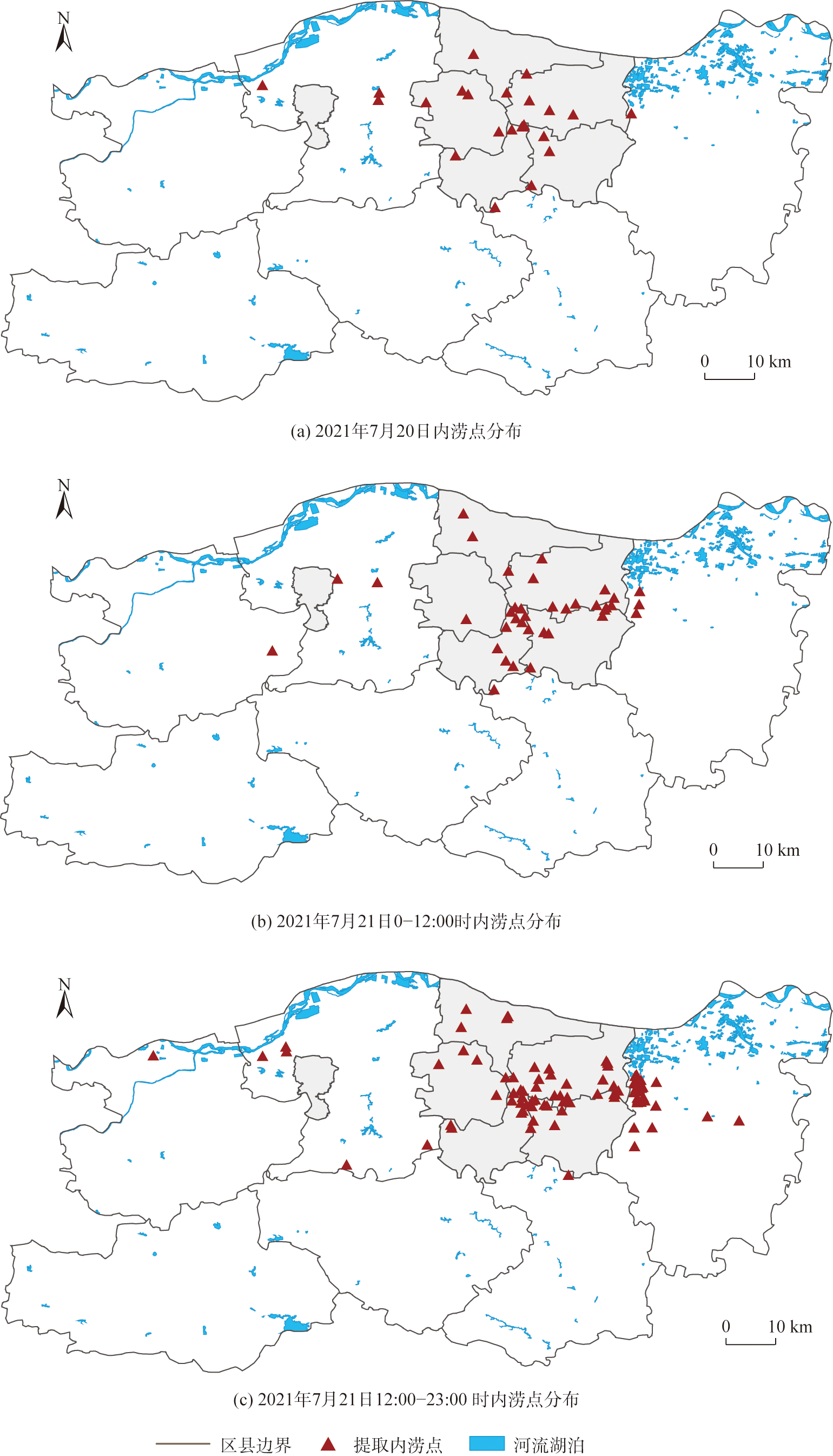
Visualization results of waterlogging points in Zhengzhou city
Fig. 6
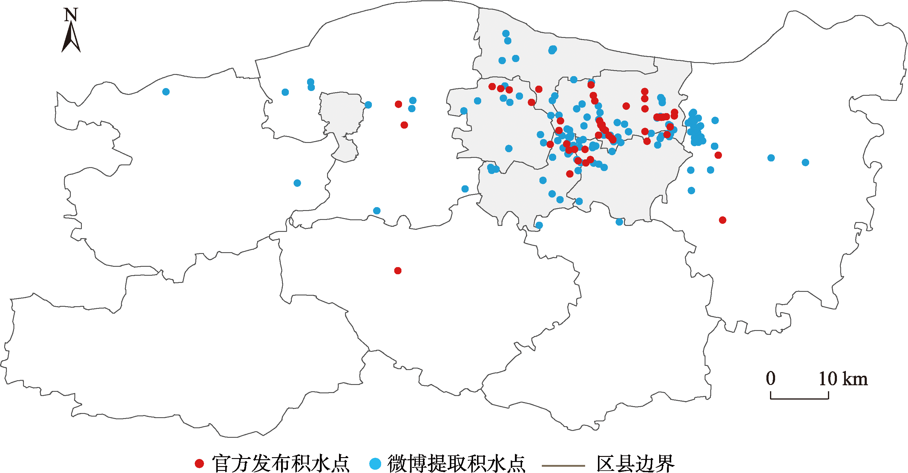
Comparison of official waterlogging points
Fig. 7
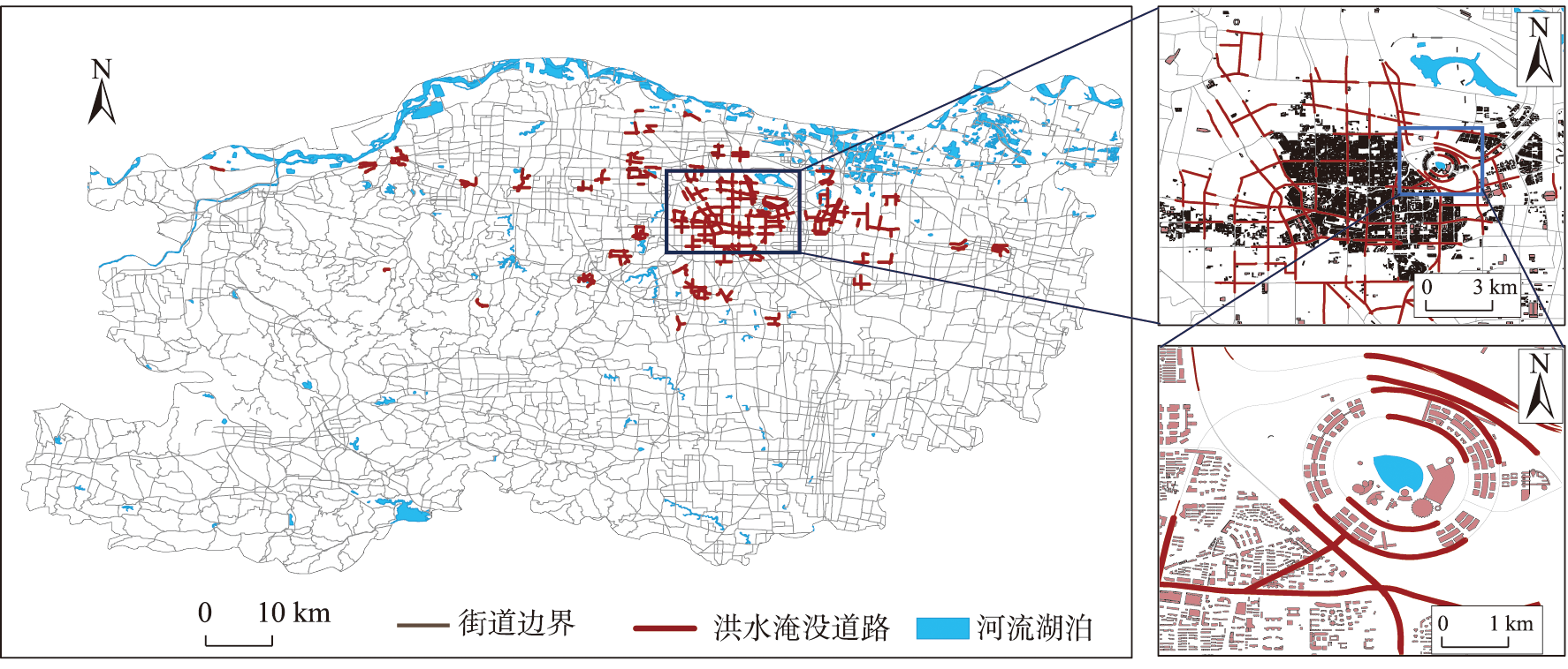
Map of urban waterlogging points at road network level
Fig. 8
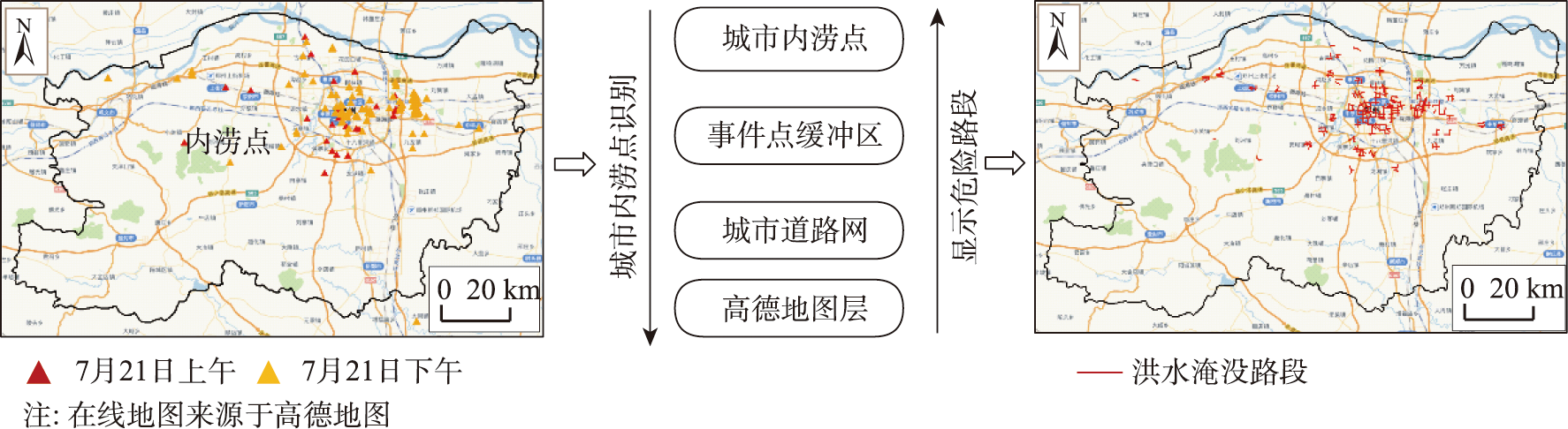
Real-time generation of online map to display waterlogged road sections
Fig. 9
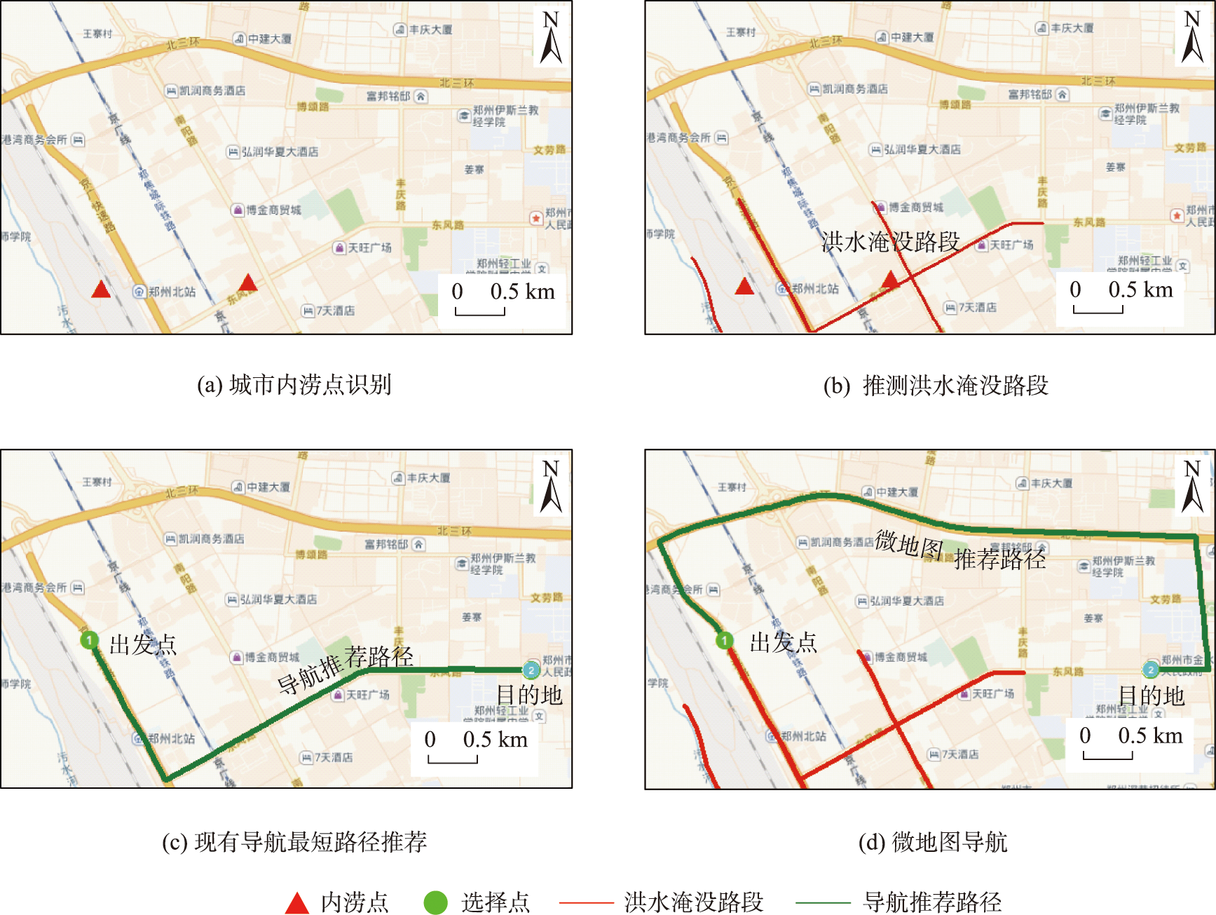
Emergency navigation we-map
Tab. 4
Comparison between conventional mapping and we-map mapping methods