×
模态框(Modal)标题
在这里添加一些文本
Close
Close
Submit
Cancel
Confirm
×
模态框(Modal)标题
×
Journal
Article
Figure
Search
EN
中文
Home
About Journal
Overview
Indexing
Awards
Editorial Board
Guide for Authors
Editorial Policies
Subscription
Contact Us
EN
中文
Figure/Table detail
MDSNet : A Multi-Scale Depth Supervision Method for High-Resolution Remote Sensing Image Semantic Segmentation
SHAN Huilin, WANG Xingtao, LIU Wenxing, WU Xinyue, GAO Runze, LI Hongxu
Journal of Geo-information Science
, 2025, 27(
6
): 1381-1400. DOI:
10.12082/dqxxkx.2025.250009
配置名称
参数
CPU
Intel(R) Core(TM) i9-12900KF
GPU
NVIDIA GeForce RTX3090
操作系统
Windows 10
框架
Pytorch1.12.0
运行内存
32 G
显存
24 G
Tab. 1
Experimental configuration information
Other figure/table from this article
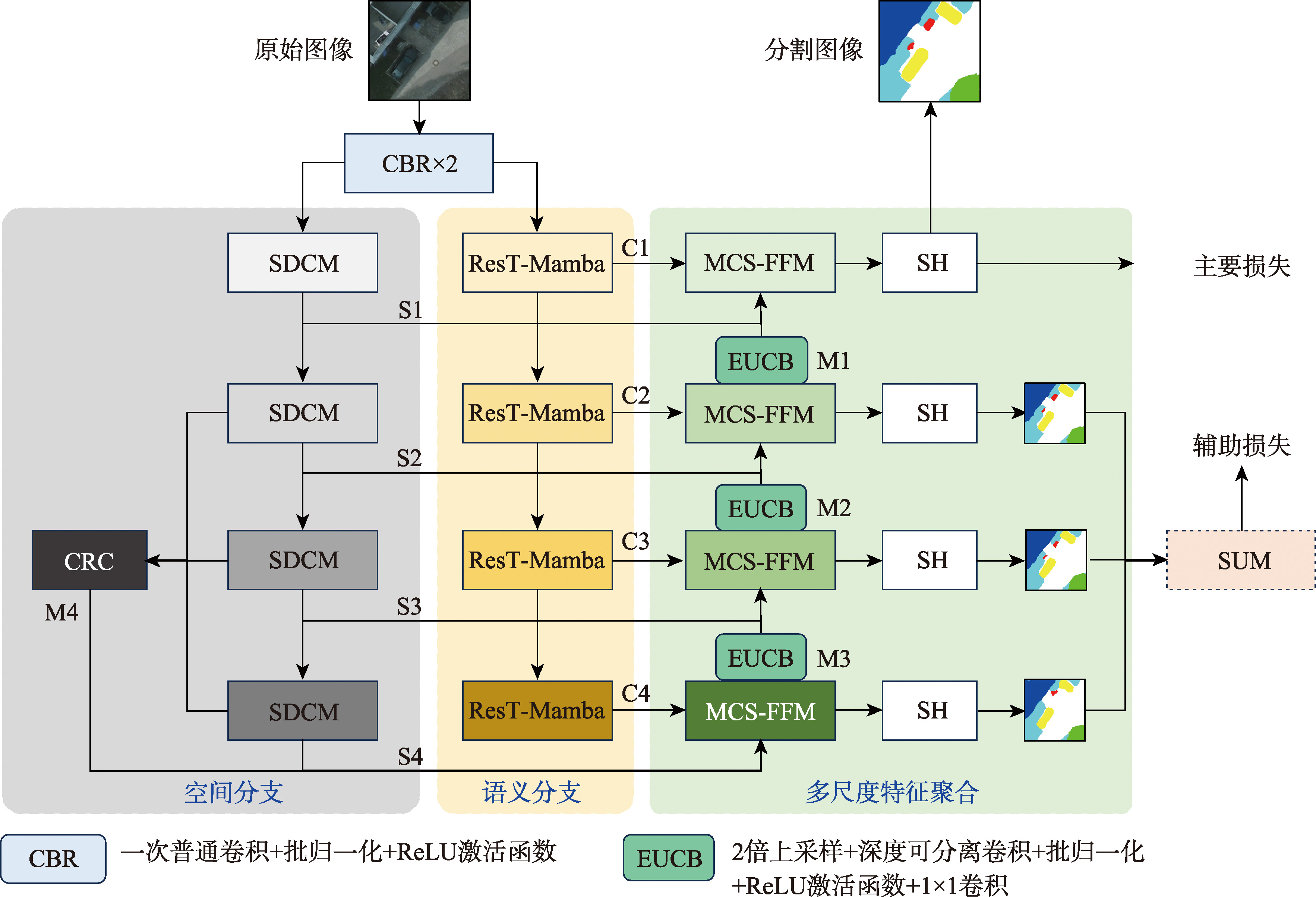
Fig. 1
The model structure of MDSNet
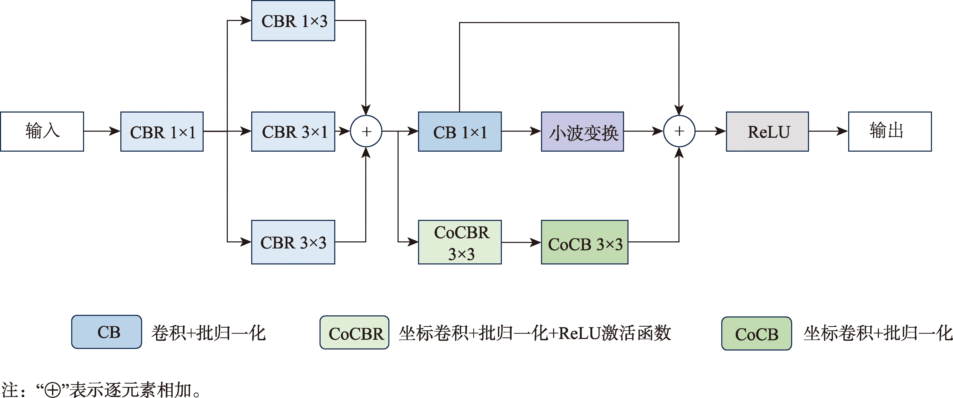
Fig. 2
Space De-redundant convolution module
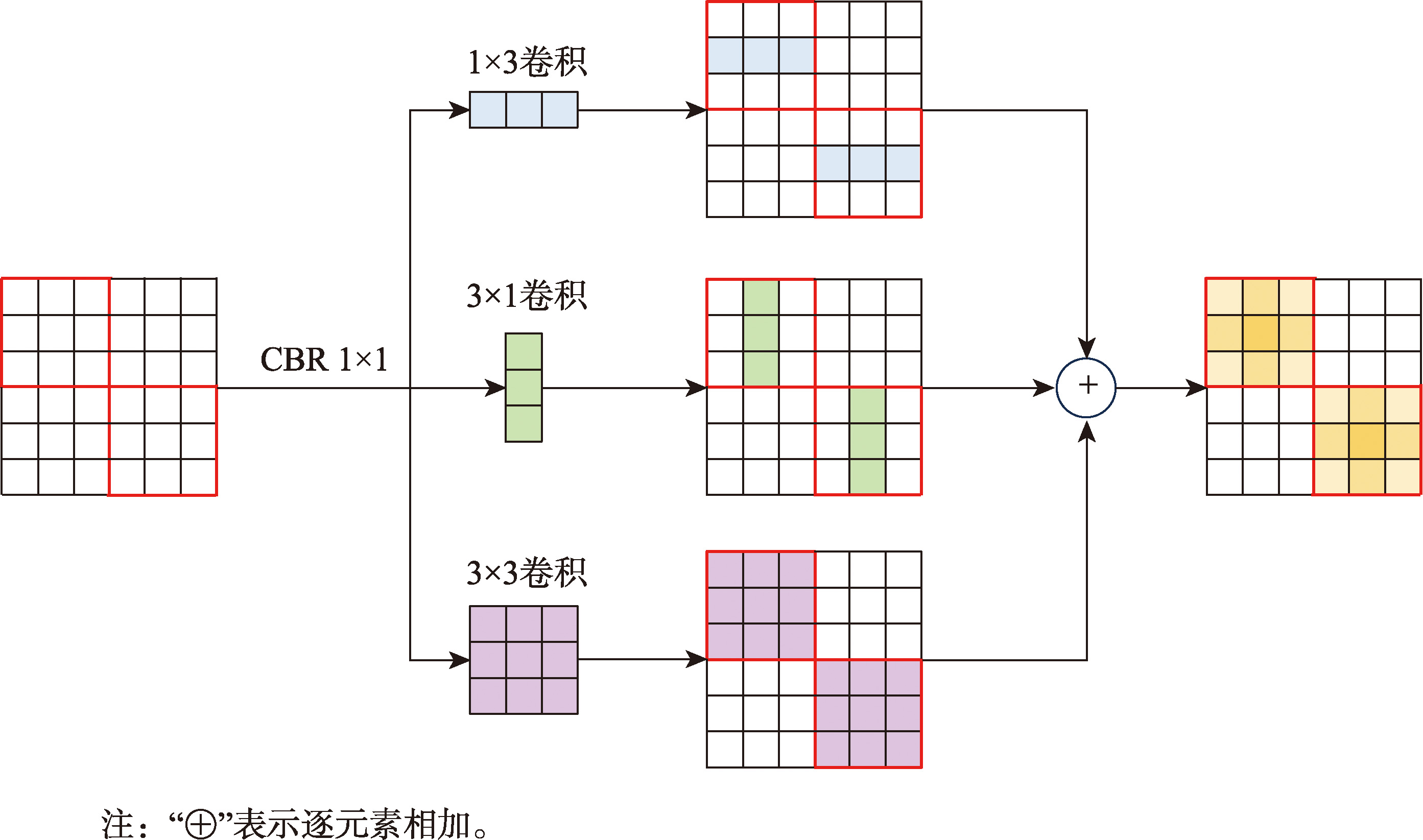
Fig. 3
Feature expressiveness enhances visualization
Fig. 4
The structure of channel reweight concat
Fig. 5
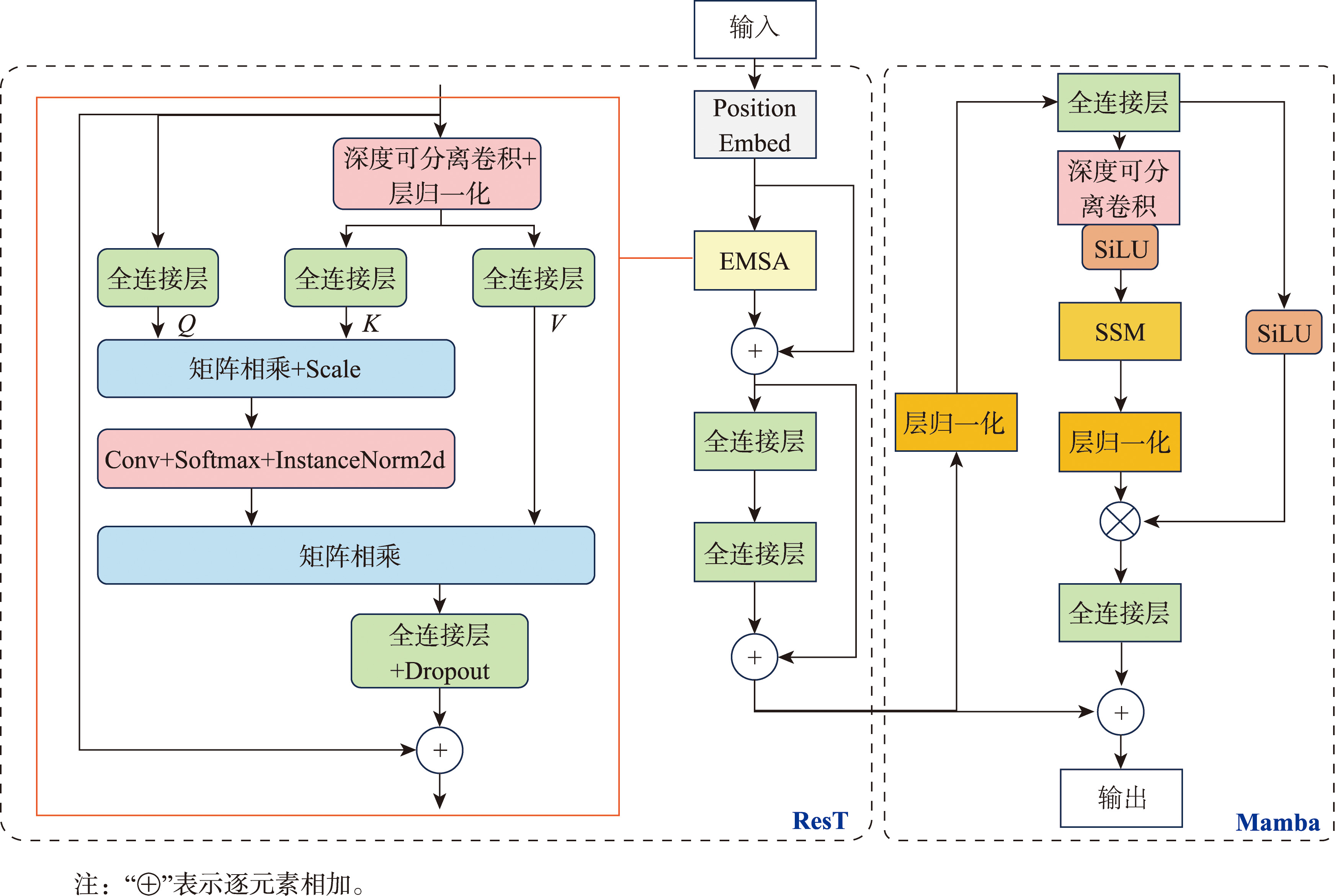
The structure of ResT-Mamba
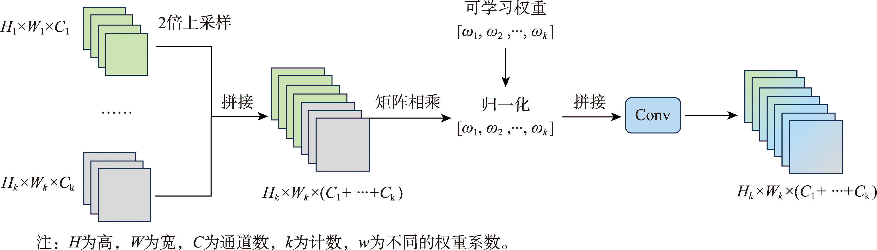
Fig. 6
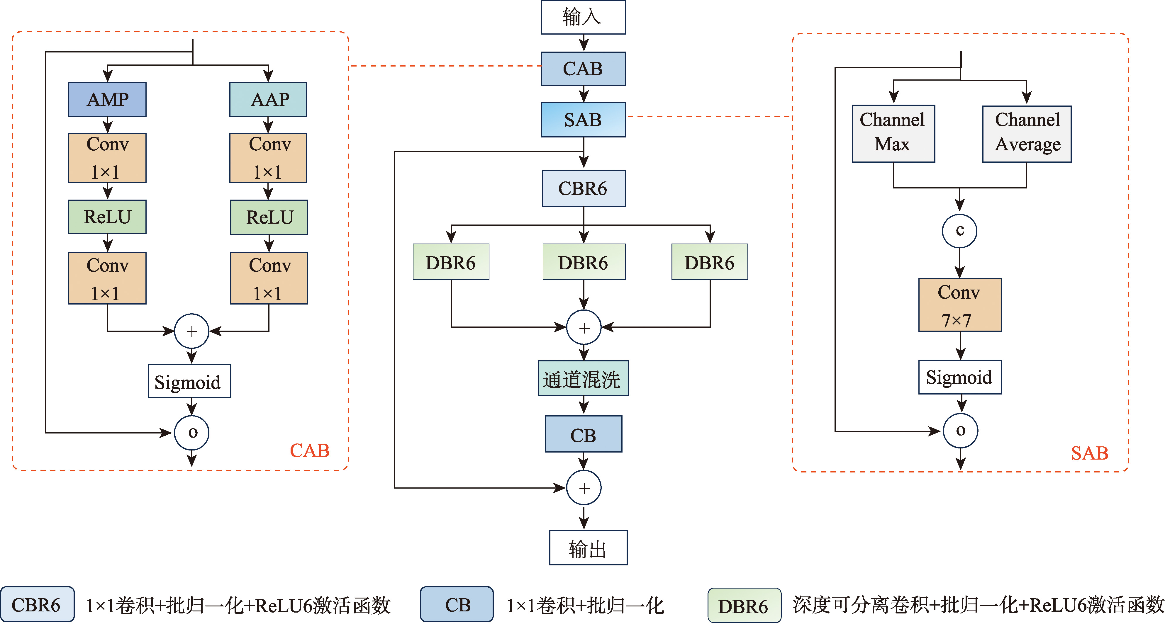
The structure of multi-scale convolutional feature fusion module
Fig. 7
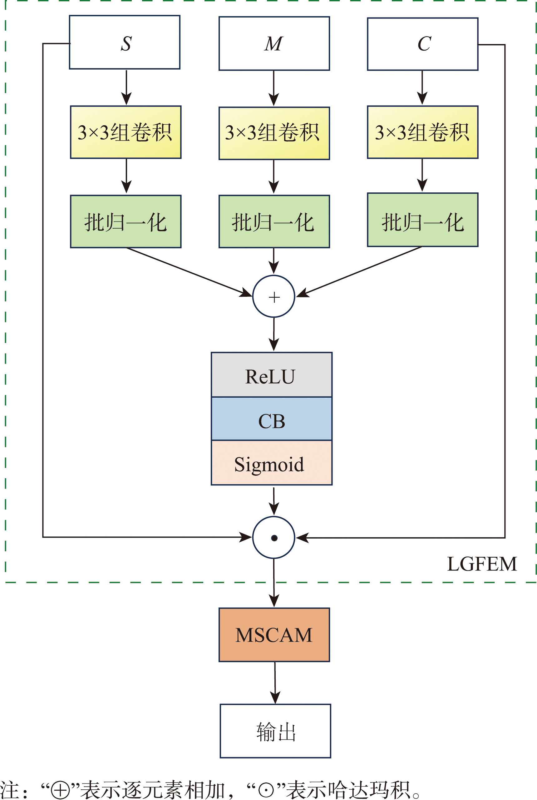
Multi-scale convolutional attention module
Fig. 8
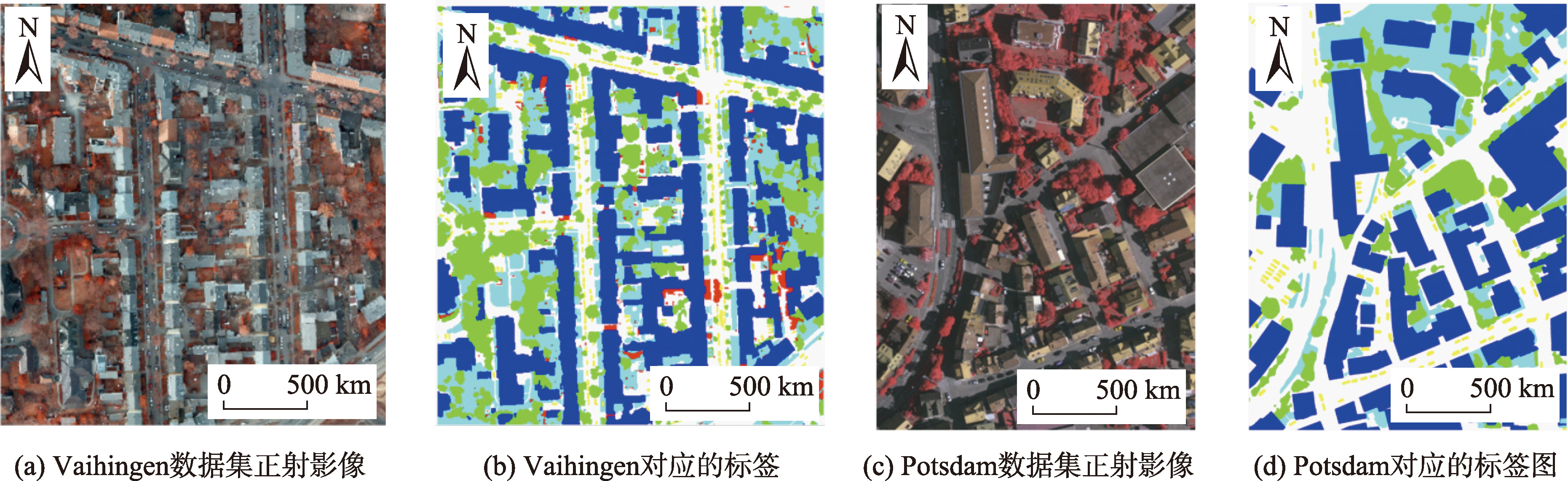
Examples of ISPRS dataset
Fig. 9
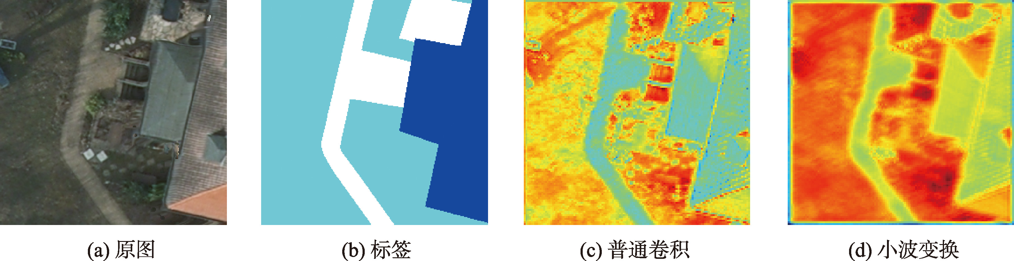
Comparison of wavelet transform ablation experiments
Tab. 2
Quantitative results of different branch stems (Vaihingen) (%)
Tab. 3
The effect comparison test of each module (Vaihingen)
Fig. 10
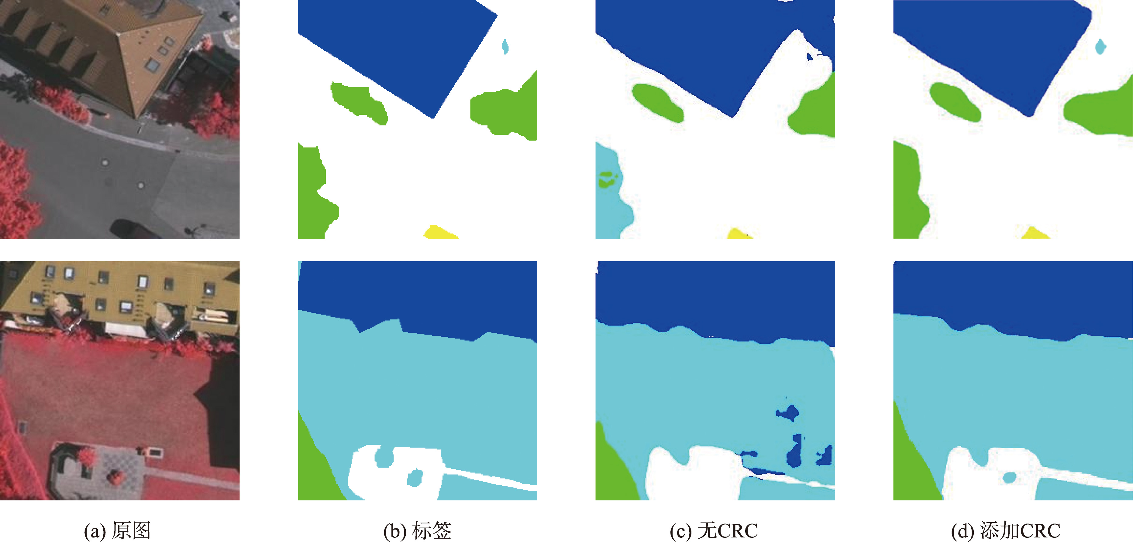
Comparison of CRC ablation experiments
Tab. 4
Segmentation results under different network models on the Vaihingen dataset (%)
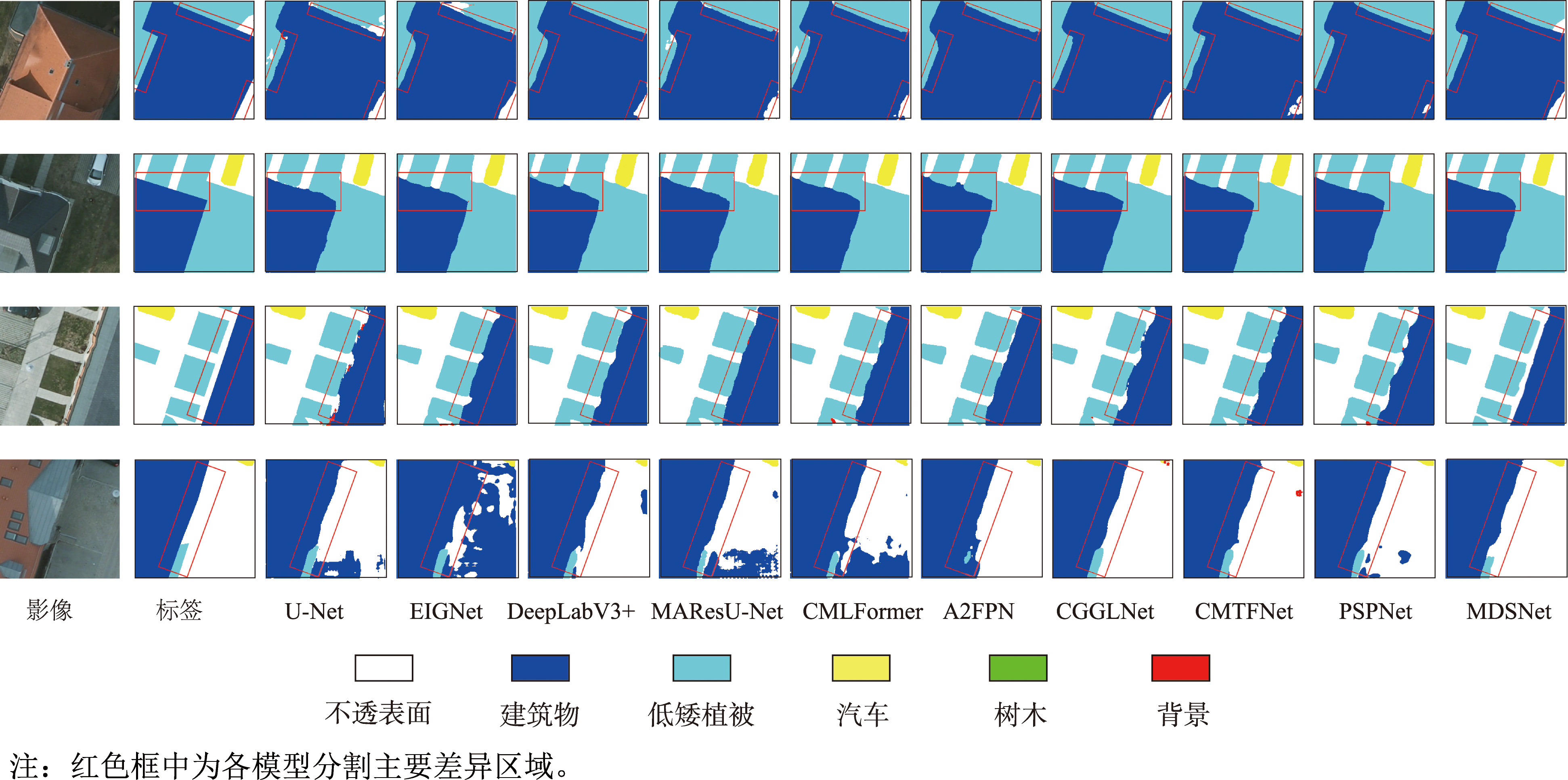
Fig. 11
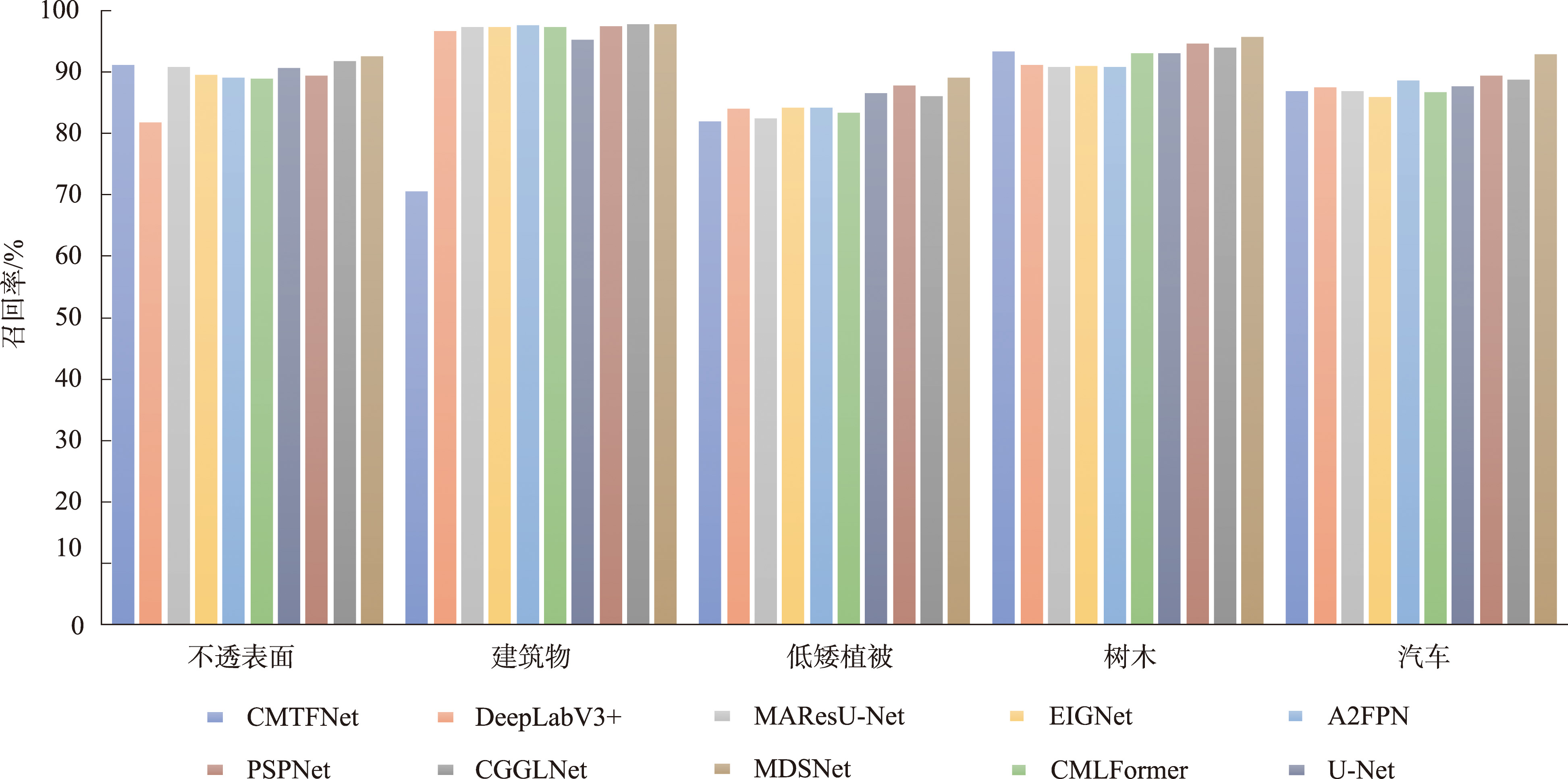
Vaihingen data on the distribution of recall rates
Tab. 5
Segmentation results under different network models on the Potsdam dataset (%)
Fig. 12
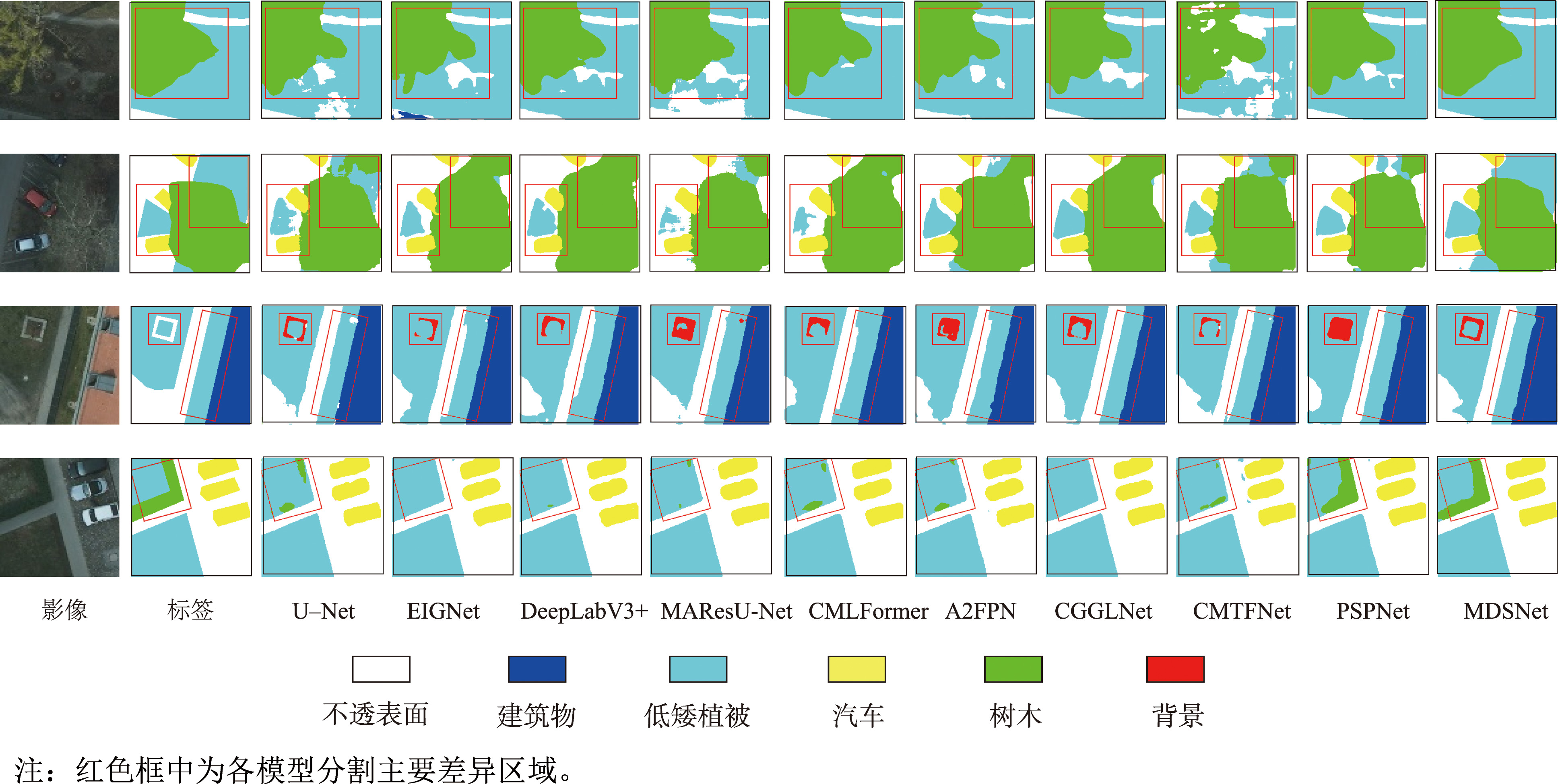
Segmentation of low vegetation and trees in Potsdam
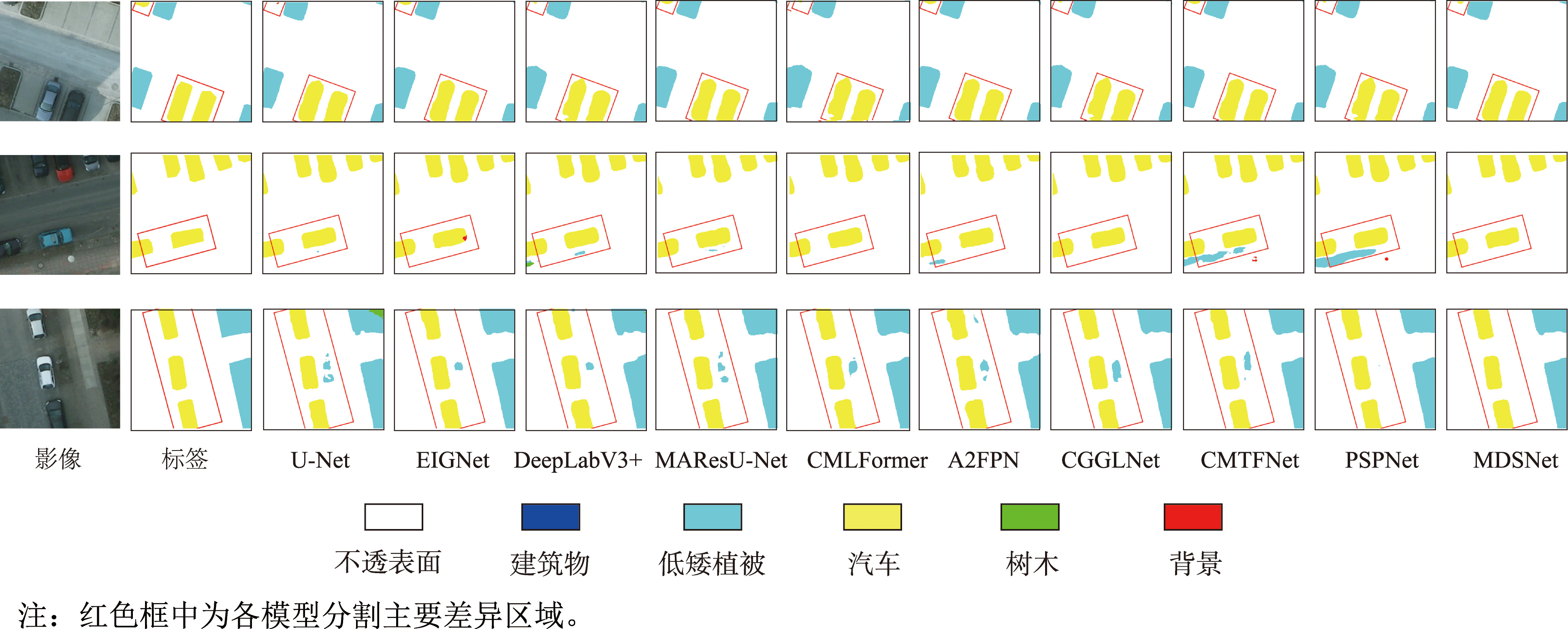
Fig. 13
Segmentation of Impervious surfaces and buildings in Potsdam
Fig. 14
Segmentation of Impervious surfaces and buildings in Potsdam
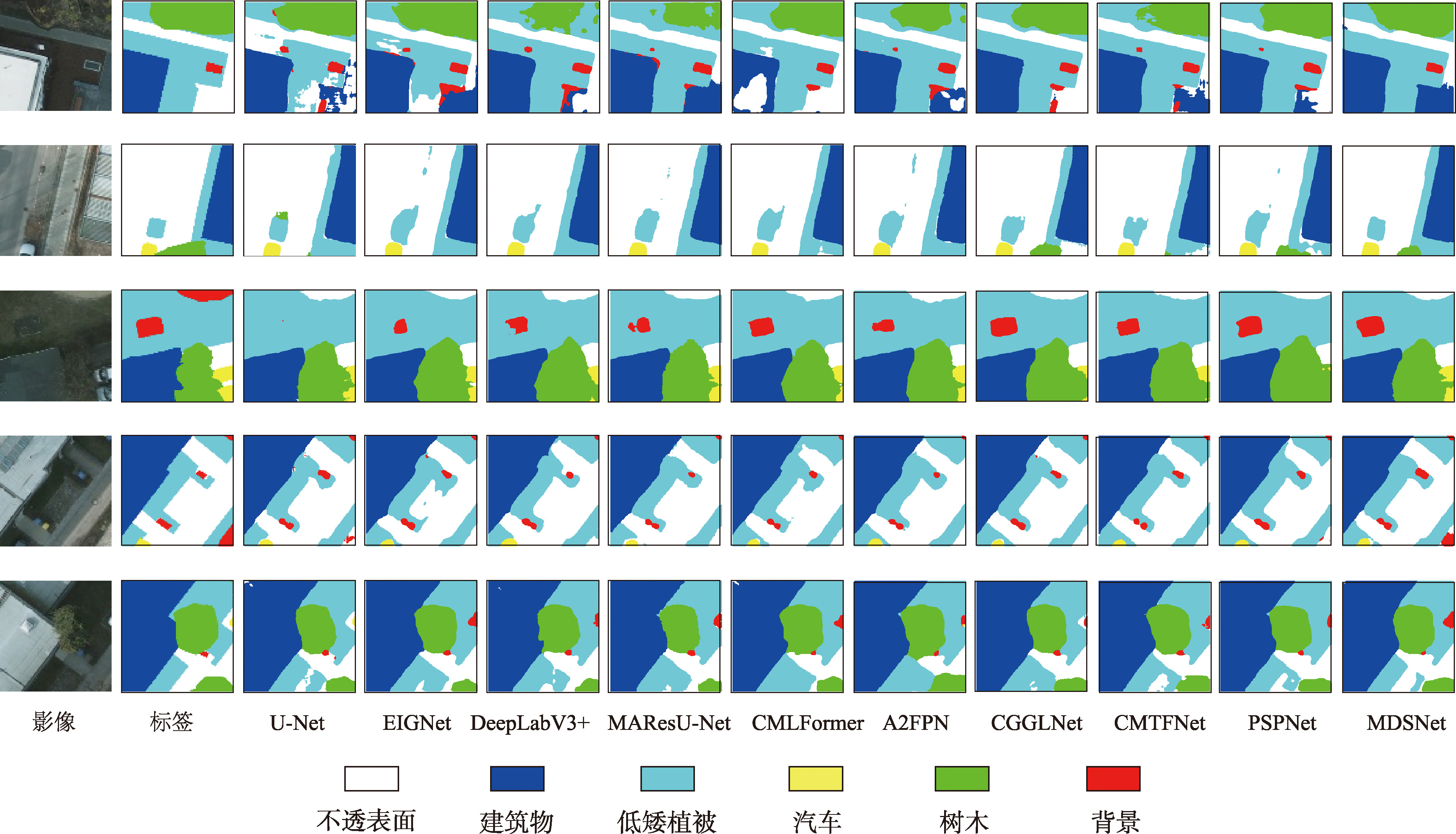
Fig. 15
Potsdam overall segmentation diagram