×
模态框(Modal)标题
在这里添加一些文本
Close
Close
Submit
Cancel
Confirm
×
模态框(Modal)标题
×
Journal
Article
Figure
Search
EN
中文
Home
About Journal
Overview
Indexing
Awards
Editorial Board
Guide for Authors
Editorial Policies
Subscription
Contact Us
EN
中文
Figure/Table detail
MDSNet : A Multi-Scale Depth Supervision Method for High-Resolution Remote Sensing Image Semantic Segmentation
SHAN Huilin, WANG Xingtao, LIU Wenxing, WU Xinyue, GAO Runze, LI Hongxu
Journal of Geo-information Science
, 2025, 27(
6
): 1381-1400. DOI:
10.12082/dqxxkx.2025.250009
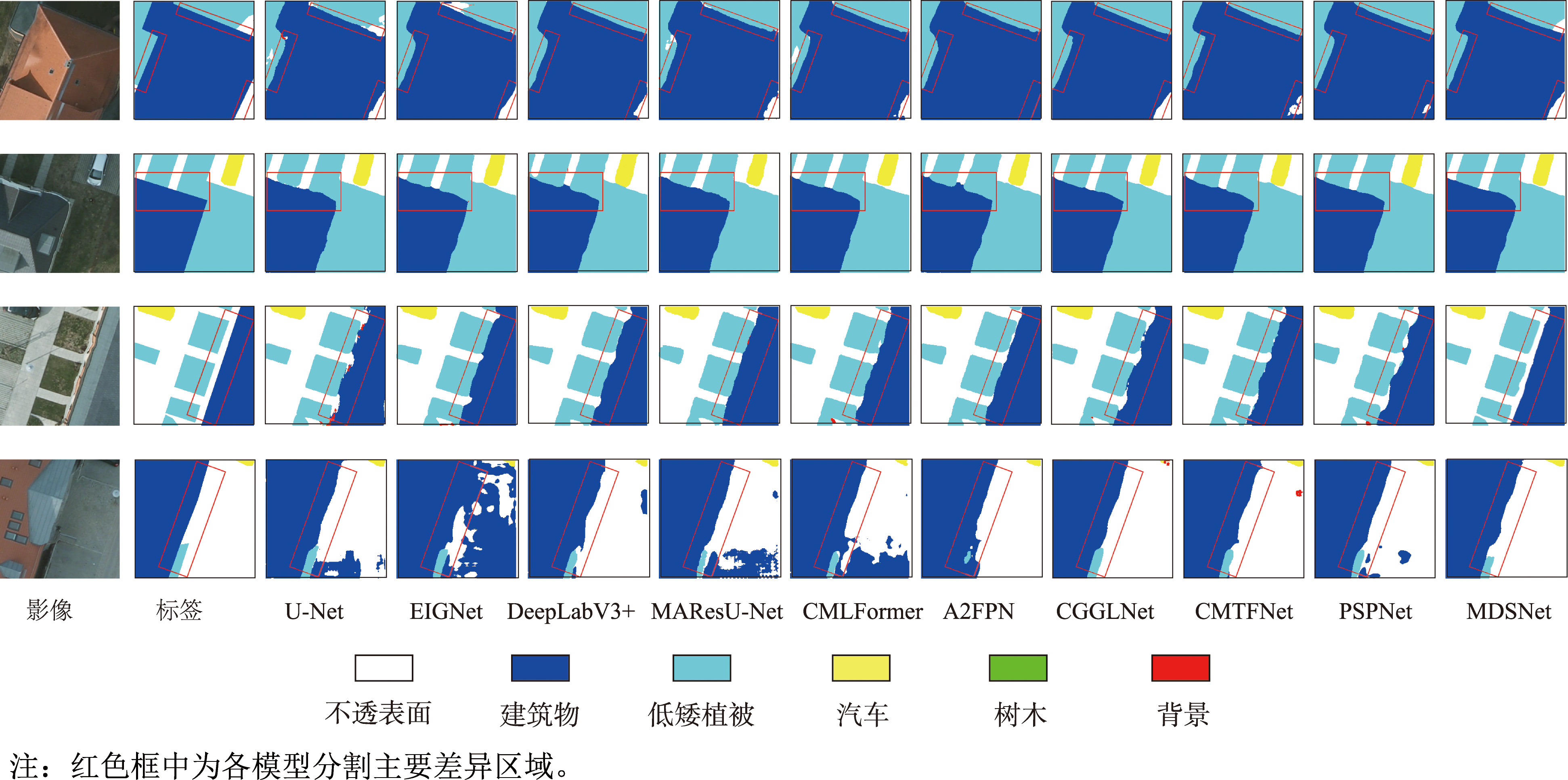
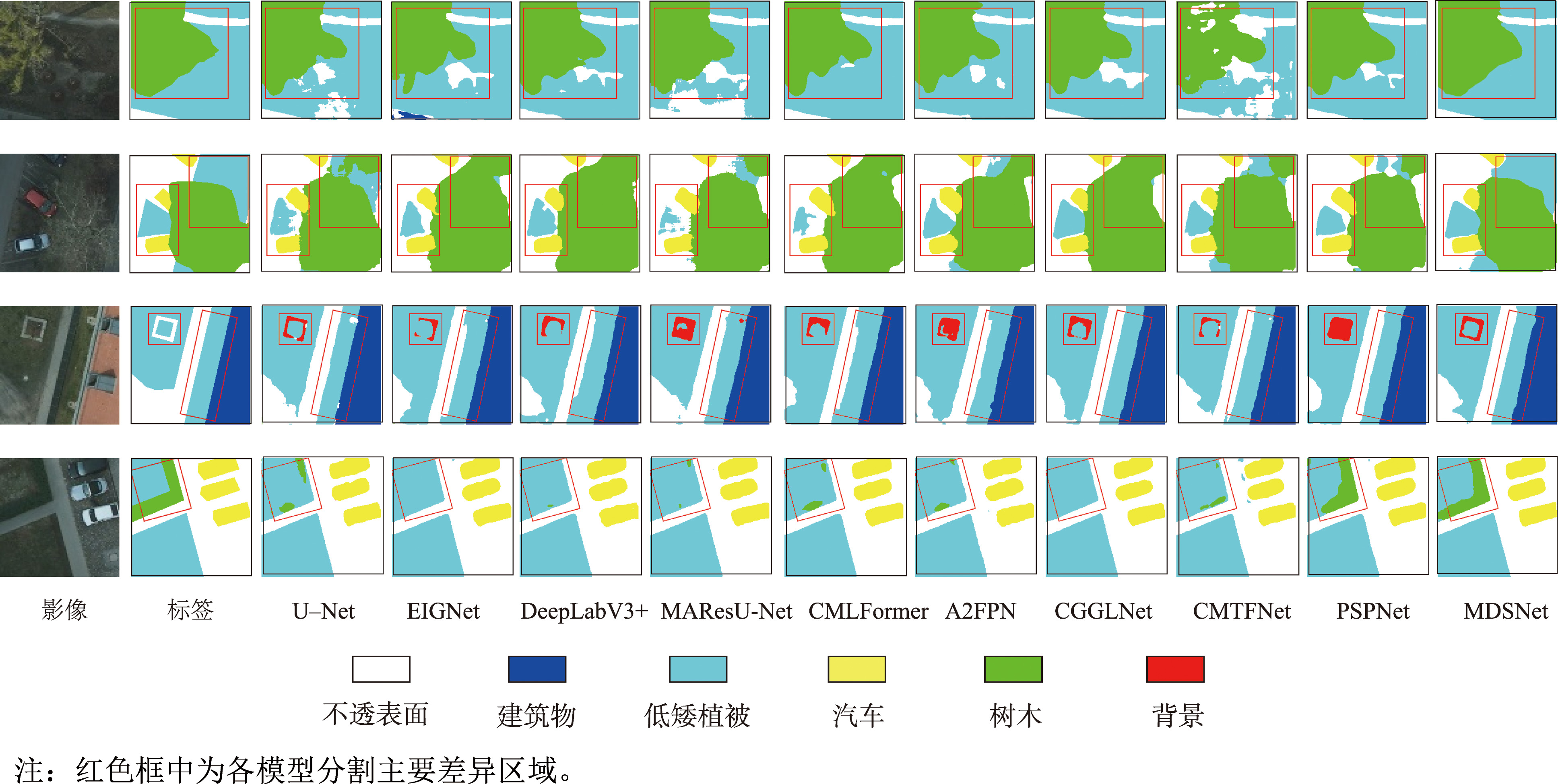
Fig. 13
Segmentation of Impervious surfaces and buildings in Potsdam
Other figure/table from this article
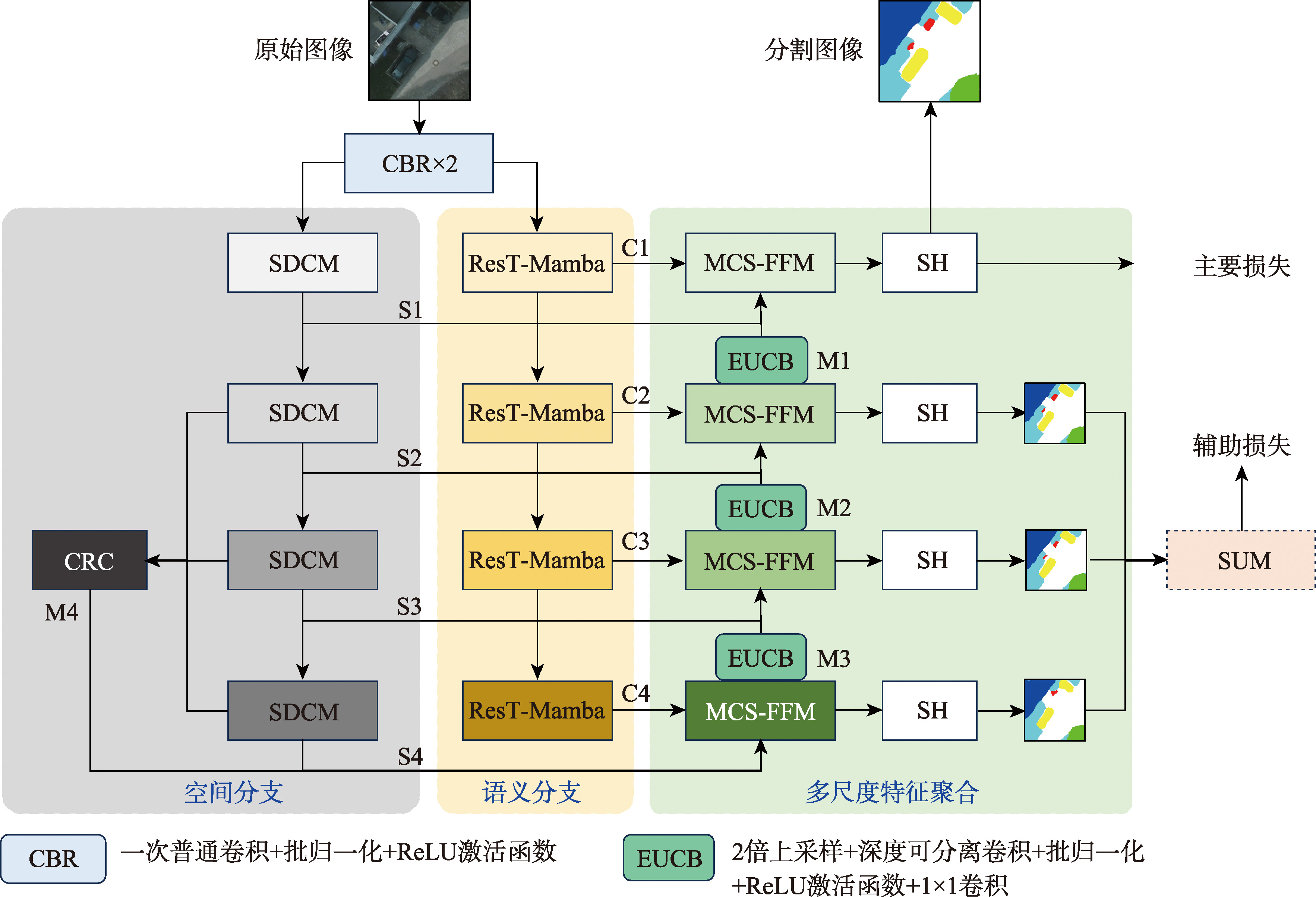
Fig. 1
The model structure of MDSNet
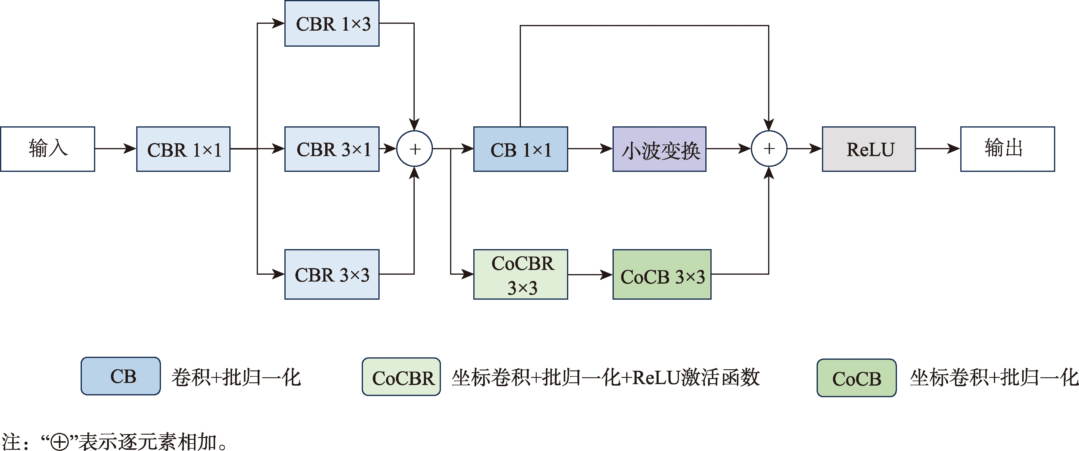
Fig. 2
Space De-redundant convolution module
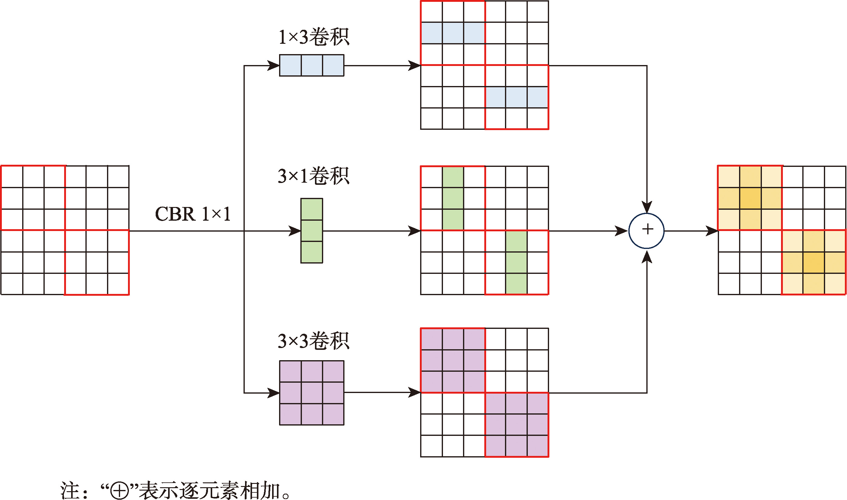
Fig. 3
Feature expressiveness enhances visualization
Fig. 4
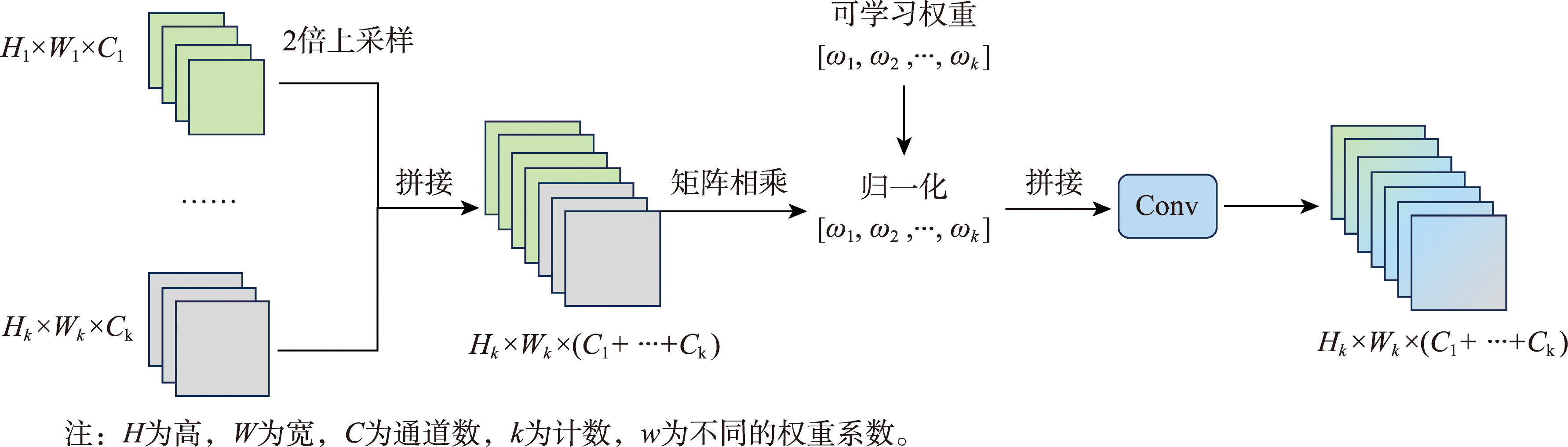
The structure of channel reweight concat
Fig. 5
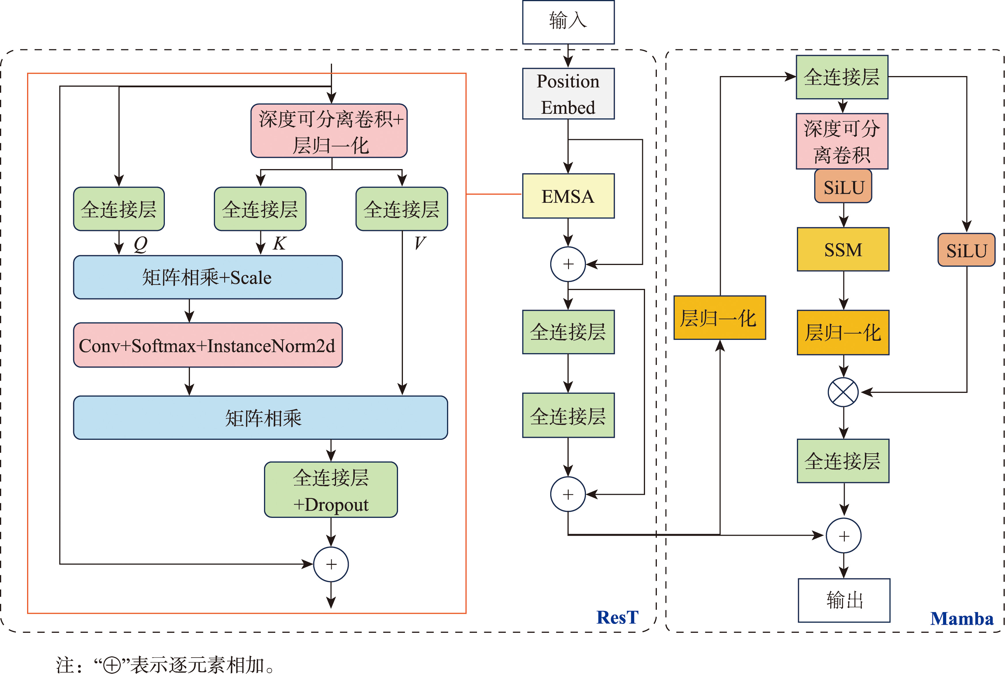
The structure of ResT-Mamba
Fig. 6
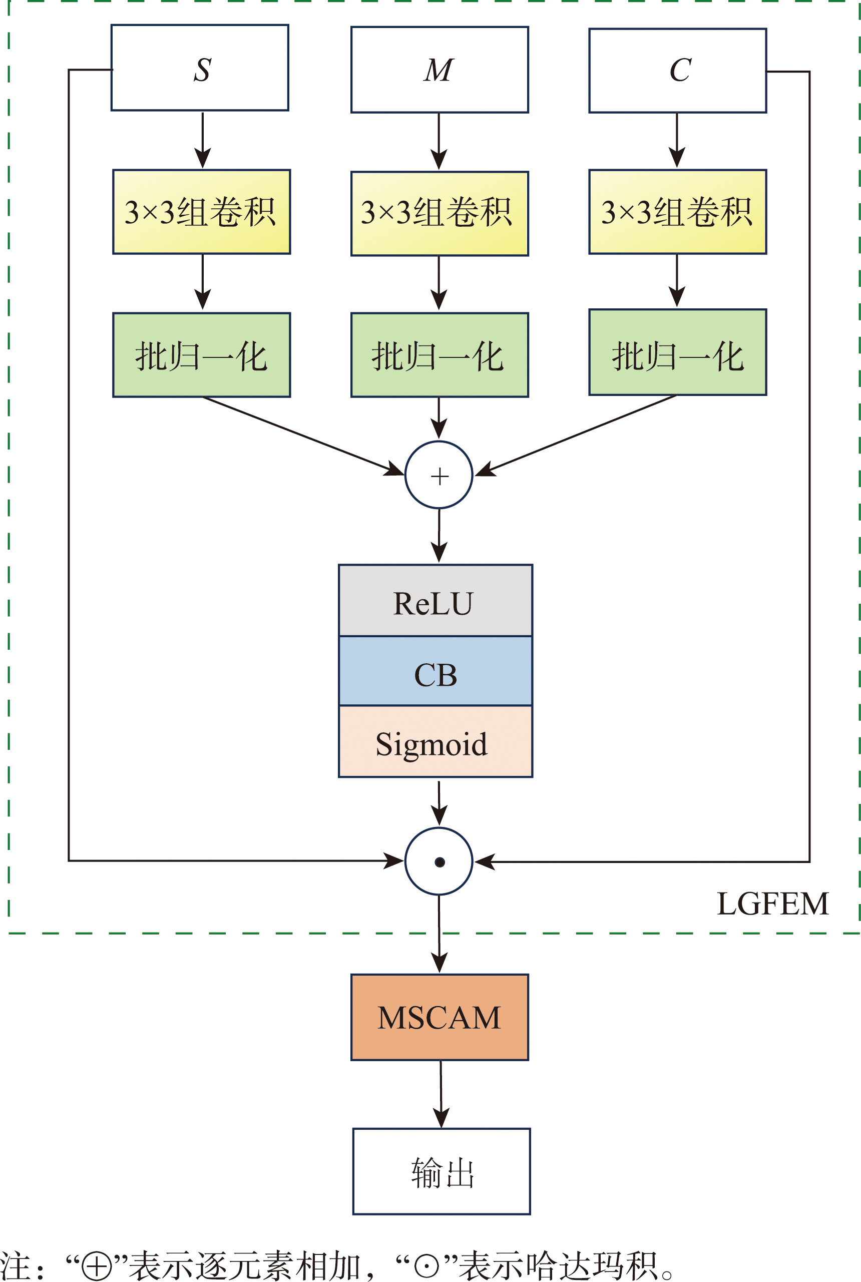
The structure of multi-scale convolutional feature fusion module
Fig. 7
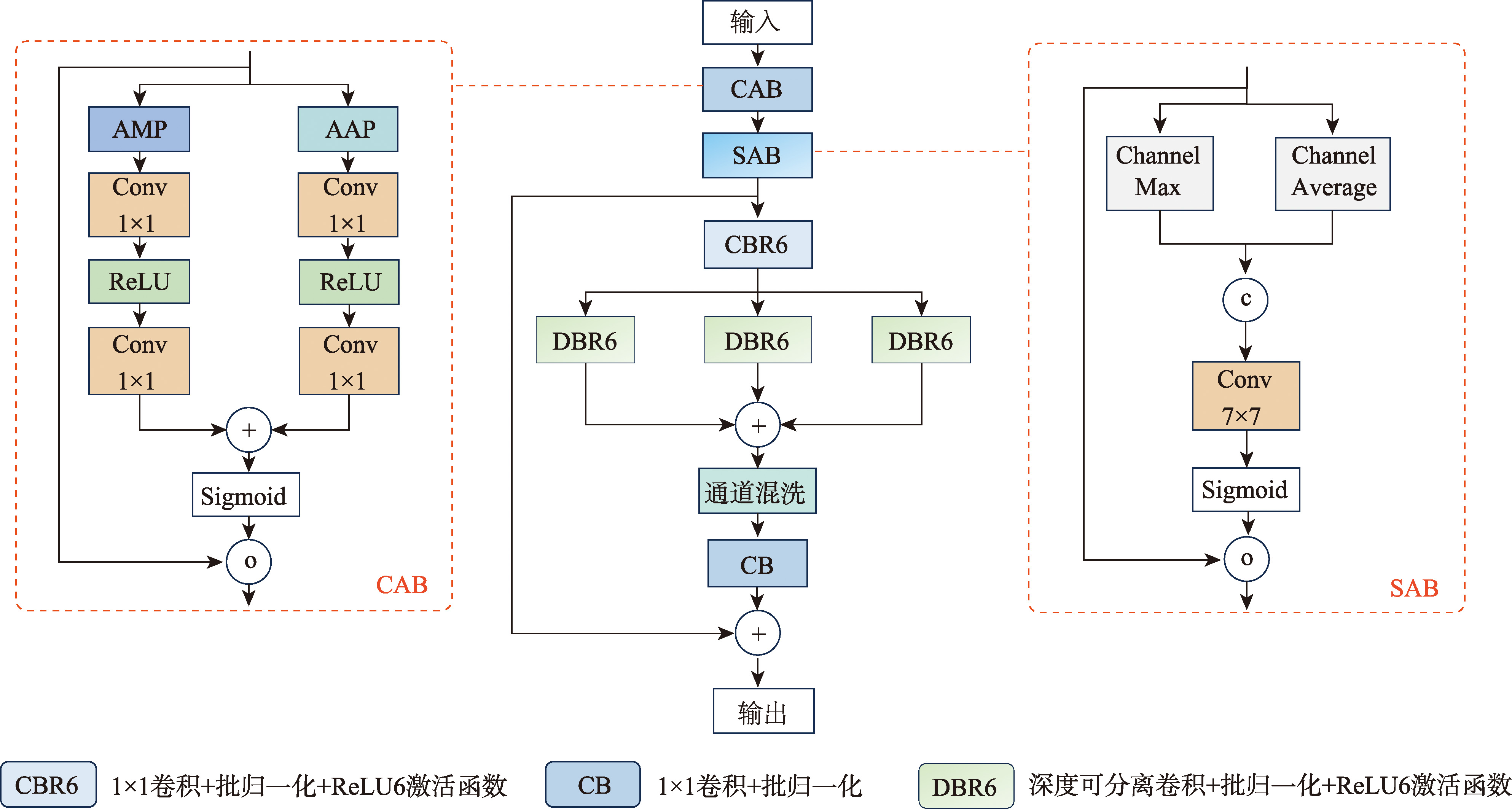
Multi-scale convolutional attention module
Tab. 1
Experimental configuration information
Fig. 8
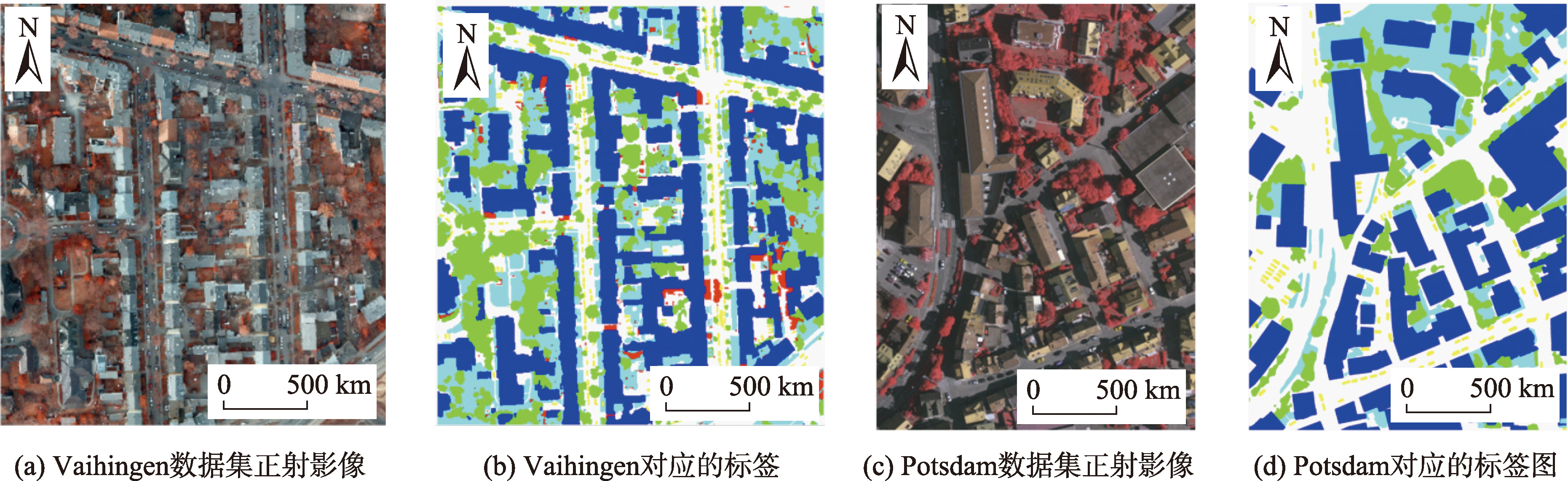
Examples of ISPRS dataset
Fig. 9
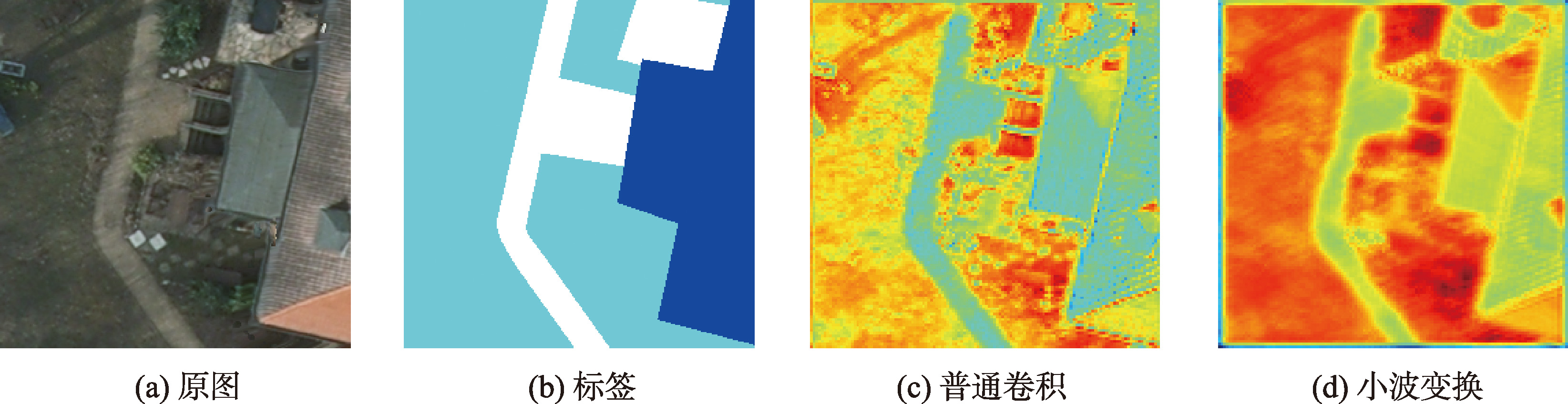
Comparison of wavelet transform ablation experiments
Tab. 2
Quantitative results of different branch stems (Vaihingen) (%)
Tab. 3
The effect comparison test of each module (Vaihingen)
Fig. 10
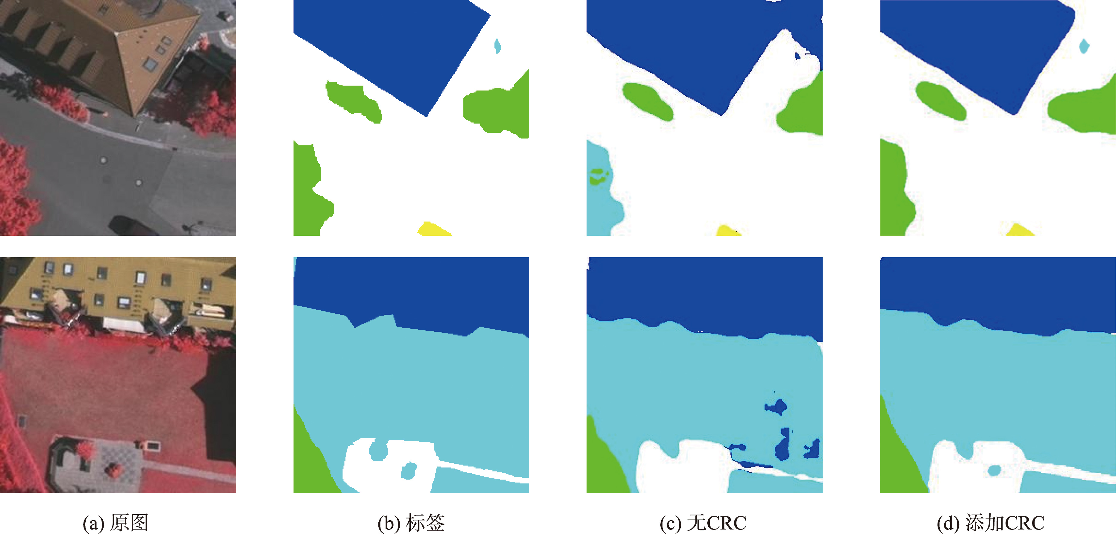
Comparison of CRC ablation experiments
Tab. 4
Segmentation results under different network models on the Vaihingen dataset (%)
Fig. 11
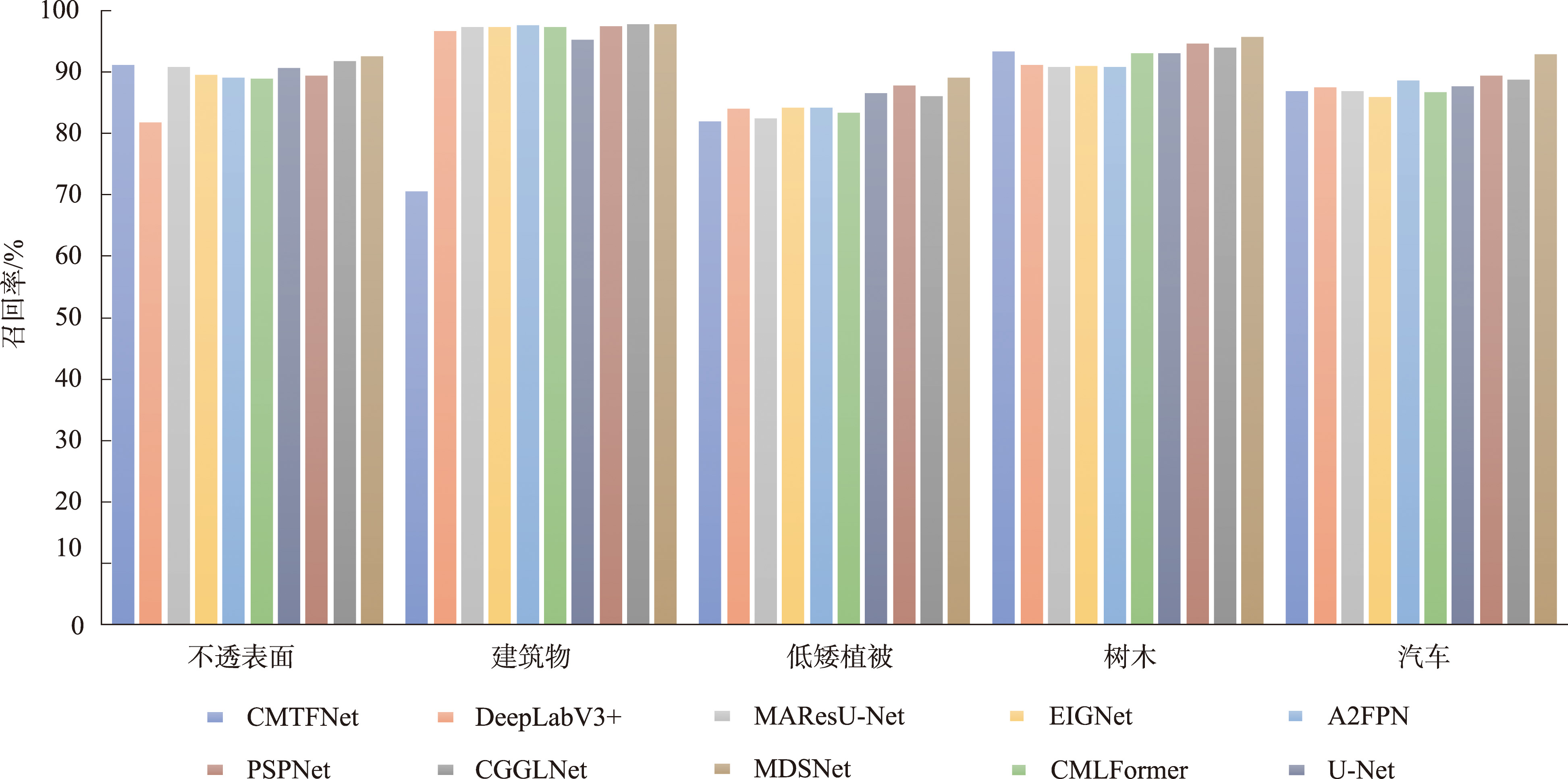
Vaihingen data on the distribution of recall rates
Tab. 5
Segmentation results under different network models on the Potsdam dataset (%)
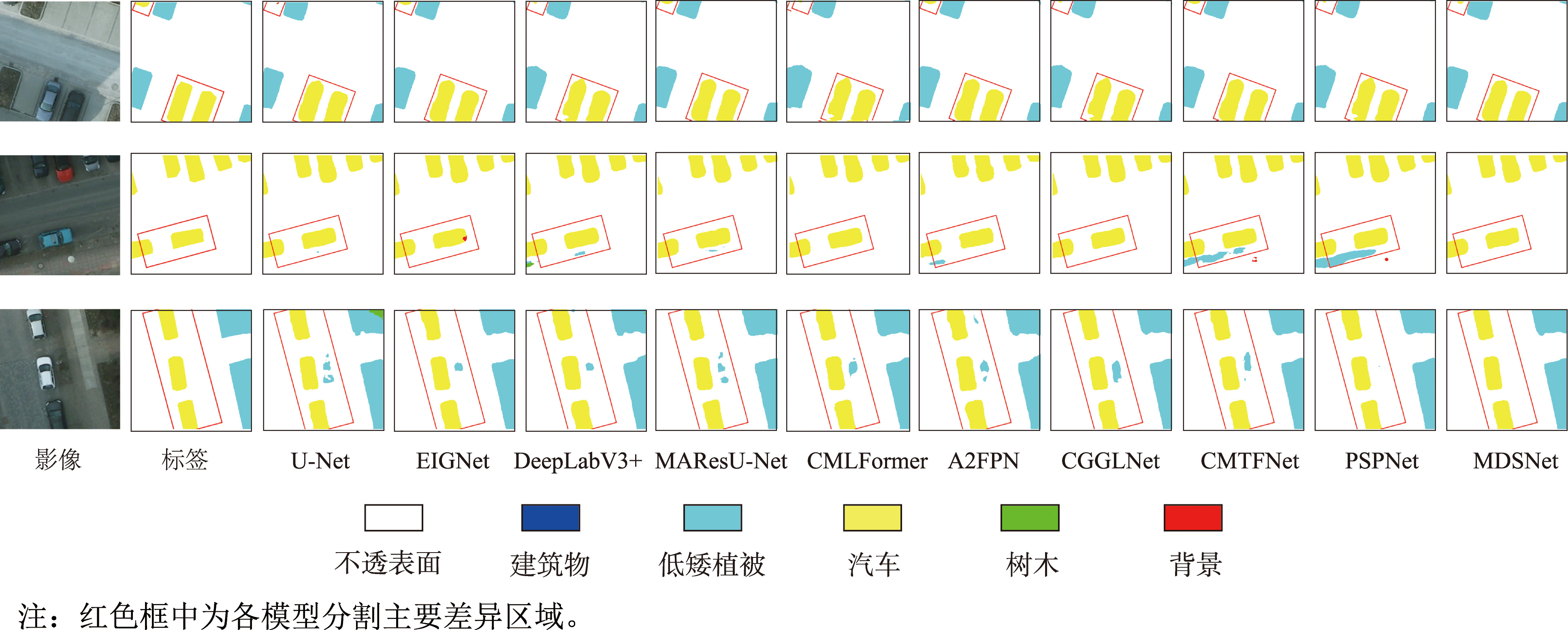
Fig. 12
Segmentation of low vegetation and trees in Potsdam
Fig. 14
Segmentation of Impervious surfaces and buildings in Potsdam
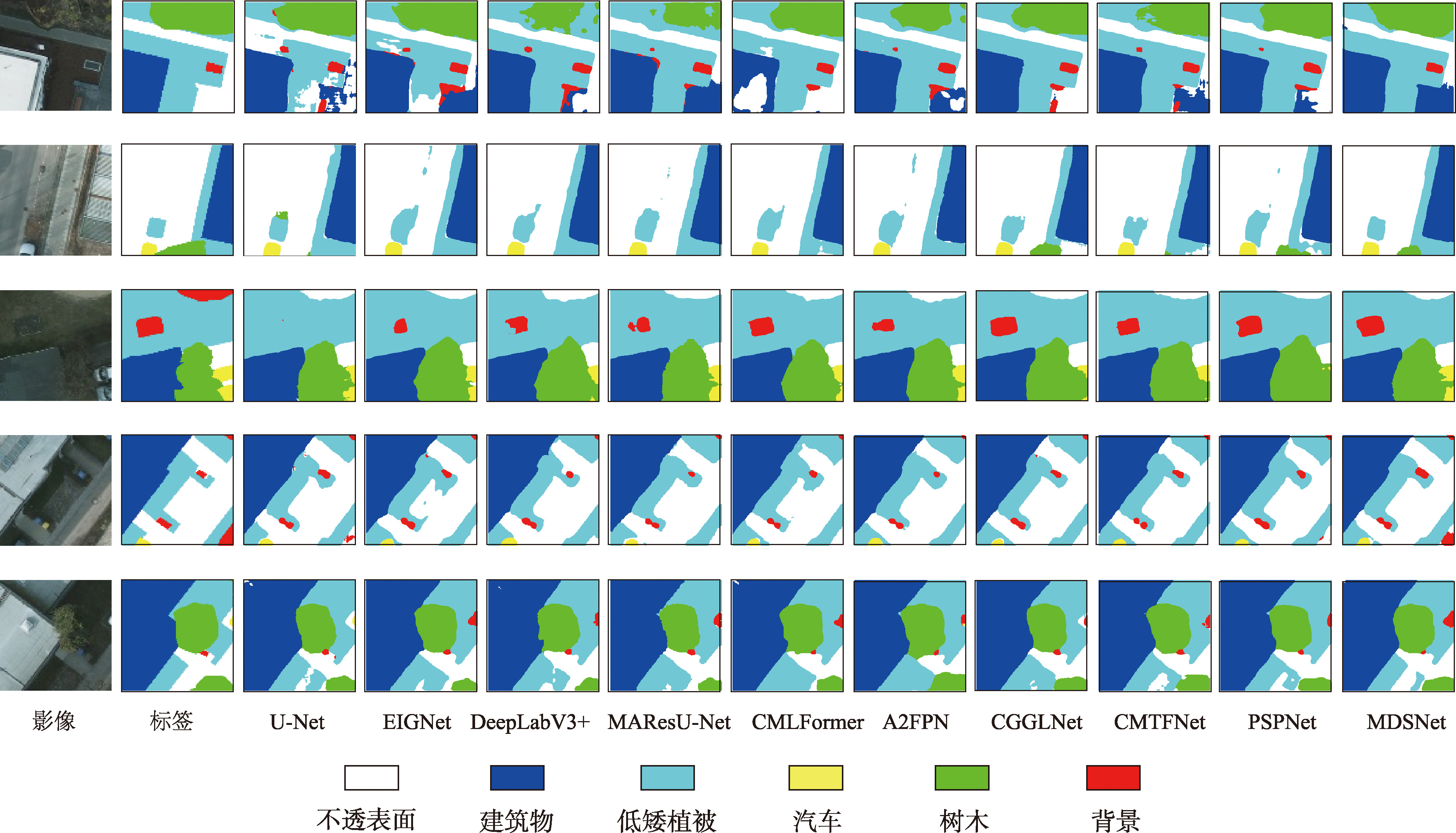
Fig. 15
Potsdam overall segmentation diagram